
30 BEST HIKES IN TENERIFE: THE ULTIMATE HIKING GUIDE
Welcome to Tenerife – my happy island and an absolute dream for hikers, trail runners, and cyclists. This place is easily the most diverse hiking destination in the Canary Islands, packed with everything from stunning mountain ridges to ancient forests and coastal cliffside trails. And the best part? You can hike here year-round!
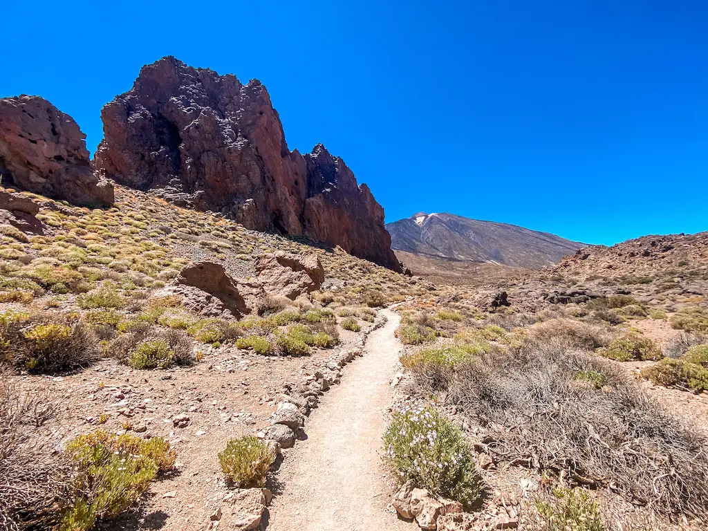
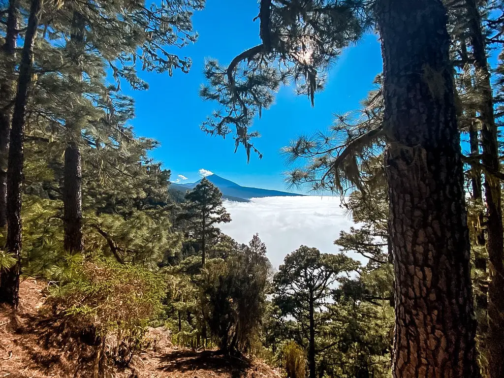
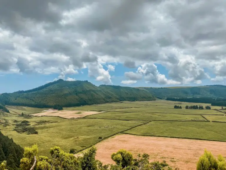
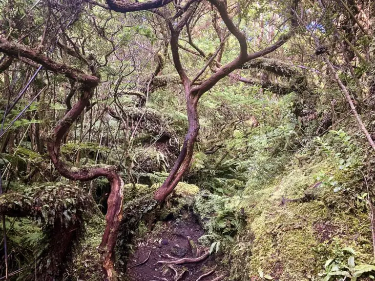
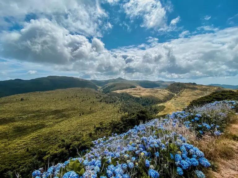
Tenerife is home to Teide Volcano, Spain’s highest peak, towering over a surreal, volcanic landscape in the heart of the island. But there’s so much more than just Teide. Expect lush and mystical Laurisilva forests in Anaga, dramatic volcanic ridges in Teno, deep ravines like Masca, and epic coastal trails that make you feel like you’ve stepped into a postcard. One day, you’ll be hiking across Mars-like lava fields, and the next, you’ll be passing through misty forests that feel straight out of a fairytale.
This guide to the 30 Best Hikes in Tenerife covers it all: easy scenic walks, tough mountain climbs, hidden gems, and absolute must-dos. So if you’re after jaw-dropping viewpoints, wild volcanic terrain or a quiet trail away from the crowds, there’s always something here for you. So, let’s get into it!
I lived and worked on this island for three months, hiking nearly every day. I’ve explored over 70 trails to bring you an ultimate guide – highlighting the top 30 best hikes in Tenerife. Go ahead and browse through, find a few that catch your eye and experience those amazing paths that Tenerife has to offer! Each guide has a detailed description including the distance, difficulty, gear needed and everything else needed to complete the hike successfully. If you happen to notice any changes on the trail that should be updated – please drop the comment below so I can keep this guide up to date.
30 BEST HIKES IN TENERIFE – ESSENTIAL INFO
This detailed guide is based on my actual experience of exploring all below trails by myself or with friends I met throughout my stay in Tenerife. In this guide, you’ll find a blend of official, clearly marked trails along with my unique combinations of routes and some hidden paths that only locals know about. Here’s some essential information to keep in mind as you explore my top 30 best hikes in Tenerife:
WHERE TO STAY IN TENERIFE?
- SOUTH: For my first stay, I chose El Medano – surfers paradise with a very nice beach and a great vibe overall. It’s well connected with Teide National Park and Teno Mountains (1-1,5h drive) and not so busy like other popular tourist towns like: Los Cristianos, Adeje or Playa de Las Americas. Las Galetas is another interesting town to consider (much more quiet).
- EAST If you like city vibes with all the shopping available, it’s probably best to stay in the capital – Santa Cruz de Tenerife, the only thing is that the city beach – famous Playa de Las Teresitas is located 20 mins away, in San Andres – that’s exactly where I decided to base myself for almost a month. It’s a cute little town with great restaurants, friendly people and an awesome beach.
- NORTH You can either choose Puerto de la Cruz – a busy town full of internationals or if you prefer a bit more authentic experience – La Orotava with its stunning architecture but further away from the coast. Otherwise any of northern towns like Punta del Hidalgo will be a great choice for a quiet stay.
Check out the rates at booking.com below:
Booking.comBest season – Tenerife is an all-year-round destination, but the weather is less stable between November and April. During this time, heavy rain and snowfalls (above 1500m) are not uncommon. In the summer season, temperatures can rise up to 40°C, so keep that in mind when planning your hikes.
Grading – Difficulty grading is subjective and can largely depend on your fitness level. I am a seasoned trail runner and usually run rather than hike but I am always trying to be as objective as I can when grading trails. Remember to always consider your own physical abilities and fitness level and check if you’re comfortable with trail’s distance and elevation gain.
Apps – The apps I’ve been using to navigate trails in Tenerife:
- mapy.cz – I’ve been using it for years now and it rarely fails me. Big plus for offline download option.
- maps.me – light app with offline download option
- strava maps – awesome new feature where you get to see a heat map where people go (premium feature)
Guide – There are two reasons when hiring a guide might be useful. One: if you’re not comfortable or experienced enough to tackle higher altitudes in Teide National Park or perhaps would like to spend a night there. Two: If you’d like to experience hiking some off-beaten paths in Tenerife.
Recovery – I spent hundreds of hours hiking here and honestly, at some point my muscles were begging for a massage. I tried 5 different places on the island and oh my god I just NEED to recommend Osteolistic. This is not a sponsored recommendation but a friendly share as a sign of respect and admiration for two girls running that place, their sport massage is the best massage I had in my 30 years of living. Don’t just believe what I write, hit them up on WhatsApp +34658390631 and let me know in the comment how it went!
Transport – There is a fairly good bus network operated by Titsa. If you want to get to the best trails you’d need to either hire a taxi/transfer – very pricy option or simply renting a car. There’s a lot of different rental offices (such as Cicar or Topcar) around the island to choose from yet I always found the best price through Discover Cars where you basically rent the same car for a better price than if you would visit the office by yourself.
Gear: don’t skip the essentials. Being underprepared can turn an epic hike into a rough day. Here’s what you’ll need:
- Footwear: Grippy hiking shoes, trail runners or boots are a game-changer, especially for those steep volcanic slopes in Teide National Park. My favourite shoes in 2024 for those type of adventures are Hoka Mafate Speed 4 but I have also tested multiple different shoes recently, check out trail running shoes I tested in 2024.
- Sun protection: Tenerife’s sun is no joke, so pack sunscreen, a hat, and sunglasses. Those are a must all year round.
- Clothing: Layers, layers, layers! For tips on staying comfy and prepared, check out my detailed gear guide for all my go-to picks.
30 BEST HIKES IN TENERIFE
Alright, here we go! I am beyond happy to be finally publishing this guide. There were days of sheer exhaustion, moments when only massages kept me moving but I’ve put in the work so you can have the best experience possible. I truly hope you find value in my “30 Best Hikes on Tenerife.” Enjoy!
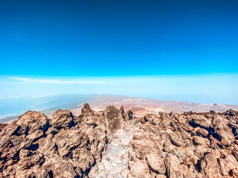
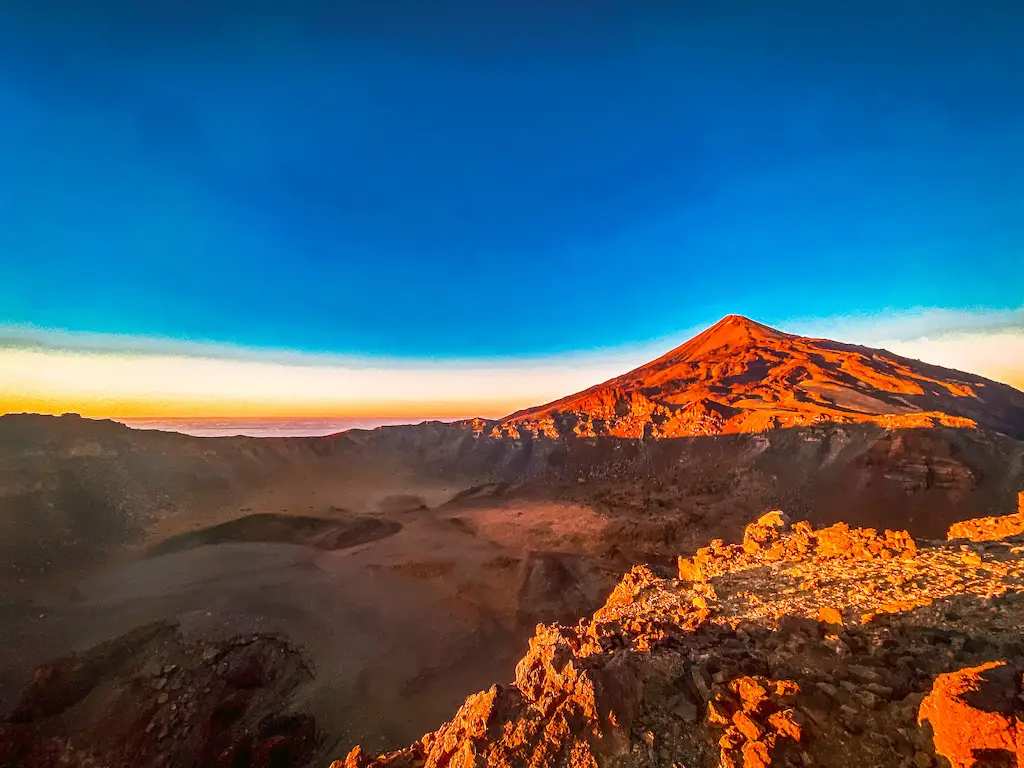
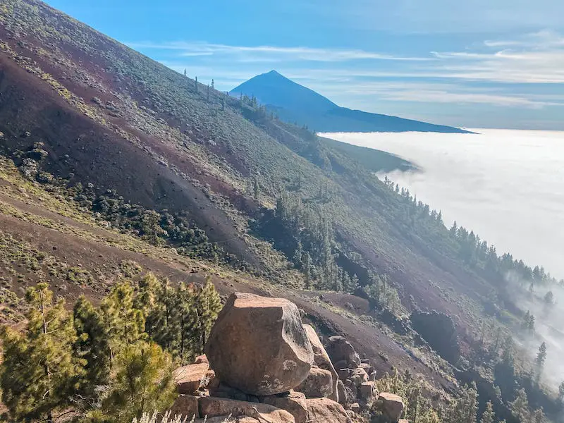
MOUNT TEIDE (3718M)
Distance: 18,5km
Elevation Gain: 1300m
Difficulty: Hard
Highlights: I mean.. the highest point of Spain right? A must do adventure to experience the altitude!
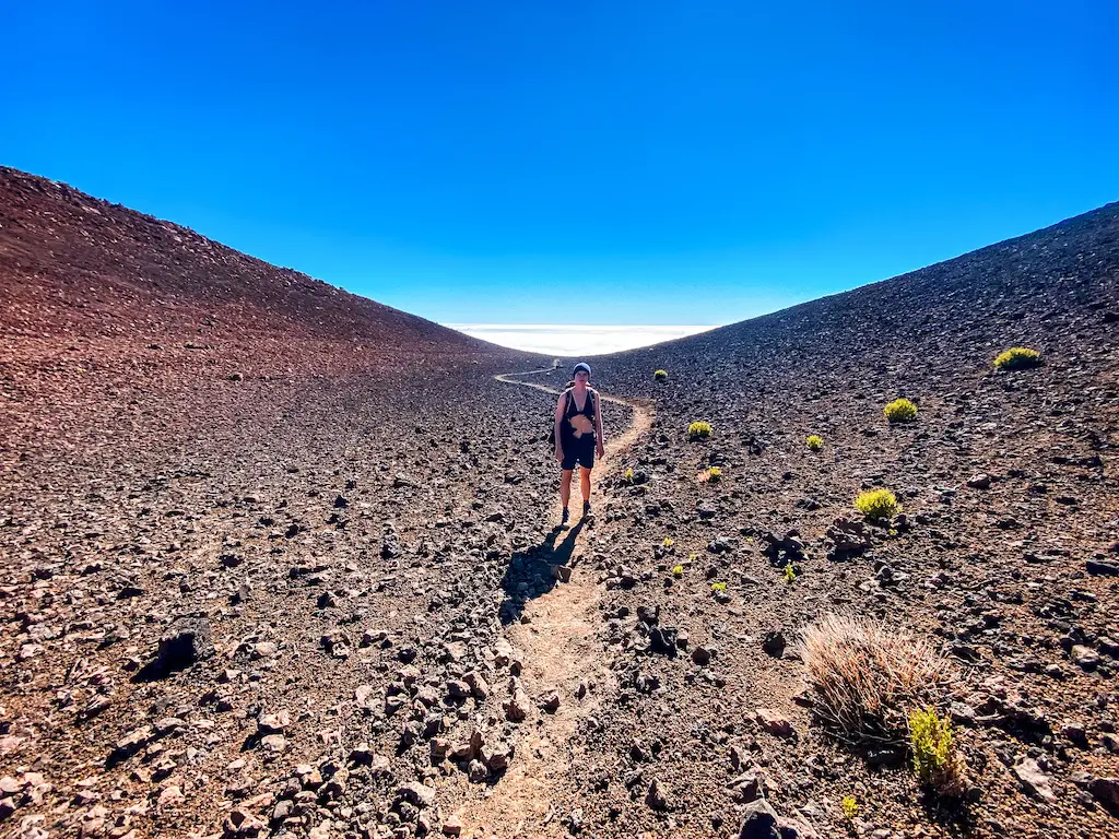
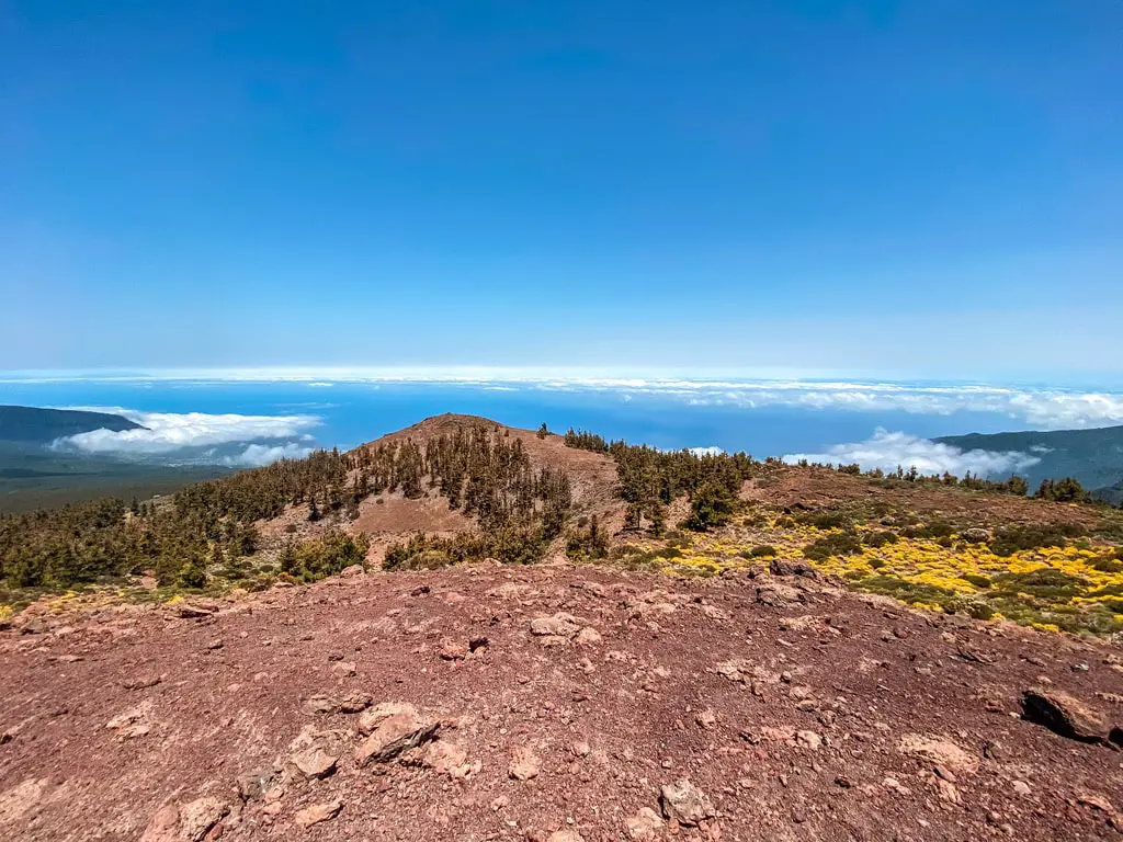
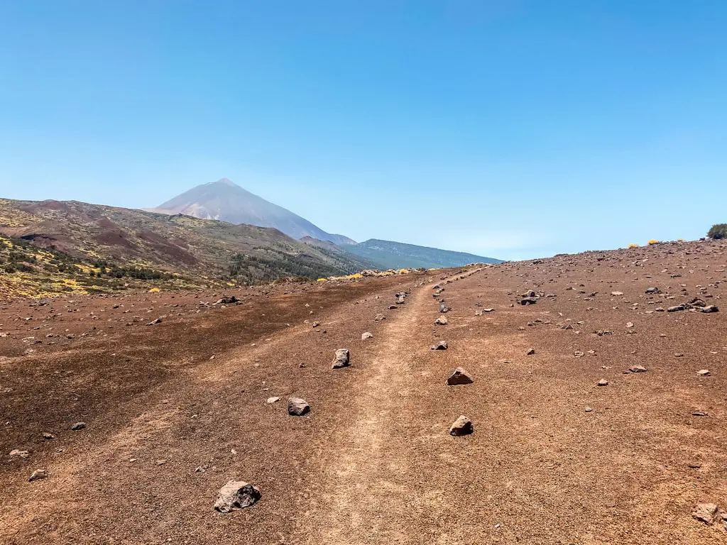
Mount Teide standing at 3,715 meters, isn’t just the tallest mountain in Tenerife. This gigantic volcano also claims the title of Spain’s highest point, making it the ultimate hiking destination in Europe. Thousands of hikers are drawn to Teide for its demanding ascent, lunar-like landscapes, and unforgettable views on the way. This guide promotes an authentic hiking experience without using the cable car. I strongly believe that climbing Teide is achievable for most, but it does demand proper preparation and a bit of determination.
READ DETAILED BLOG POST: HIKING TEIDE – HOW TO CLIMB THE HIGHEST POINT OF SPAIN
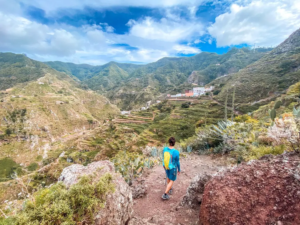
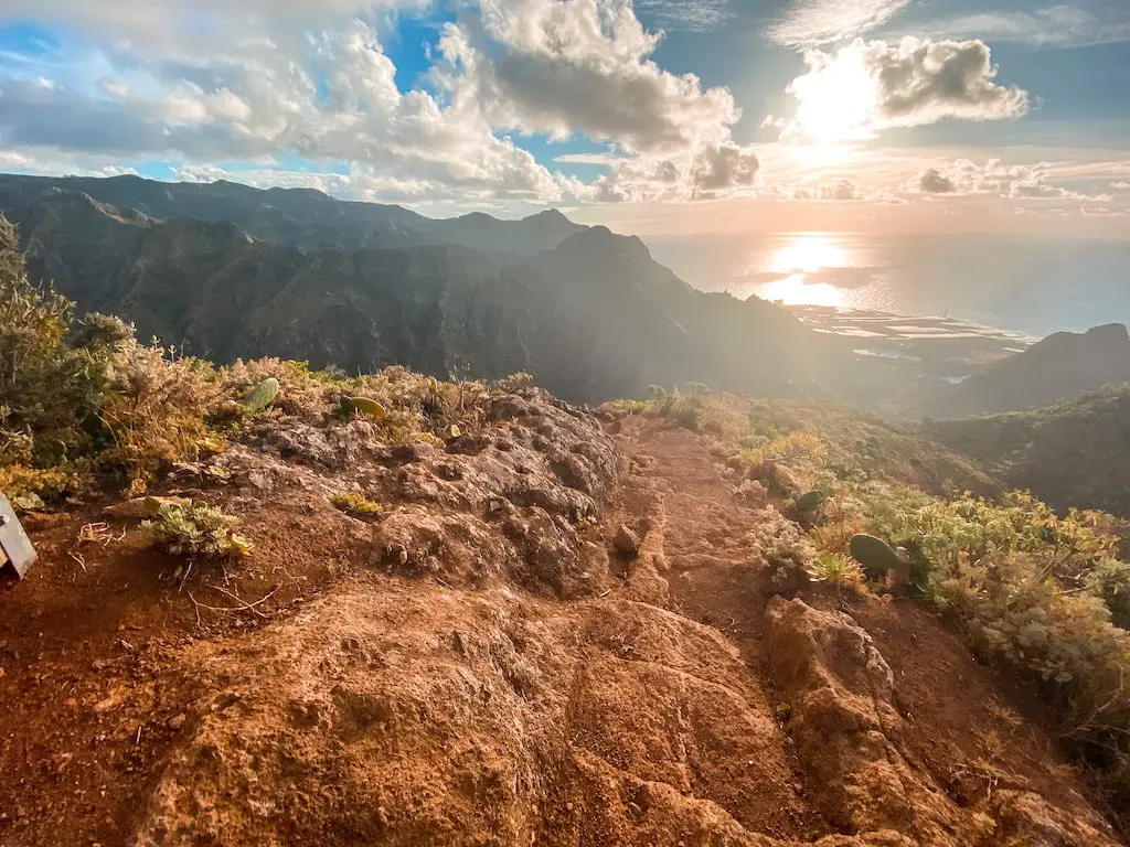
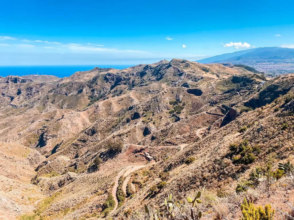
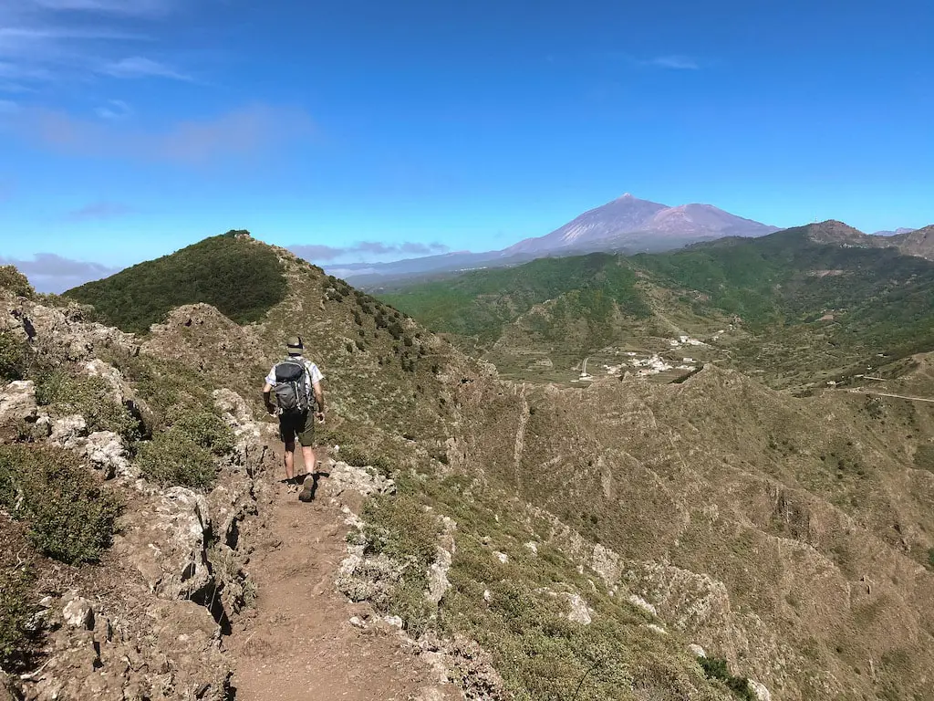
AN OLD LINEN TRAIL FROM PUNTA DEL HIDALGO TO CHINAMADA VIA BATAN VILLAGE
Distance: 13km
Elevation Gain: 900m
Difficulty: Moderately Hard
Highlights: My personal favourite of the island. Off the beaten path, crazy little mountains and hidden villages!
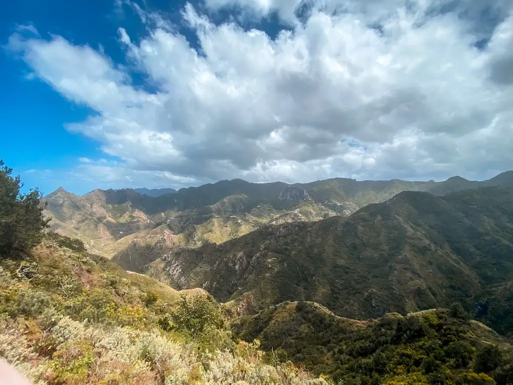
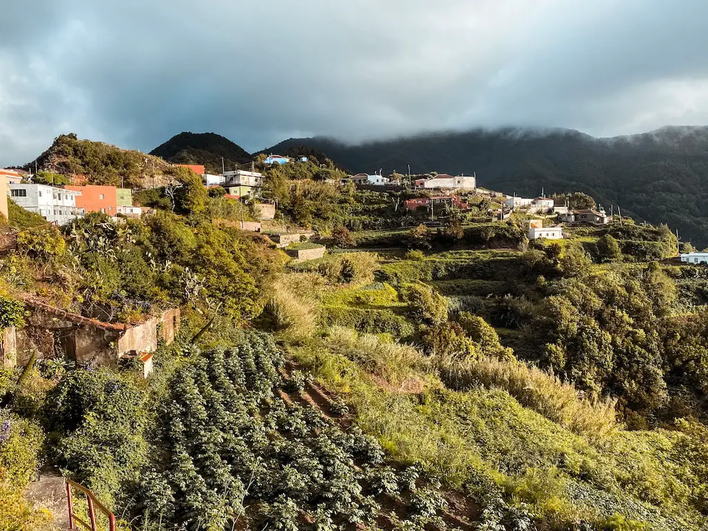
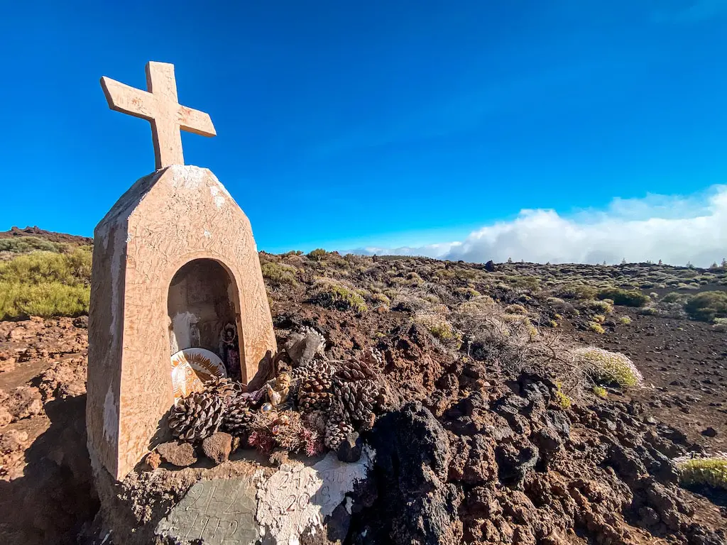
This hidden trail from Punta del Hidalgo to Batan and Chinamada is my number one hiking adventure in the Anaga Mountains, and maybe even on the whole island. The whole journey is full of beautiful views of the northern part of the island and the coast. The route takes you through an old linen route from Punta del Hidalgo to Chinamada, passing through the village of Batan where time seems to have stopped. This is a great way to forget about the world for a while.
READ THE FULL DETAILED BLOG POST: PUNTA DEL HIDALGO – CHINAMADA
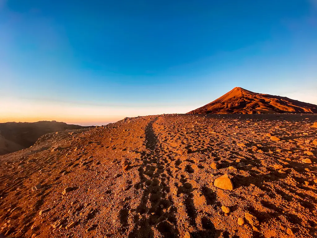
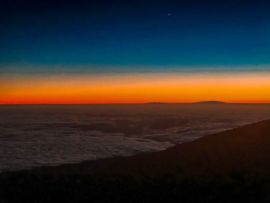
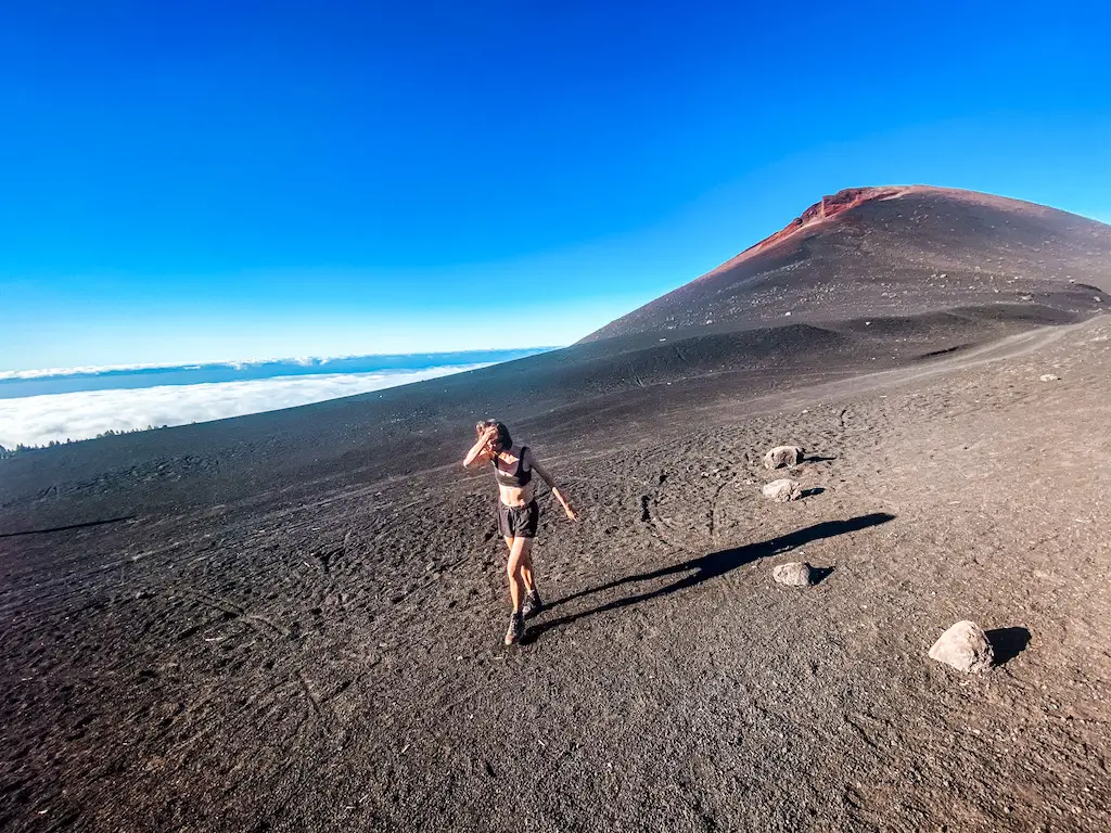
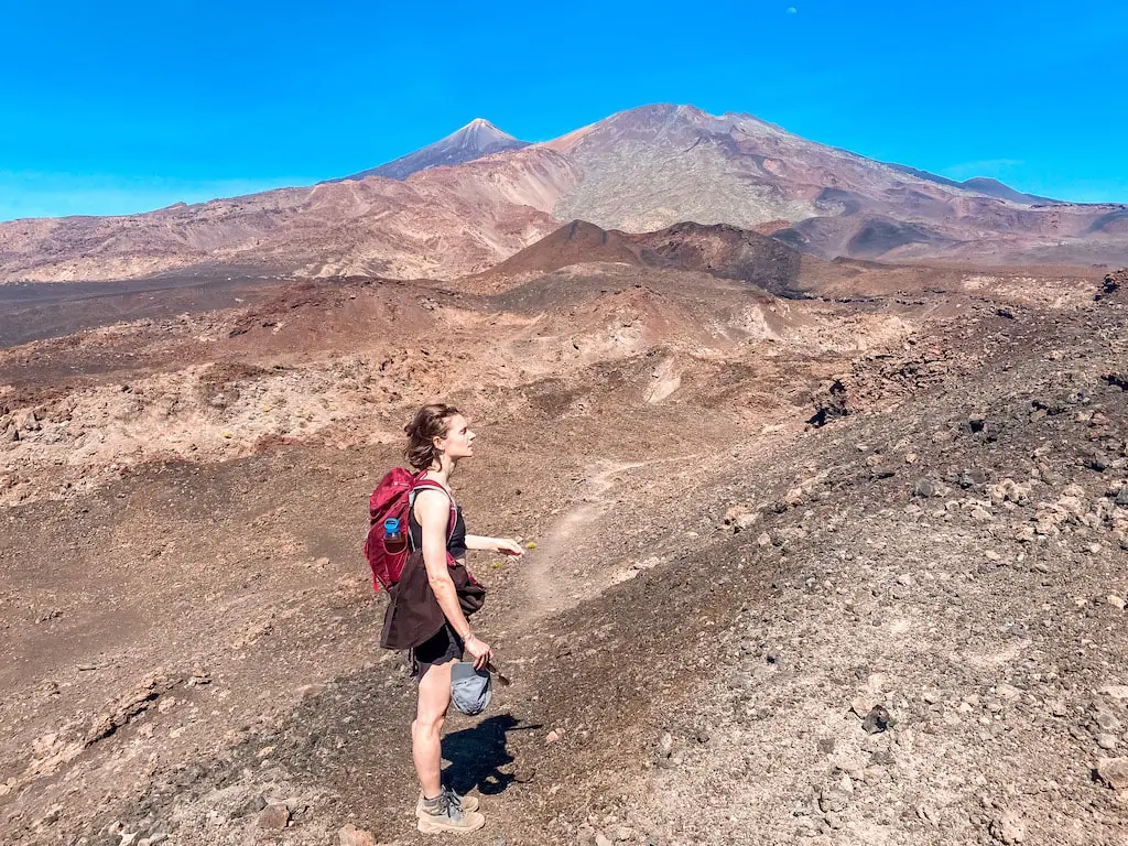
PICO VIEJO SUNSET HIKE
Distance: 13,5km
Elevation Gain: 1050m
Difficulty: Hard
Highlights: Stunning lunar landscape, almost nobody on the trail. Incredible views and best sunset on the island.
Pico Viejo (3135m) is the second highest peak in Tenerife. This sunset hike is a great alternative to its famous neighbour, Mount Teide. It offers a quieter experience, a challenging ascent and if timed right, offers one of the most spectacular sunset views on the entire island. Don’t tell anybody, but I found climbing Pico Viejo more challenging and interesting than Teide. Probably because not many people decide to go after this huge caldera.
READ THE FULL DETAILED BLOG POST: PICO VIEJO
ENJOYING 30 BEST HIKES IN TENERIFE?
Support my work and grab me a coffee. It helps me create even more! 😊
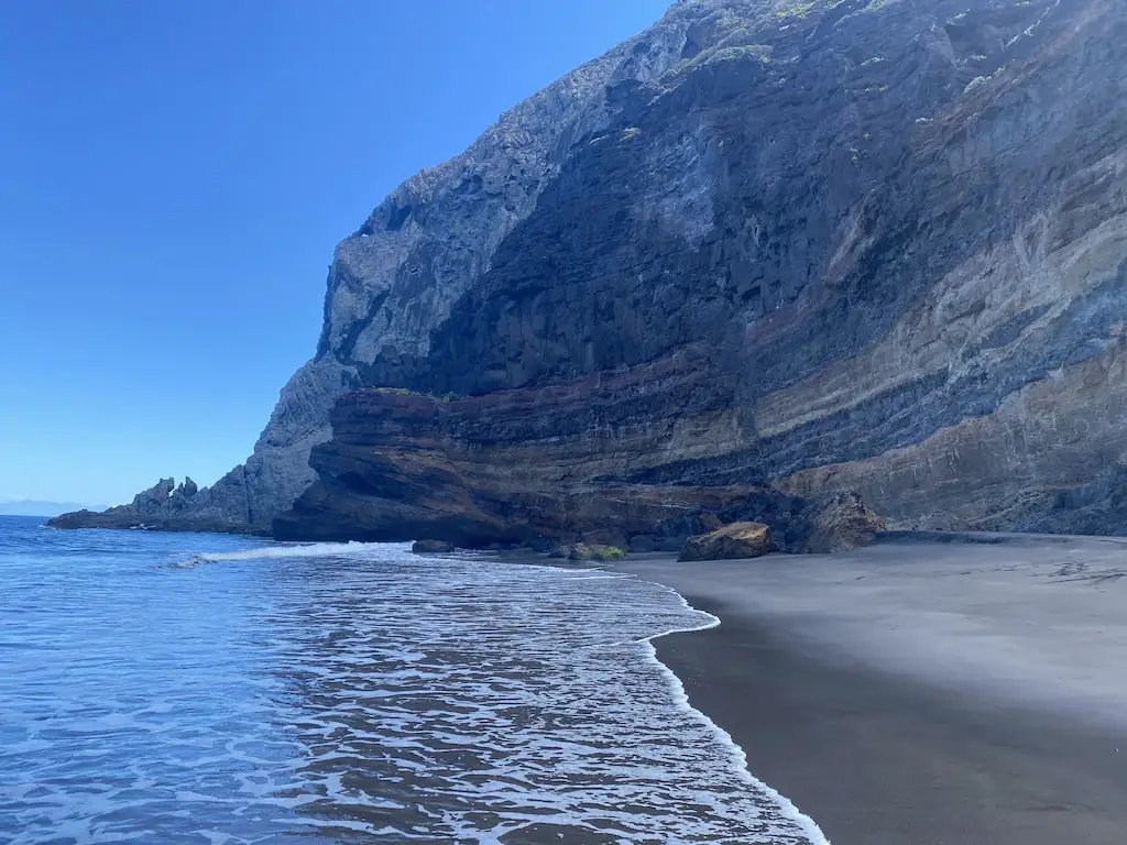
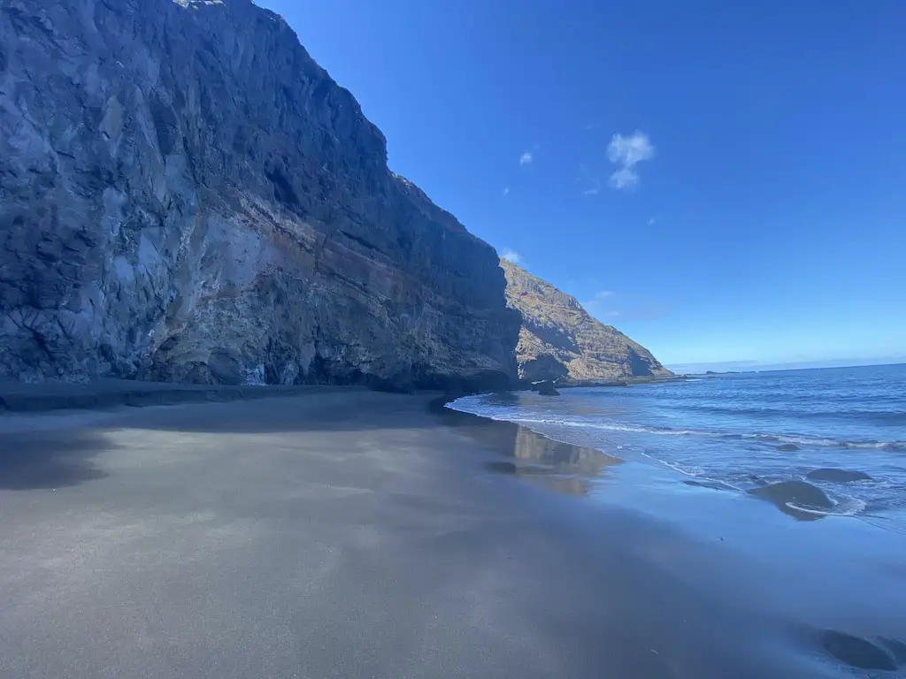
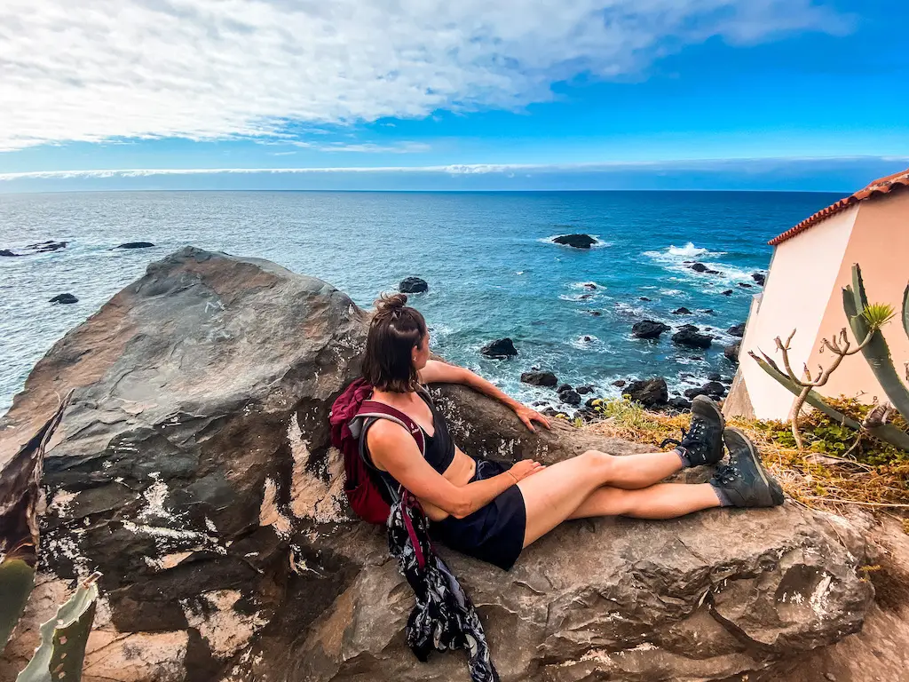
PLAYA DE IJUANA – THE HIDDEN GEM OF TENERIFE
Distance: 11,5km
Elevation Gain: 850m
Difficulty: Moderate
Highlights: Possibly the most serene, untouched and beautiful beach on the island.
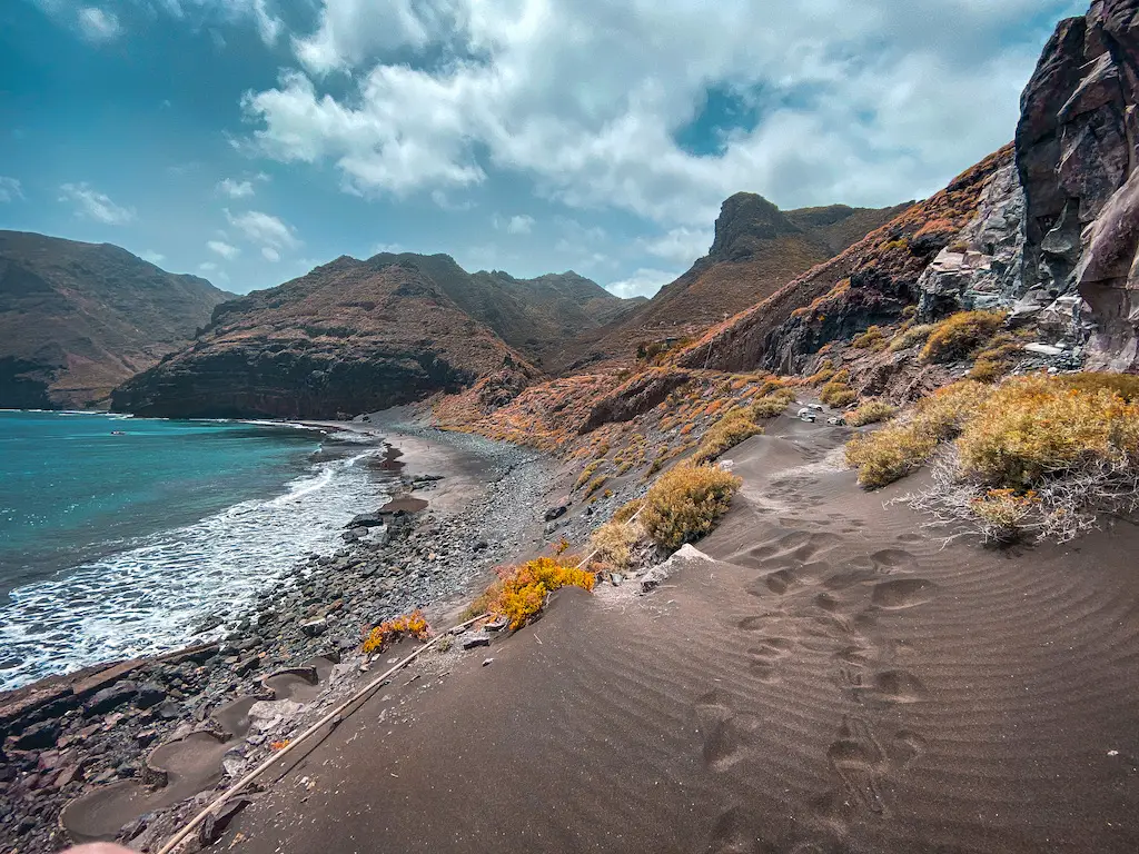
Playa de Ijuana is a true hidden gem of Tenerife. Not only does it offer spectacular views of the Anaga Mountains and surrounding villages, but it also leads to one of the most amazing beaches I’ve ever seen. What makes this place so unique is the fact that it can only be reached by foot. You can’t even get close there by boat, because the tides are strong. On top of that, this remote black sand beach is unknown to both tourists and many locals, making it a true “hidden gem.”
READ THE FULL DETAILED BLOG POST: PLAYA DE IJUANA
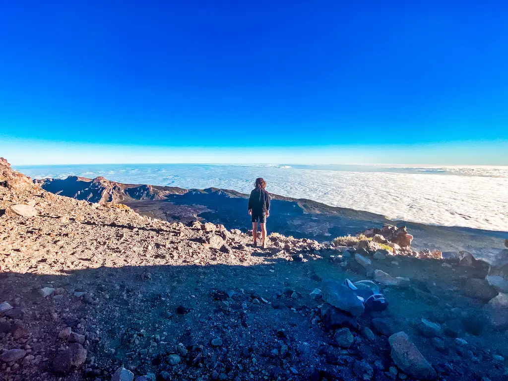
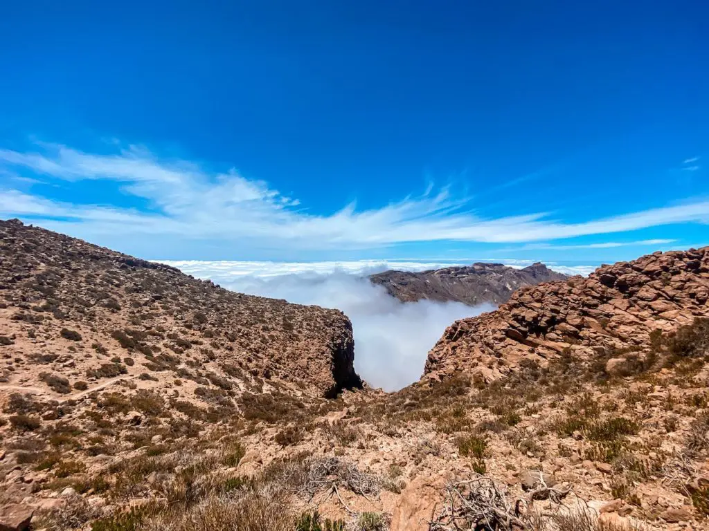
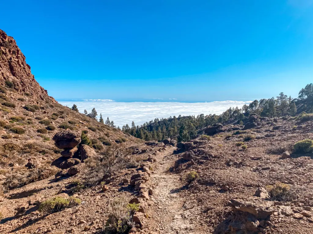
ALTO DE GUAJARA
Distance: 11km
Elevation Gain: 700m
Difficulty: Moderate
Highlights: Incredible views on Teide, scenic trail overall with enough of a challenge!
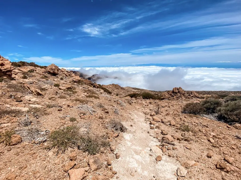
Alto de Guajara (2718m) is one of my favourite hiking adventures in Tenerife. The trail to the top of the mountain is full of great sights, with beautiful views of the Teide (3715m) and the ocean of clouds below. It’s a great intro to Teide National Park and if hiked anti-clockwise it presents a good physical challenge as well.
READ THE DETAILED BLOG POST: ALTO DE GUAJARA
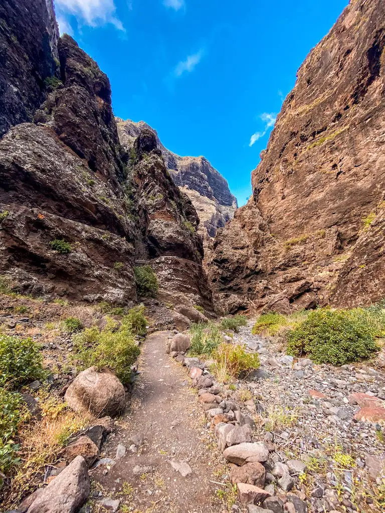
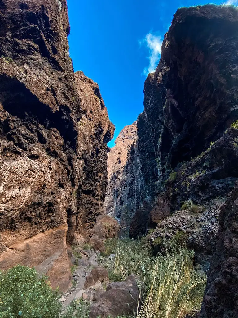
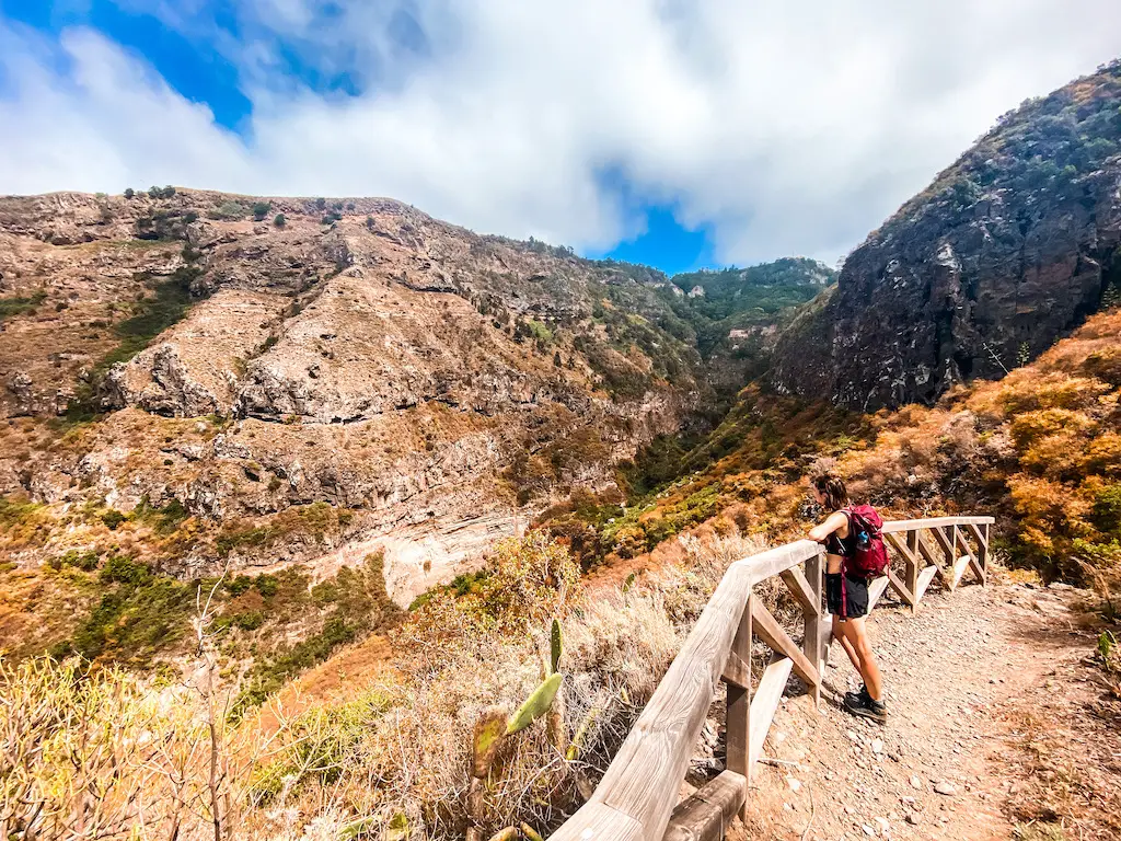
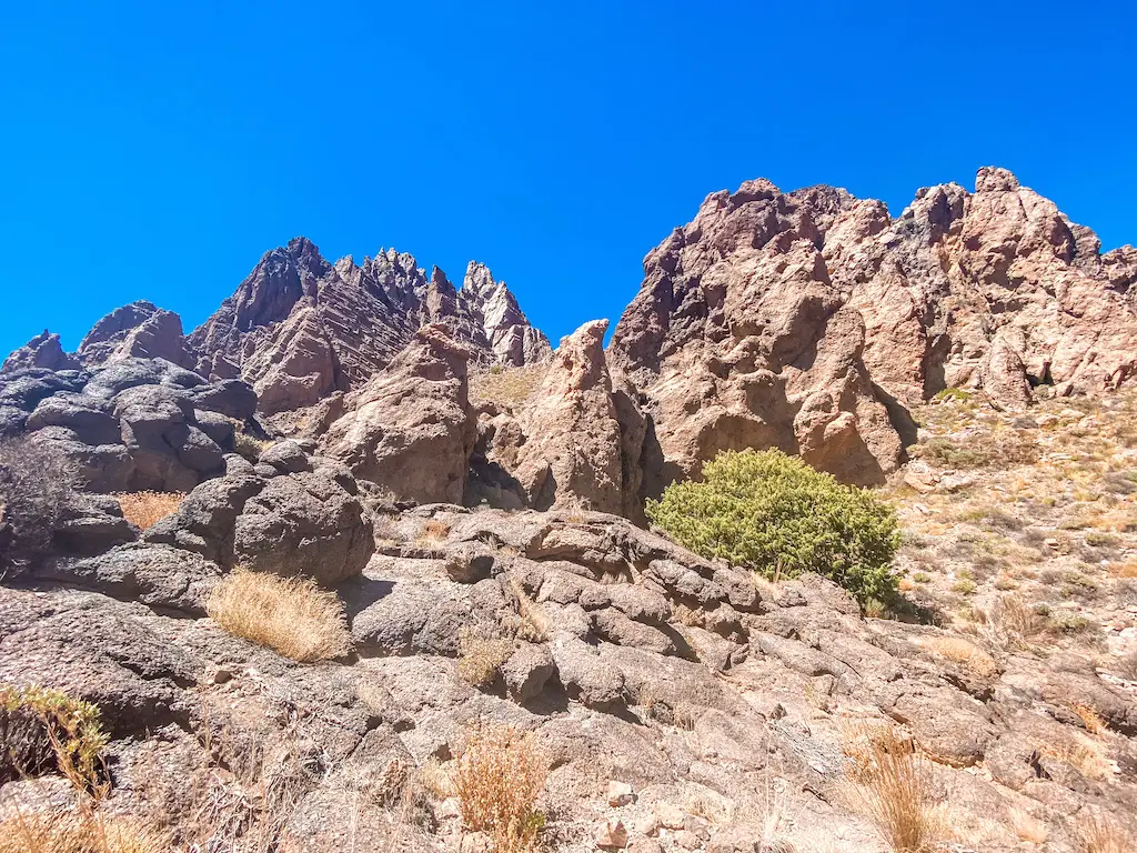
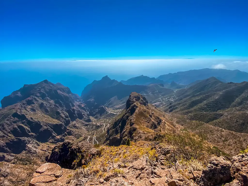
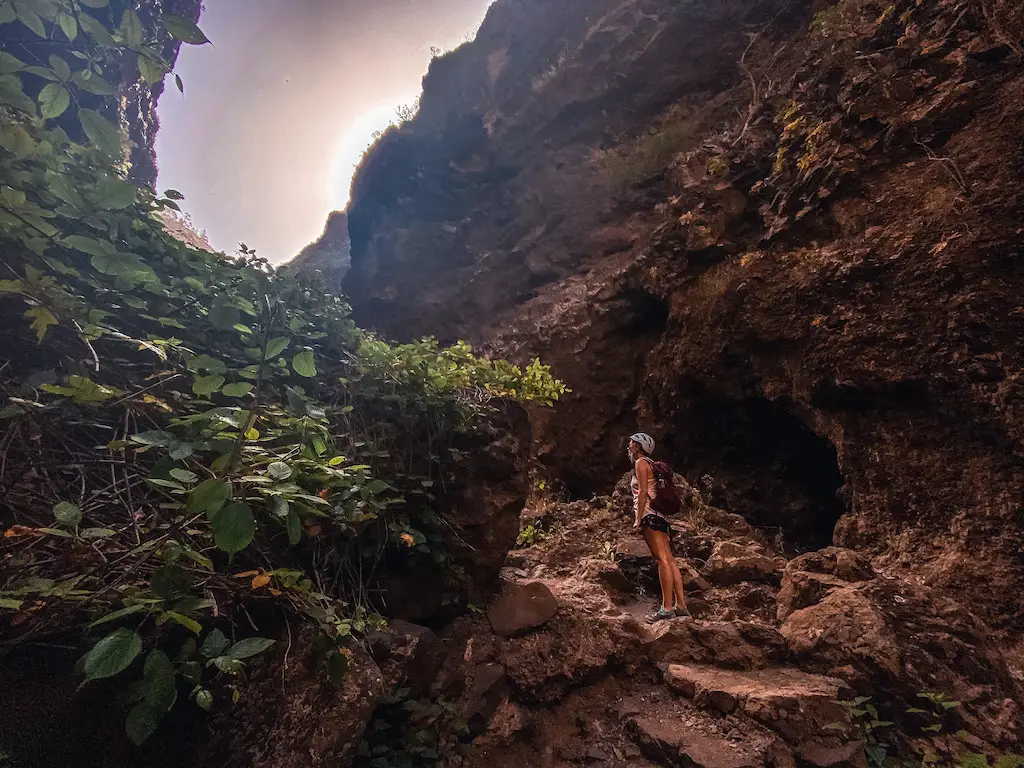
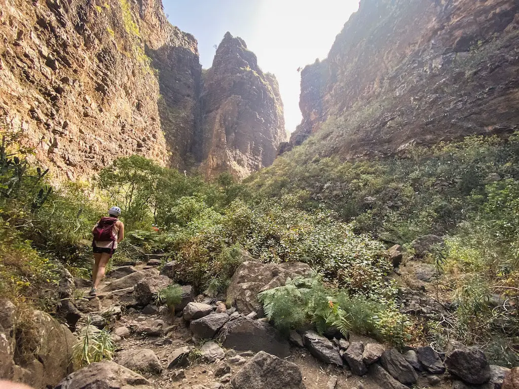
MASCA GORGE
Distance: 8,5km
Elevation Gain: 650m
Difficulty: Moderately Easy
Highlights: Crazy canyon walk, featuring scenery similar to Mordor in Lord of the Rings.
Masca Gorge hike (620m) is one of the most popular hiking trails in Tenerife. This stunning canyon route runs through a gorge surrounded by high, several hundred meter-tall rocks, all the way to the Masca Beach. Before it was closed in 2018, the Masca Gorge hike was one of the most popular trails in Tenerife. However, due to the high number of accidents and rescue services to assist unprepared and irresponsible tourists, local authorities decided to secure the trail with railings, chains, and additional markings to prevent hikers from getting lost or injured. While these measures have made the trail safer, it is still a hike and requires some fitness and preparation.
READ THE DETAILED BLOG POST: MASCA GORGE
You can book a tour for Masca Gorge with fast track access to avoid queues.
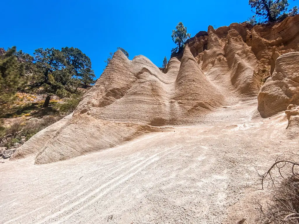
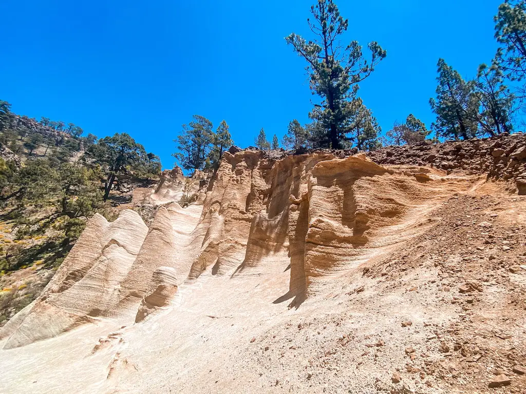
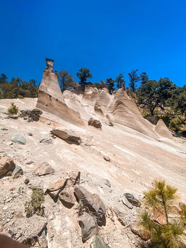
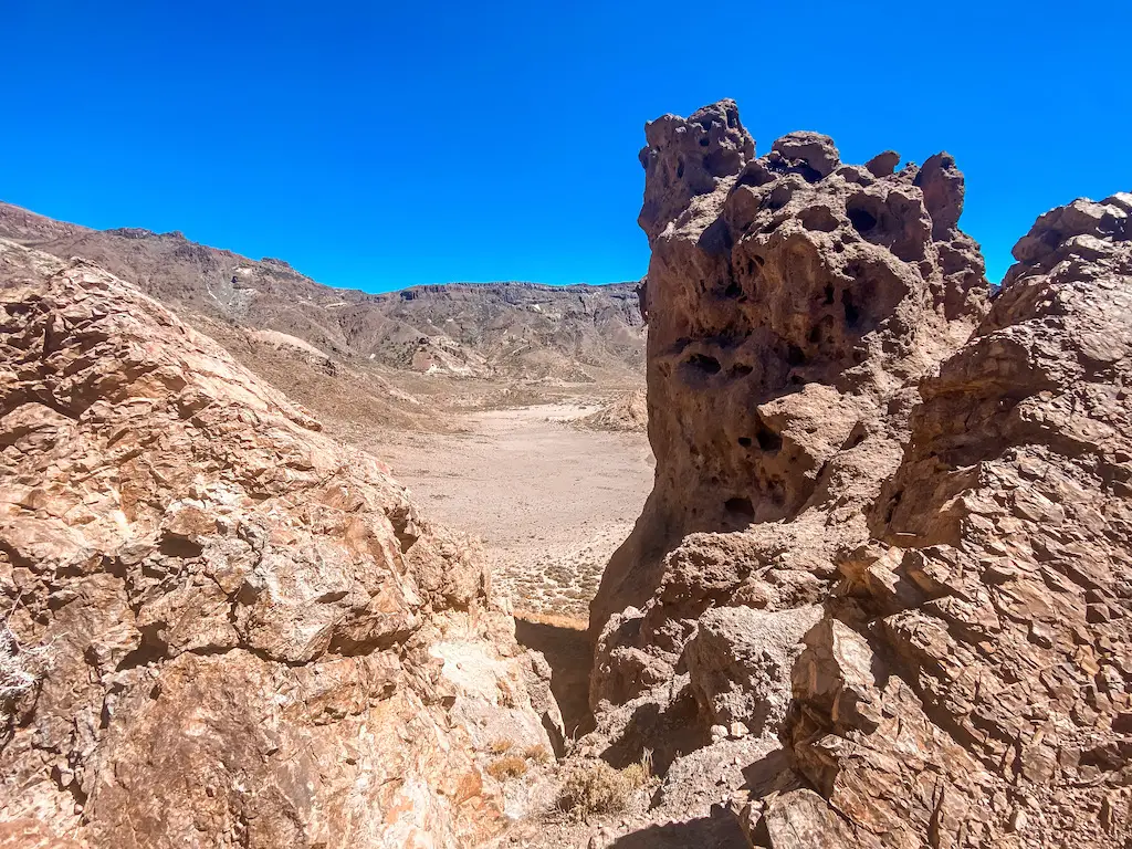
PAISAJE LUNAR – TWO DIFFERENT TRAILS TO CHOOSE
Distance: 9km or 18km
Elevation Gain: 400m or 100m
Difficulty: Easy and Moderately Easy
Highlights: The weird, unreal and interesting rock formations you won´t experience elsewhere.
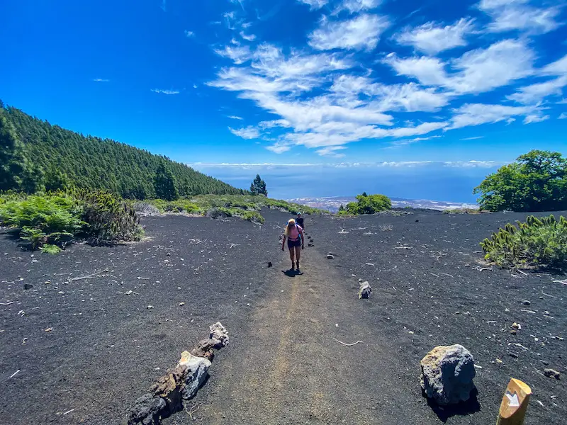
Paisaje Lunar is one of the most interesting natural wonders in Tenerife. This unique hiking trail takes you through a lunar landscape created by volcanic eruptions, with lava that has hardened into striking rock formations. My initial plan was to hike Paisaje Lunar only once, taking the longer route from Cruz de Tea. The whole journey was really beautiful, leading through pine tree forests and up to the peak of Montaña Bermeja (1883m). Unfortunately, the weather on that day was not cooperating, and I was unable to see much of the lunar landscape due to fog and clouds. As a result, I decided to come back the next day and take a different route to Paisaje Lunar. This allowed meto see Paisaje Lunar in all its glory and take some great photos.
READ THE DETAILED BLOG POST: PAISAJE LUNAR
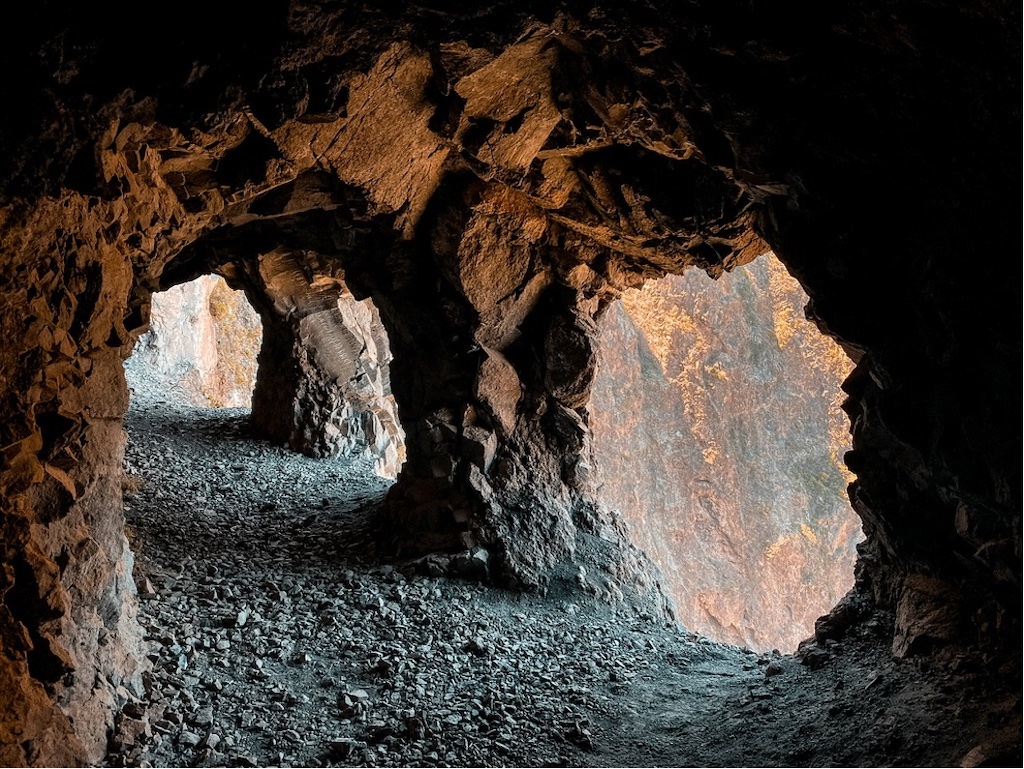
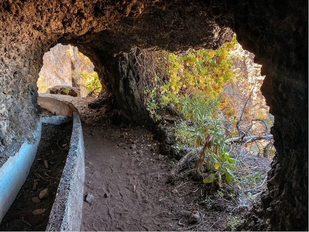
LAS VENTANAS DE GUIMAR
Distance: 14-17km
Elevation Gain: None
Difficulty: Moderately Easy
Highlights: Absolutely incredible “tunnel” experience.
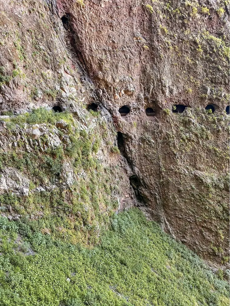
Las Ventanas de Guimar is one of the coolest adventures on the island. The name, “Mil Ventanas de Güimar,” translates to “A Thousand Windows of Güimar,” and it’s easy to see why. This unique tunnel route takes you through dozens of windows made by nature, is easy and provides a magical hiking experience that can’t be found else where.
READ THE DETAILED BLOG POST: LAS VENTANAS DE GUIMAR
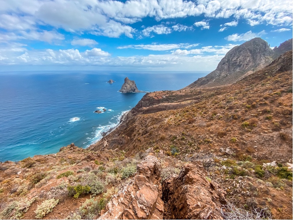
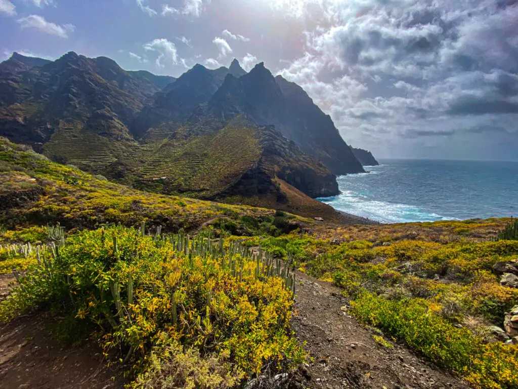
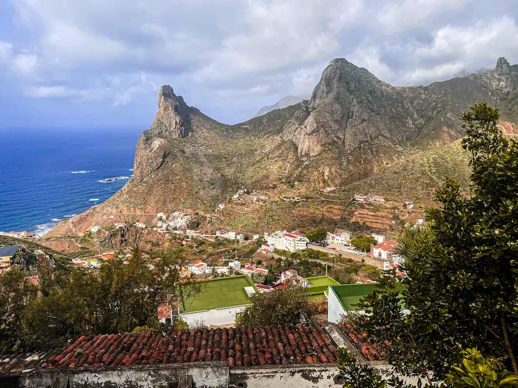
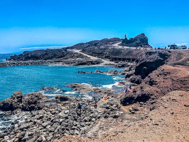
GRAND FARO DE ANAGA
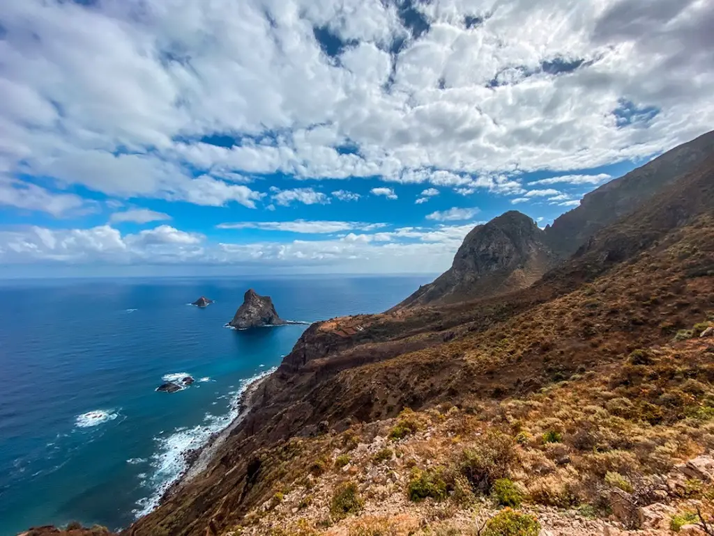
Distance: 14km
Elevation Gain: 1000m
Difficulty: Moderate
Highlights: Stunning coastal views, historical old transportation paths.
There is a reason why Grand Faro de Anaga is so popular, in my personal view it is one of the top hikes on the island. It was actually my first hike I’ve done on the island and I had a lot of fun doing this loop. If you love diverse coastal walks, I’m sure you’re going to love it too.
READ THE DETAILED BLOG POST: GRAND FARO DE ANAGA
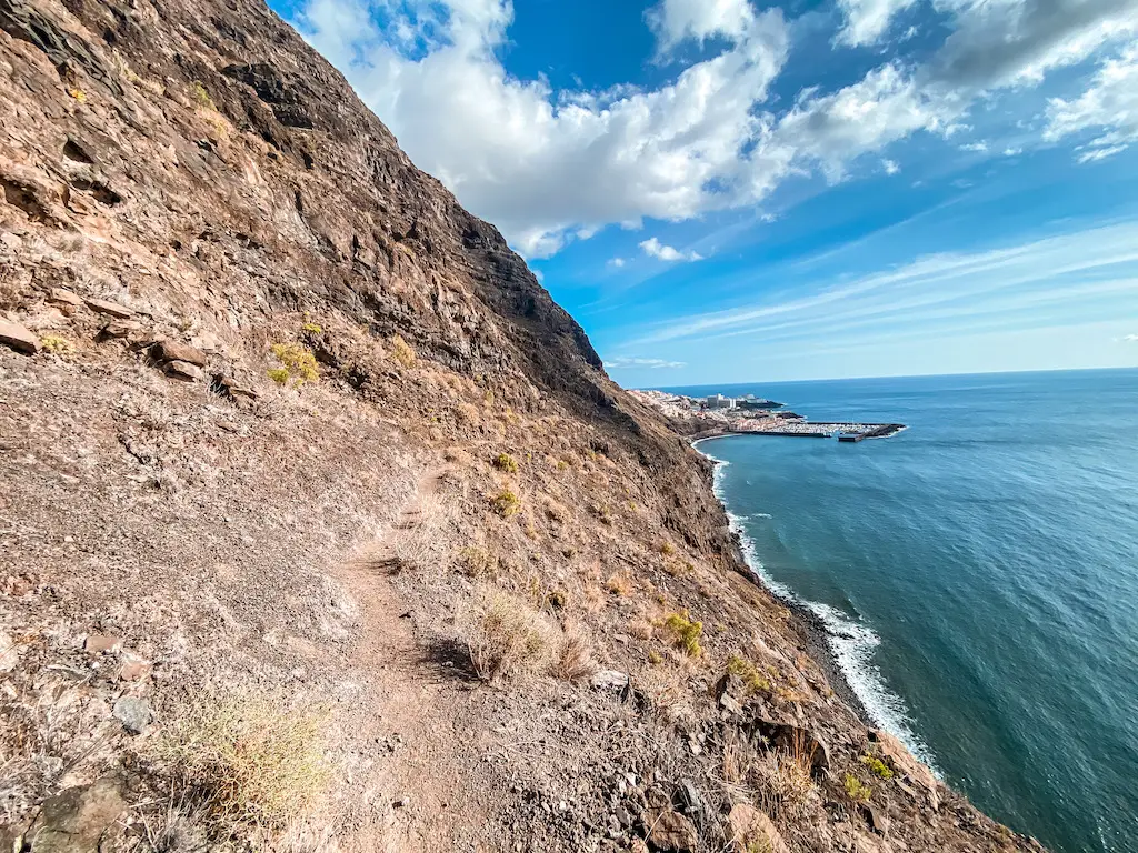
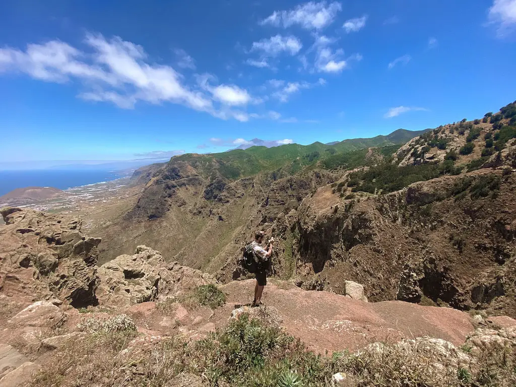
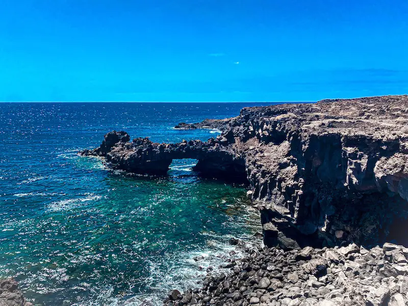
EPIC LOS GIGANTES HIKE
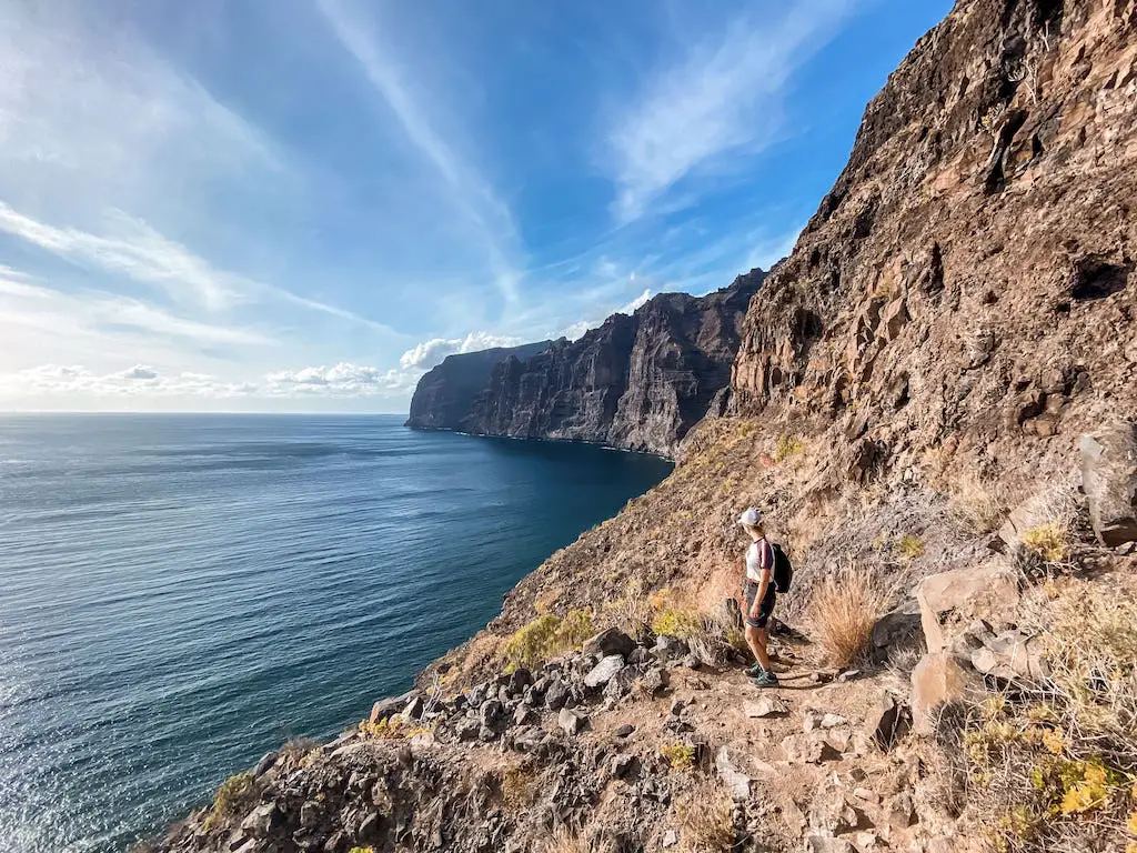
Distance: 23km
Elevation Gain: 1400m
Difficulty: Hard and possible danger
Highlights: Hardcore trail with hardcore views. Not for faint-hearted.
This hardcore trail can be classified as an extreme adventure and is one of my personal favourites when it comes to hiking in Tenerife. Starting from the village of Tamaimo, the route takes you through a secluded gorge, a tunnel, and an incredible cliff walk 100 meters above the coast. Warning: this trail is not recommended for unexperienced hikers or people with vertigo.
READ THE DETAILED BLOG POST: EPIC LOS GIGANTES HIKE
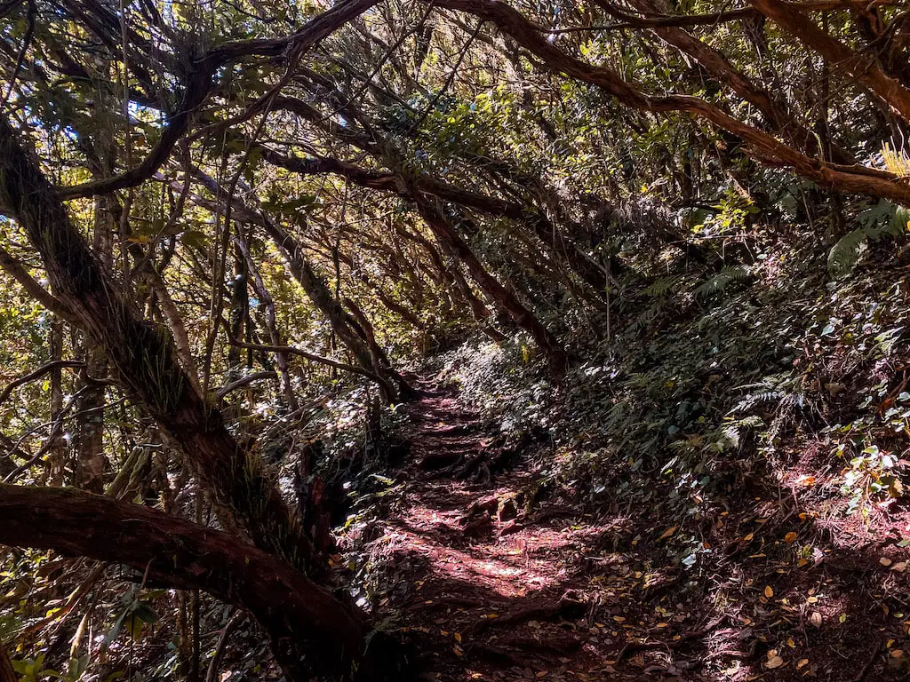
MONTE AGUIRRE AND THE MAGICAL LAURISILVA FOREST
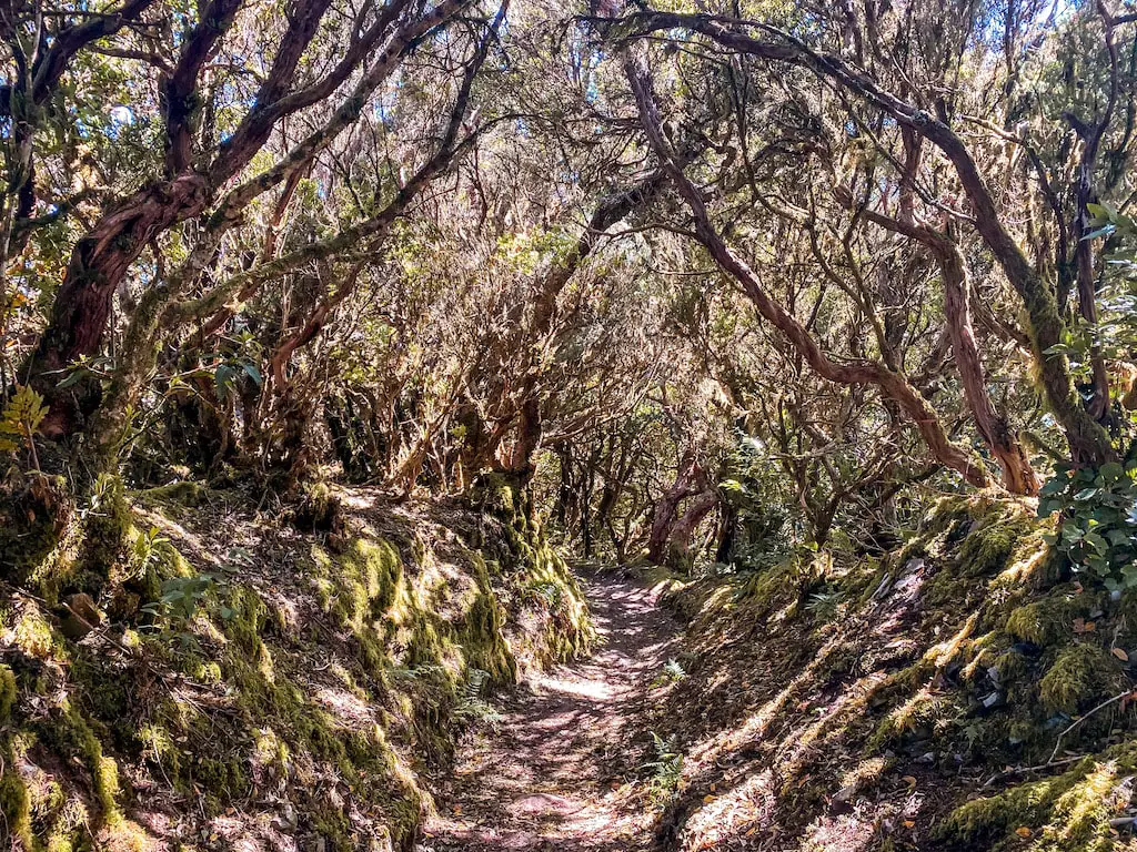
Distance: 8km
Elevation Gain: 350km
Difficulty: Easy
Highlights: Stunning laurel forest and peaceful walking-meditation opportunities.
Monte Aguirre is the most magical forest experience you can find in Tenerife. I came up with this route by combining a few trails so I could reach the Monte de Aguirre, Pico del Ingles and experience the magical Laurel Forest in the Zona de Exclusion. This short adventure is a must do for all Laurisilva Forest fans.
READ THE DETAILED BLOG POST: MONTE AGUIRRE AND THE MAGICAL LAUREL FOREST
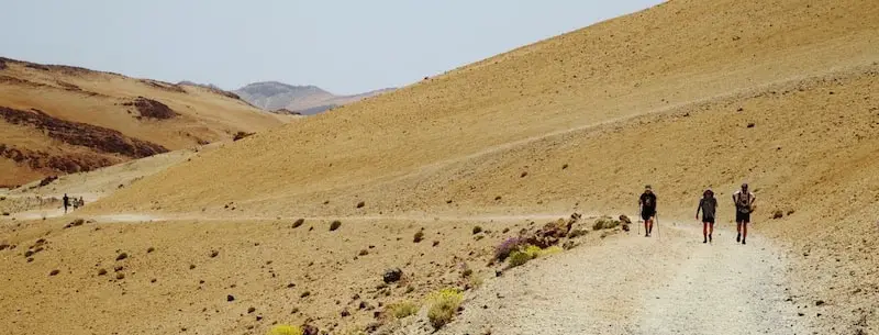
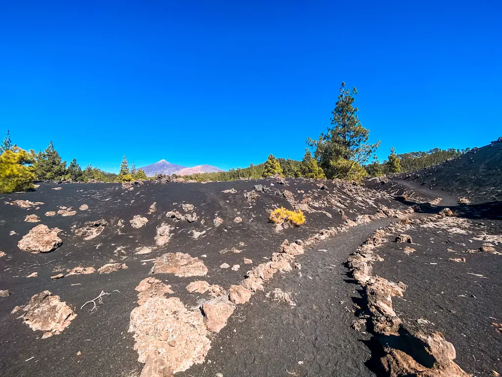
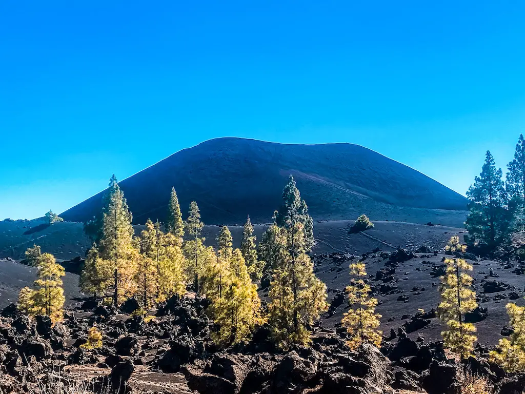
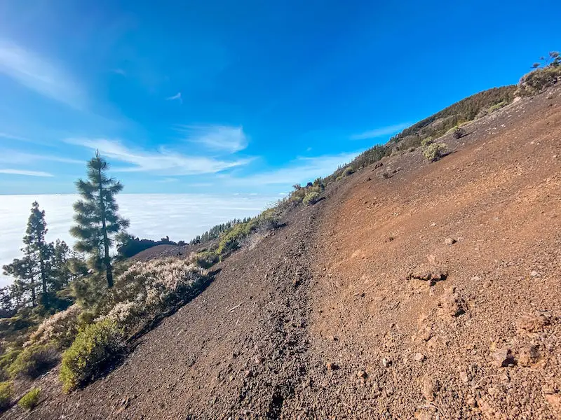
CHINYERO VOLCANO
Distance: 14km
Elevation Gain: 350m
Difficulty: Easy
Highlights: Less popular volcano, with beautiful cloud immersions and easy paths.
Chinyero Volcano hike (spanish: Volcan Chinyero) is a unique adventure that takes you on a journey through the volcanic legacy of Tenerife. This trail holds significant historical and geological importance as it leads through landscapes shaped by the last volcanic eruption on the island in 1909. Read my guide for this stunning hike featuring some fascinating lava formations and the rich historical significance of the Chinyero area.
READ THE DETAILED BLOG POST: CHINYERO VOLCANO
SENDERO DE BARACAN
Distance: 19km
Elevation Gain: 1400m
Difficulty: Hard
Highlights: Beautiful Teno mountains, less crowded, with incredible views on surrounding islands.
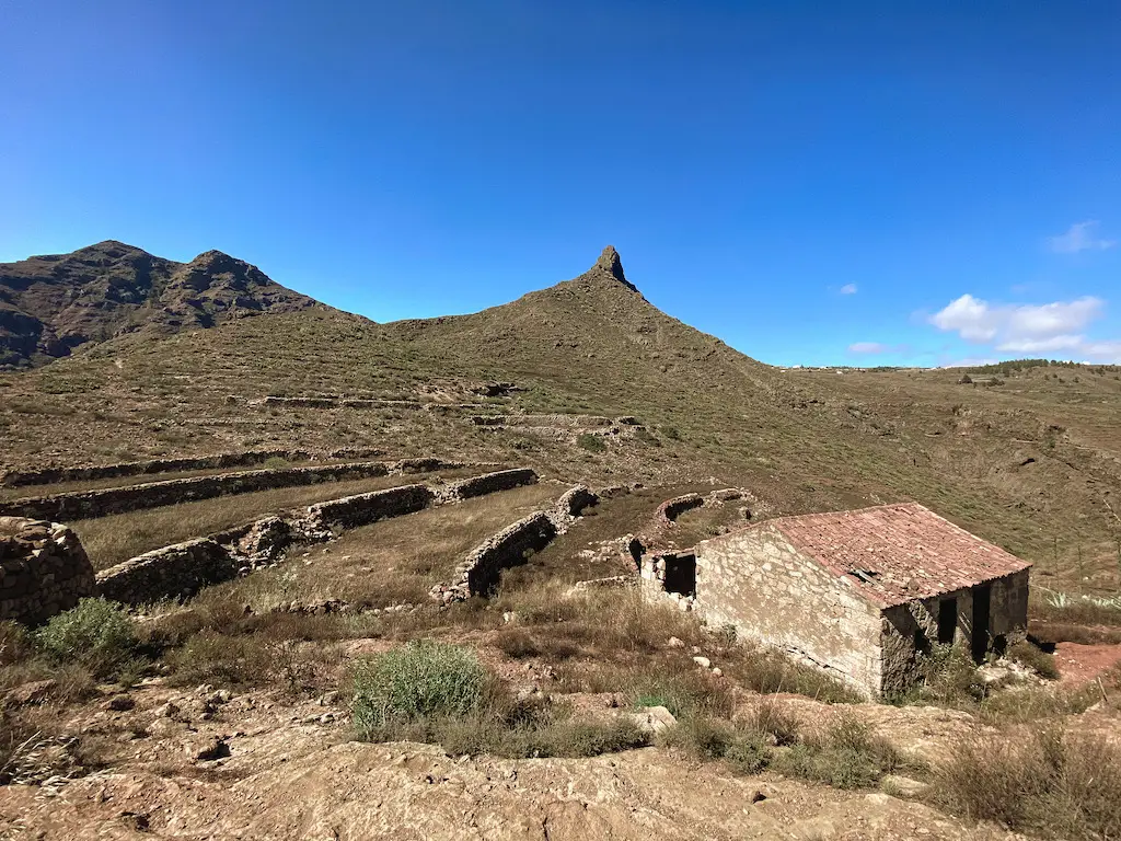
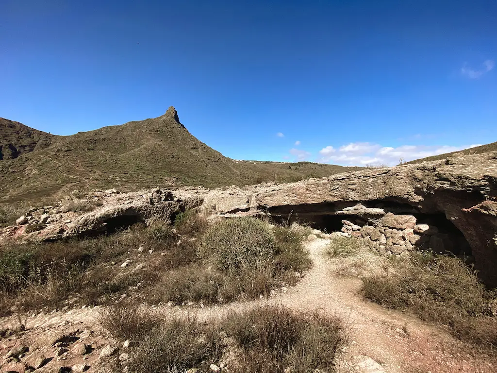
Welcome to Teno Mountain Range in Tenerife! This guide is for a challenging route that combines a few different trails around the area. The trail winds its way up the steep slopes of the Teno Mountains, reaching an elevation of 1,350 meters. Starting from Buenavista del Norte, it goes through a beautiful town of Teno Alto, the magnificent Sendero de Baracan and the town of El Palmar.
READ THE DETAILED BLOG POST: SENDERO DE BARACAN
CAMINO DE CANDELARIA SOUTH
Distance: 19km
Elevation Gain: 1500m
Difficulty: Hard
Highlights: Old pilgrim route, featuring a climbing challenge and awesome views on the island.
Camino de Candelaria from the South is an awesome hike for everyone who likes physical challenges. This is a demanding climb through the mixed terrain yet very, very rewarding. The views from the Mirador de la Crucita are truly fantastic! Don’t forget to tackle Camino de Candelaria North to complete the whole pilgrim route. I hope you enjoyed reading this guide and will have a lot of fun hiking Camino de Candelaria South as much as we did.
READ THE FULL DETAILED BLOG POST: CAMINO DE CANDELARIA SOUTH
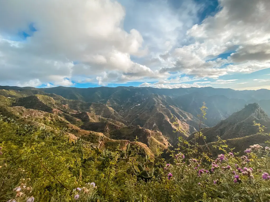
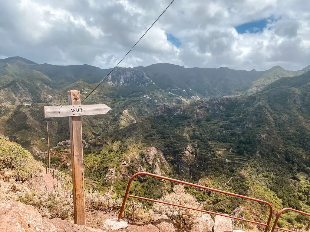
AFUR HIKE IN ANAGA MOUNTAINS
Distance: 12km
Elevation Gain: 970m
Difficulty: Easy to Moderate
Highlights: Hidden villages, less crowded trails and a serene experience.
Afur hike is a beautiful loop trail located in the Anaga Rural Park in Tenerife. This guide is for one of the less-known trails on the island, so you will often have the beautiful views all to yourself. Hiking Afur from Casa Carlos is a serene experience plus it’s also a great introduction to the Anaga Mountains in Tenerife. This trail goes along many different sights including the village of El Fronton and Roque Negro. If you’re looking for alternative and more quiet experience hiking in Anaga Mountains, this one’s for you.
READ THE FULL DETAILED BLOG POST: AFUR HIKE IN ANAGA MOUNTAINS
PLAYA DE ANTEQUERA – A HIDDEN PARADISE
Distance: 17km
Elevation Gain: 1000m
Difficulty: Moderate
Highlights: Second best beach on the island(after Playa de Ijuana)- a total hidden gem!
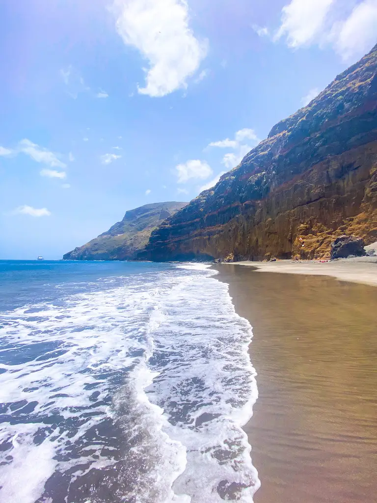
Playa de Antequera hike is one of those places where you can escape the crowds. This beautiful black sand beach is a hidden paradise since it can be only accessed by foot or a boat. It is also a great alternative to other busy beaches around the island.
FULL DETAILED BLOG POST: PLAYA DE ANTEQUERA HIKE – A HIDDEN PARADISE
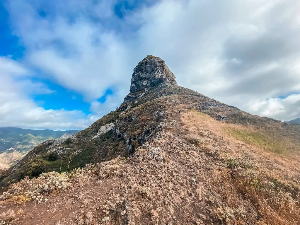
ROQUE DE TABORNO
Distance: 6km
Elevation Gain: 400m
Difficulty: Easy
Highlights: Great, short walk full of crazy coastal views.
Roque de Taborno is one of the coolest short hikes in Tenerife. This striking basaltic rock, rising 706 meters above sea level, is one of the most characteristic geological features of the Anaga Massif. Despite its relatively short distance of only 6 kilometers, this hike offers awesome views of the northern coast and is a great introduction to the beauty of Anaga Parque Rural. The trail is relatively easy, making it a great warm-up hike for those looking to explore the area.
READ THE FULL DETAILED BLOG POST: ROQUE DE TABORNO
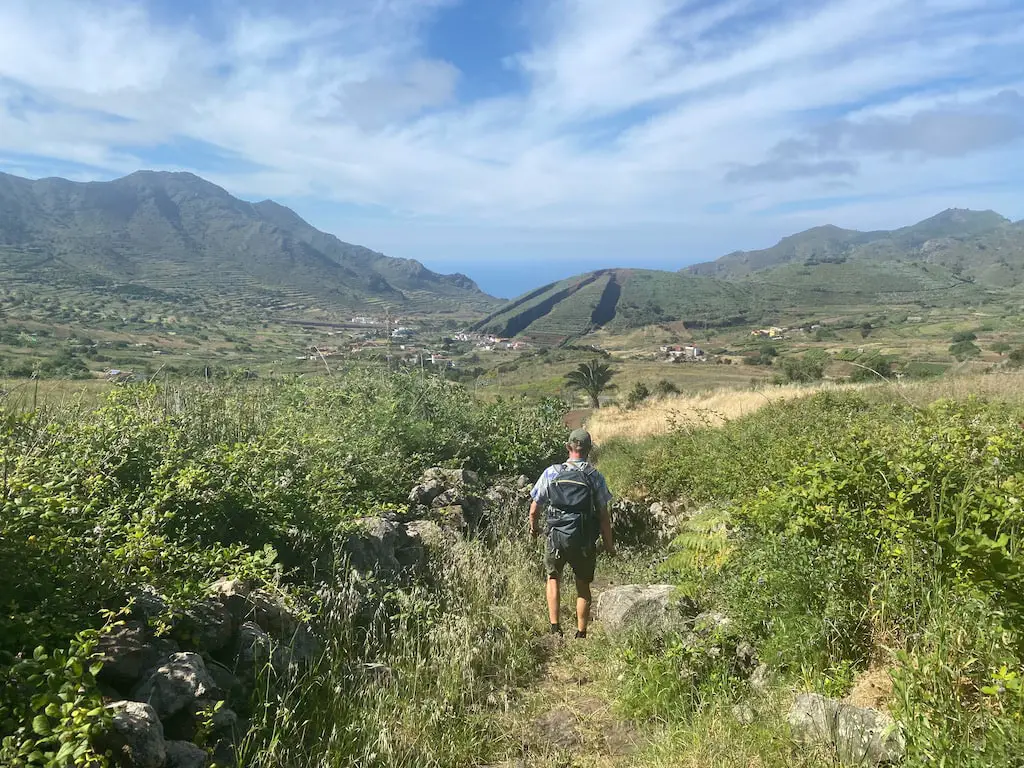
BARRANCO DE RUIZ – SAN JUAN DE LA RAMBLA COASTAL WALK
Distance: 9km
Elevation Gain: 550m
Difficulty: Easy
Highlights: Less popular trail linked with an incredible coastal walk.
Barranco de Ruiz – San Juan de Rambla is one of the most diverse short hikes I did in Tenerife. Although short, this hike offers great views of Barranco de Ruiz gorge and goes along picturesque villages. San Juan de La Rambla is a beautiful town that has one of the best coastlines in the north of the island.
READ THE FULL DETAILED BLOG POST: BARRANCO DE RUIZ – SAN JUAN DE LA RAMBLA COASTAL WALK
PLAYA TAMADITE HIKE
Distance: 13km
Elevation Gain: 840m
Difficulty: Moderately Easy
Highlights: One of the most beautiful beaches of the island.
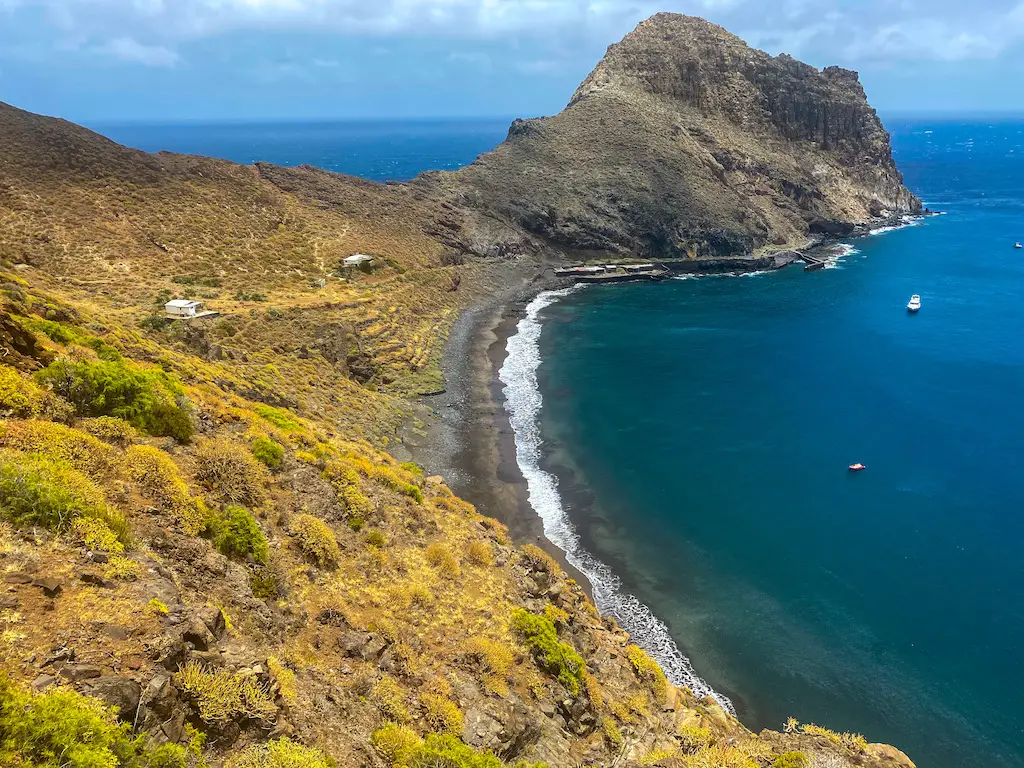
This guide is for a very beautiful loop hike in the greenest part of Tenerife – Parque Rural de Anaga. This awesome route starts from the village of Afur and goes along a beautiful gorge Barranco de Afur leading to the black sand beach – Playa de Tamadite, followed by the charming town of Taganana, surrounded by a natural landscape with great views of the Atlantic Ocean.
READ THE FULL DETAILED BLOG POST: PLAYA DE TAMADITE HIKE
LA FORTALEZA
Distance: 14km
Elevation Gain: 400m
Difficulty: Easy
Highlights: Heaven for flora lovers and geologists. Crazy rock formations.
La Fortaleza is one of Tenerife’s remarkable natural landmarks located within Teide National Park. Known for its breathtaking views, this unique geological formation stands as a testament to the island’s volcanic history. Although, there are many trails with different difficulty level leading all the way up to La Fortaleza, this guide is for an easy hike that begins in El Portillo Visitor Center and is a great intro to the diverse landscapes of Teide National Park.
READ THE FULL DETAILED BLOG POST: LA FORTALEZA
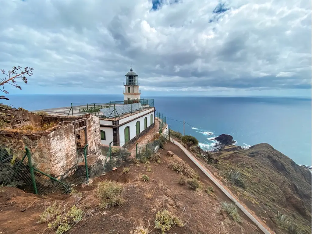
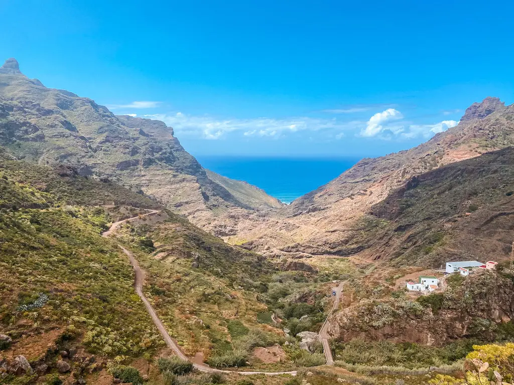
PUNTA DE TENO HIKE – A CHALLENGING LOOP FAR FROM THE CROWDS
Distance: 20km
Elevation Gain: 1000m
Difficulty: Hard
Highlights: Challenging, steep and demanding trail, perfect for those who love putting an effort.
Punta de Teno hike is one the most memorable hiking adventures I had in Tenerife. This very challenging but rewarding route has everything Teno Mountans have to offer: beautiful gorges, challenging descents, strenuous ascents, some scrambling, unforgettable coastal walks and the famous Punta de Teno lighthouse.
READ THE FULL DETAILED BLOG POST: PUNTA DE TENO – A CHALLENGING LOOP FAR FROM THE CROWDS
CAMINO DE CANDELARIA NORTH
Distance: 11km
Elevation Gain: 1000m
Difficulty: Moderate
Highlights: A pilgrim route, unknown to most. Great way to uncover the history.
Camino de Candelaria trail has a very rich history, dating back to the early settlers of the region who used it as a way to travel and trade between the various villages. Hiking Camino de Candelaria allowed me to do a little discovery of the history and natural beauty of Tenerife.
READ THE FULL DETAILED BLOG POST: CAMINO DE CANDELARIA NORTH
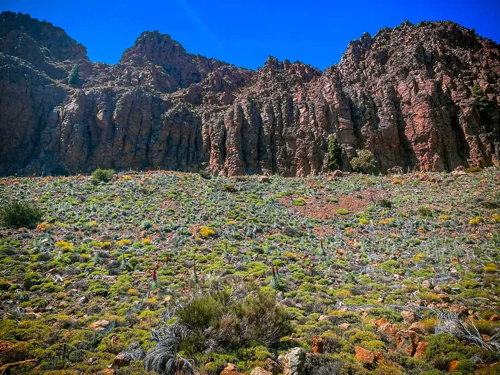
ROQUES DE GARCIA
Distance: 4,5km
Elevation Gain: 188m
Difficulty: Easy
Highlights: Awesome rock formation for relatively little effort.
The Roques de Garcia trail is one of the best short hikes you can do in Tenerife. Located within the Teide National Park, this trail stands out as a prominent attraction with its bizarre rock formations. The scenery along the hike reminds me of the iconic landscapes from the movie “Planet of the Apes.” On top of that, this famous route offers an opportunity to see the rock formation called “Roque Cinchado” or the “Finger of God.”
READ THE FULL DETAILED BLOG POST: ROQUES DE GARCIA
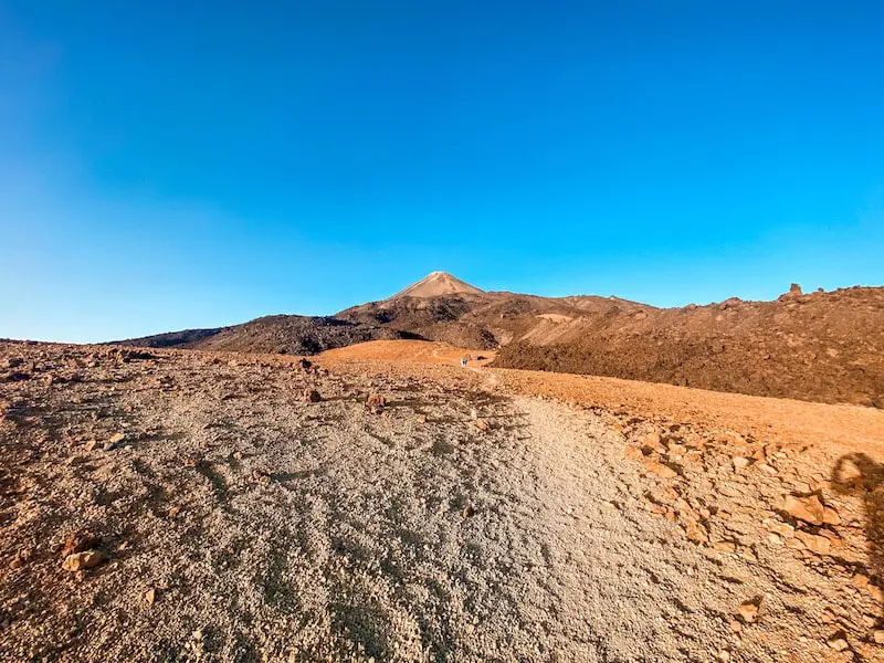
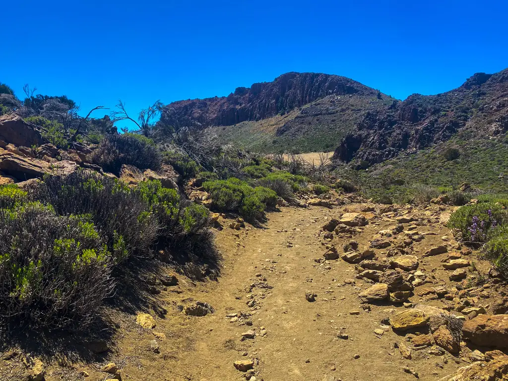
MIRADOR DE SAMARA LAVA WALK
Distance: 10km
Elevation Gain: 400m
Difficulty: Easy
Highlights: Have you been to Mars? Hike this trail to feel like going to Mars, or some other planet.
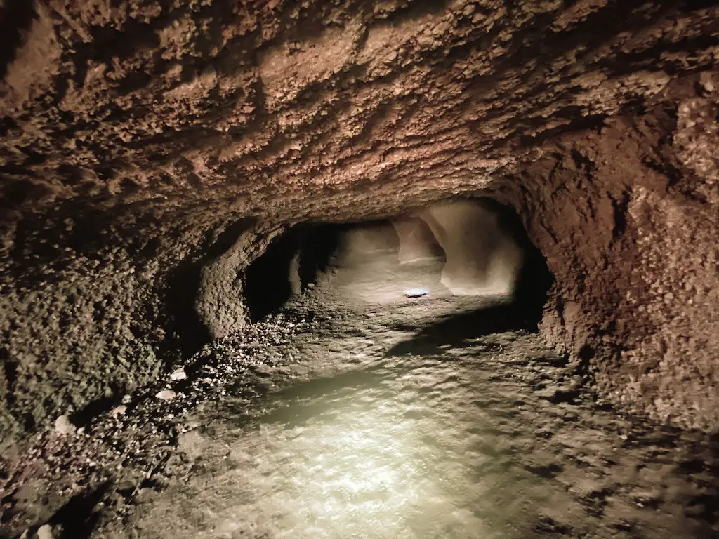
Mirador de Samara is short but very cool hike located in Teide Park. Not only it is less popular among other trails in Tenerife, it also allows you to walk on lava fields as well as (after a short detour) seeing Cuevas Negras. Very interesting set of caves carved inside of the volcanic grounds. If you’re looking for an easy, short yet rewarding adventure in Teide Park, Mirador de Samara is what you’re after. I promise!
READ THE FULL DETAILED BLOG POST: MIRADOR DE SAMARA LAVA WALK
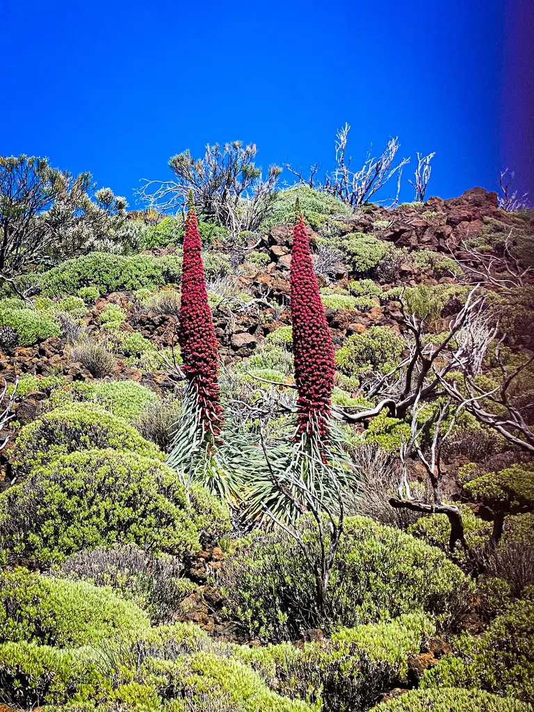
SOMBRERO DE CHASNA
Distance: 8km
Elevation Gain: 435m
Difficulty: Easy
Highlights: Serene, peaceful and short hike with crazy cloud immersion.
Sombrero de Chasna (2407m) is one of the coolest short hikes in Tenerife. This short but rewarding route takes you to the top of the peak, which resembles a hat, and offers panoramic views of Mount Teide, the Las Cañadas National Park, and the south coast of Tenerife. At just 8 km in distance, this hike is a great way to explore the higher elevations of Tenerife in just a few hours. Of all the short hikes I’ve done on the island, this one is definitely one of my favourites.
READ THE FULL DETAILED BLOG POST: SOMBRERO DE CHASNA
ROQUE DEL CONDE & ROQUE DE LOS BREZOS IN THE SOUTH + EXPLORING GUANCHA CAVES
Distance: 12km
Elevation Gain: 700m
Difficulty: Moderately Easy
Highlights: Guancha caves and the historical trail, not known by many.
Although Southern Tenerife isn’t popular for hiking as Teide National Park or Anaga Mountains, you can still find a few hides gems in the area. In this guide, I combined a few different trails and came up with an adventure featuring two summits of Roque del Conde (1001m), Roque de los Brezos (1108), stunning Barranco del Rey Ravine and on top of that – the fascinating archeological area of mysterious Guancha Caves. These caves hold the secrets of the indigenous Guanche people, who sought refuge within these sacred chambers.
READ THE FULL DETAILED BLOG POST: ROQUE DEL CONDE & ROQUE DE LOS BREZOS IN THE SOUTH + EXPLORING GUANCHA CAVES
LOS ORGANOS HIKE
Distance: 9km
Elevation Gain: 540m
Difficulty: Moderately Easy
Highlights: Insane rock formations and possible cloud inversion despite the low altitude.
Los Organos high mountain trail is one of my favorite hikes in Tenerife. Not very popular, yet demanding and offering some beautiful views. I was lucky enough to do this hike on a day when the clouds were chasing me the whole time.
READ THE FULL DETAILED BLOG POST: LOS ORGANOS HIKE
MONTANA DE LIMON

Distance: 17km
Elevation Gain: 915m
Difficulty: Moderate
Highlights: Pine tree forest and alternative trail on less known part of the island.
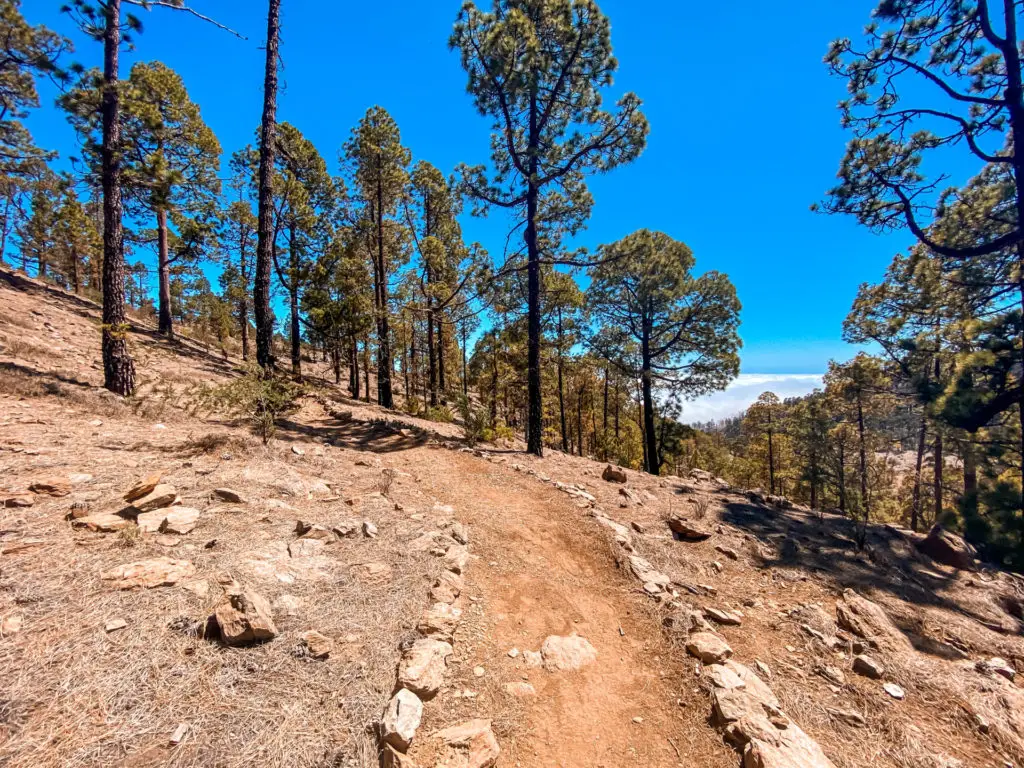
Montana de Limon is a great warm-up hike before tackling higher altitudes in Tenerife. This 5-hour hike is perfect for forest lovers, as the majority of the climb takes place in a pine tree forest. The trail ends in a lunar-like landscape, offering incredible views of Mount Teide and its neighbours.
READ THE FULL DETAILED BLOG POST: MONTANA DE LIMON
PICO VERDE IN TENO MOUNTAINS
Distance: 9km
Elevation Gain: 330m
Difficulty: Easy
Highlights: Teno mountains, less known part of the island by many!
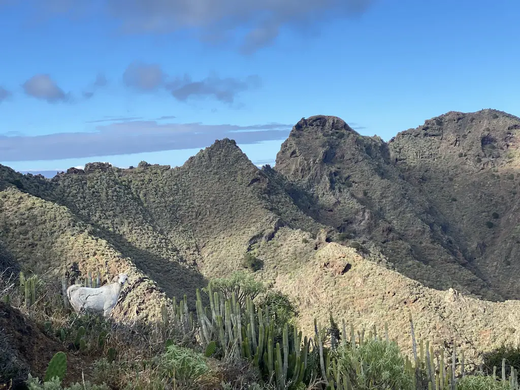
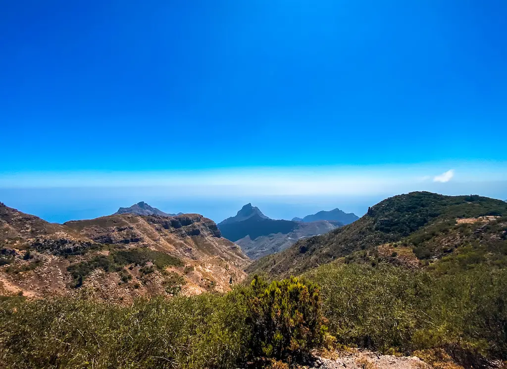
Pico Verde (1318m) hike is an awesome hiking adventure away from the crowded tourist routes in the area. Also known as Montana de las Rosas, it is the second highest peak in the Teno Mountain range, located high above the famous trail of Masca Gorge. This circular route goes through a beautiful laurel forest, panoramic summits and offers great views of La Gomera and La Palma.
READ THE FULL DETAILED BLOG POST: PICO VERDE IN TENO MOUNTAINS
BARRANCO DEL INFIERNO, A STUNNING RAVINE IN ADEJE
Distance: 6km
Elevation Gain: 350m
Difficulty: Easy
Highlights: Short, family friendly journey into the canyon.
Barranco del Infierno is an awesome ravine trail located in the municipality of Adeje in the south of Tenerife. It’s one of the most popular natural areas in Tenerife and it offers stunning views, lush vegetation, and a unique ecosystem that you can explore in more or less 3 hours. If you’re looking for an easy and short adventure, read on and learn all about Barranco del Infierno hike.
READ THE FULL DETAILED BLOG POST: BARRANCO DEL INFIERNO
I hope you enjoyed reading this guide and it helped planning your trip to Tenerife better! You can also follow me on social media below or if you enjoy my content, please consider supporting me with a coffee 😊
Safe and happy hiking!

FINAL THOUGHTS
Exploring Tenerife’s rugged volcanic trails, lush laurisilva forests, and insane coastal walks has been one of the most fulfilling adventures of my life. This guide is your ticket to discovering the best hikes on Tenerife, an island that truly lives up to its reputation as an ultimate hiking destination.
I hope you found this guide helpful and you’ll have a lot of fun hiking Tenerife! If you find my content useful, drop a comment below, or if you wish to support my efforts, you can do so by grabbing me a coffee 😊. And don’t forget to follow me on social media for more trail tips and adventures!
And don’t forget to follow me on social media for more trail updates and inspiration for your next adventure!
impressive list, thanks for sharing this!
glad you liked it! happy hiking!
Hi Paweł! Thanks for an amazing guide through Tenerife and a bunch of very fresh information including GPS routes and a lot of beautiful photos! I plan to round-hike the whole island and your posts helped me to tune up my planned route. Hope I will enjoy it at least as much as you did 🙂
Thanks a lot Pavel! I’m so happy you found it useful. I wish you lots of fun and beautiful memories on this awesome island. Enjoy your adventure!