ALTO DE GUAJARA
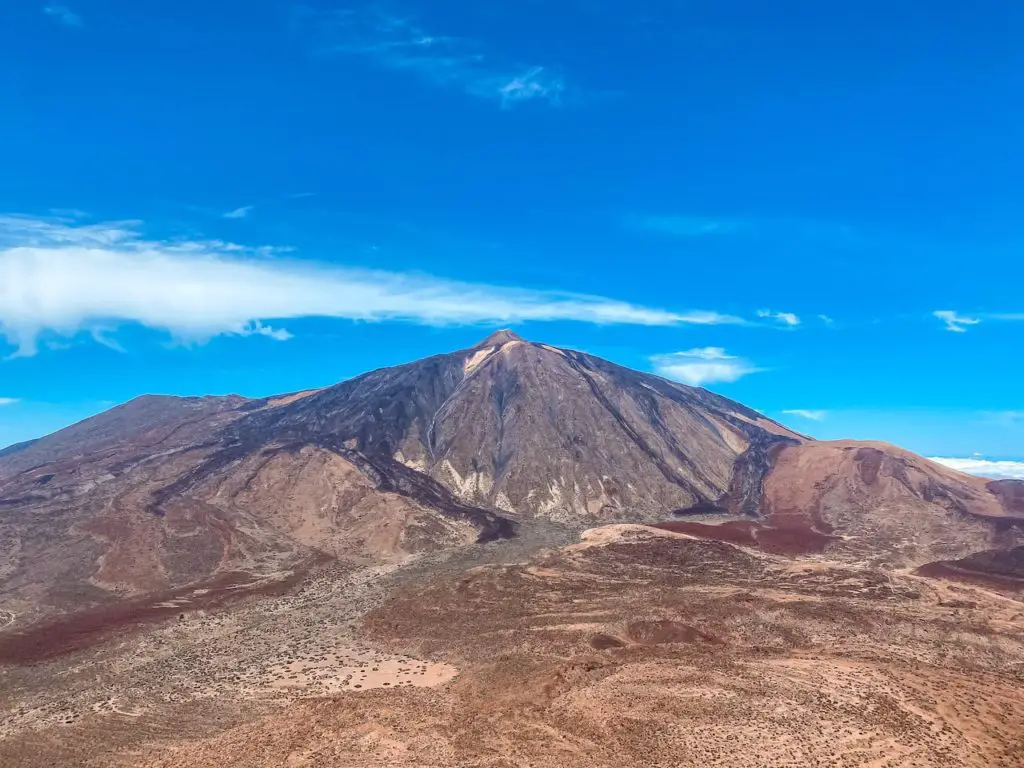
Alto de Guajara (2718m) is one of my favourite hiking adventures in Tenerife. In fact, that was my first hike in the Teide National Park I chose to acclimatise before going after higher elevations on the island. The trail to the top of the mountain is full of great sights, with beautiful views of the Teide (3715m) and the ocean of clouds below. If you are planning a hiking trip to Tenerife, the Alto de Guajara trail is a must-do. Join me as I recount my experience hiking to the top of this beautiful mountain.
ALTO DE GUAJARA FACTS
Distance: The total distance for this hike was 11km for a loop trail.
Hike duration: Alto de Guajara hike duration was 3h and 30 minutes. Adding a snack break, this hike should take no more than 5h.
Elevation gain: The total elevation gain for this hike was 689m.
Difficulty: This hike is moderate. Difficulty will of course depend on your fitness level and experience. This hike is moderate because of the total distance, elevation gain, high elevation and the descent on an uneven surface that might be challenging for some people.
Gear needed: Although Tenerife is warm all year round, you should always remember to check the weather forecast. I was fine wearing a t-shirt and shorts but would recommend to bring a windproof jacket, a hat and sunglasses. Sunscreen is a must too. If you’re unsure on what else to bring for a hike, read this guide.
My strava upload can be found here: Alto de Guajara route
GPS route for your watch or smartphone: Montaña Guajara .GPX
GETTING TO ALTO DE GUAJARA
By car: The starting point for Mount Guajara hike is located right next to the only hotel in Teide National Park – Parador de Las Cañadas del Teide (2151m). Google pin for parking the car can be found here.
By bus: Take the bus no 342 or 348. Current bus schedules can be found here: https://www.titsa.com/index.php/en/
MY EXPERIENCE HIKING ALTO DE GUAJARA
Alto de Guajara was an amazing experience and a great way to start my adventures in Teide National Park. I would highly recommend this hike to anyone visiting the area. It’s also a great acclimatisation hike before going after Teide (Read my guide for climbing the highest mountain of Spain here). Please note that the official route is recommended to be done in a clockwise direction, but I chose to do it in a counterclockwise direction to make it more challenging.
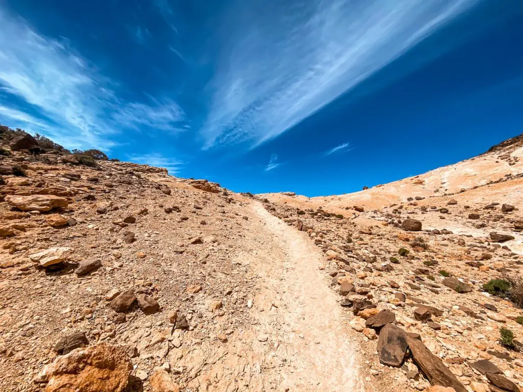
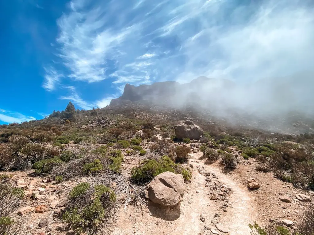
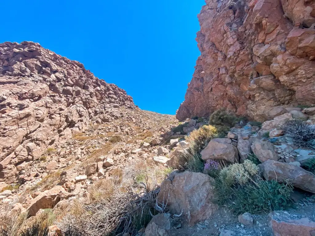
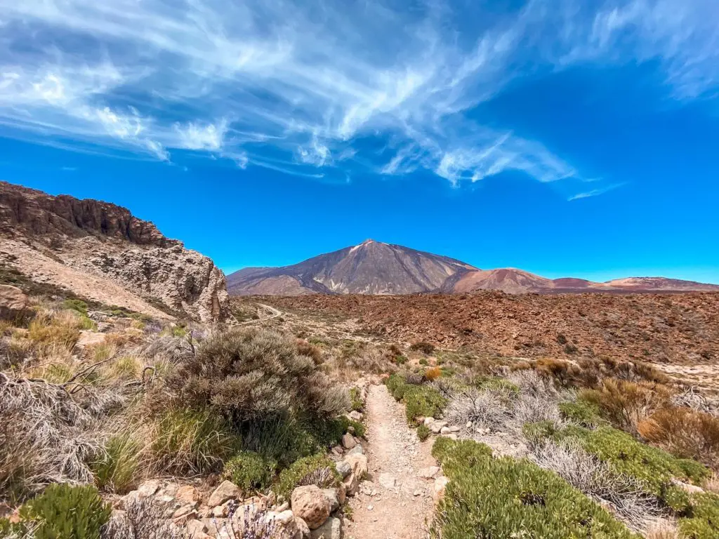
The adventure begins near the Parador Hotel, and the trail is well-marked and easy to follow. The first part of the hike is relatively flat, but after about 15 minutes, you will reach the first descent, which will take you to the top of Degollada de Ucanca. From here, the trail continues upwards, offering stunning views of the surrounding landscape. 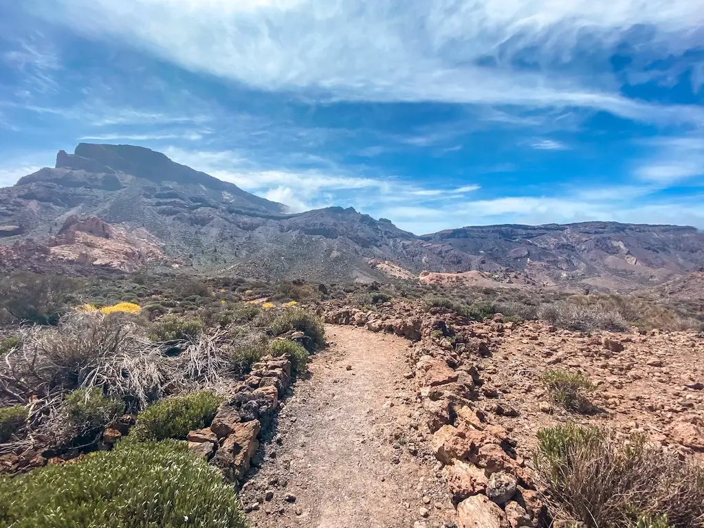
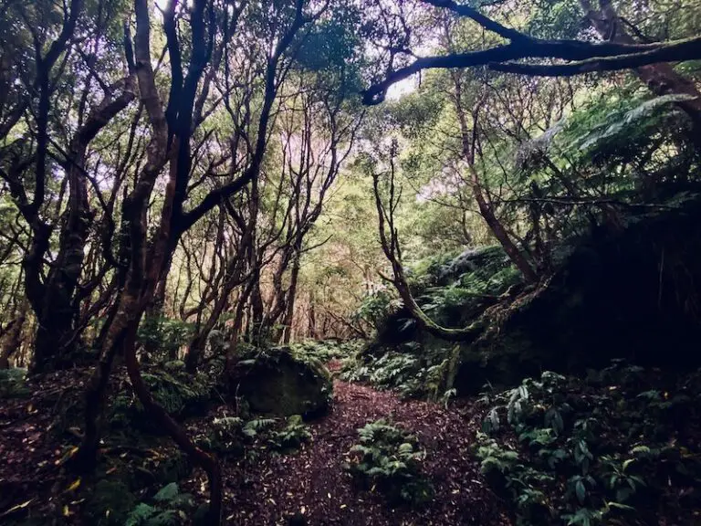
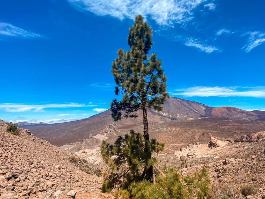
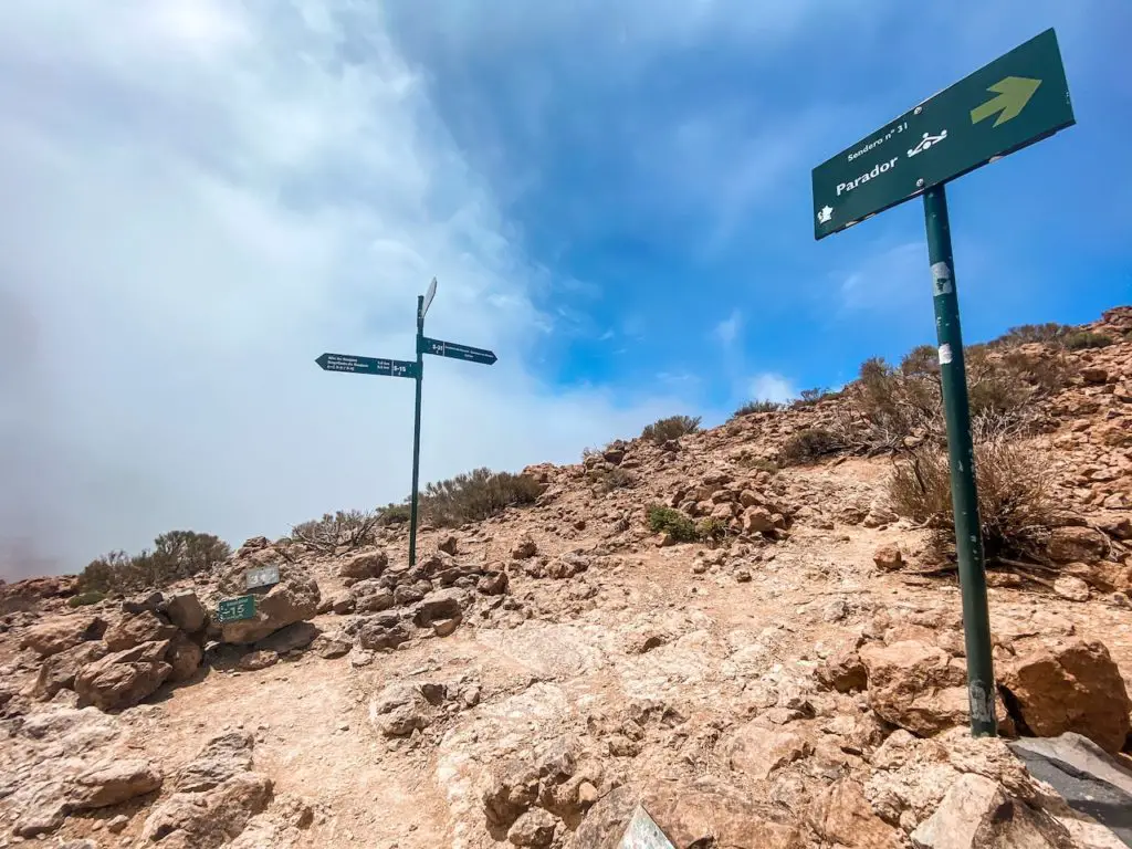
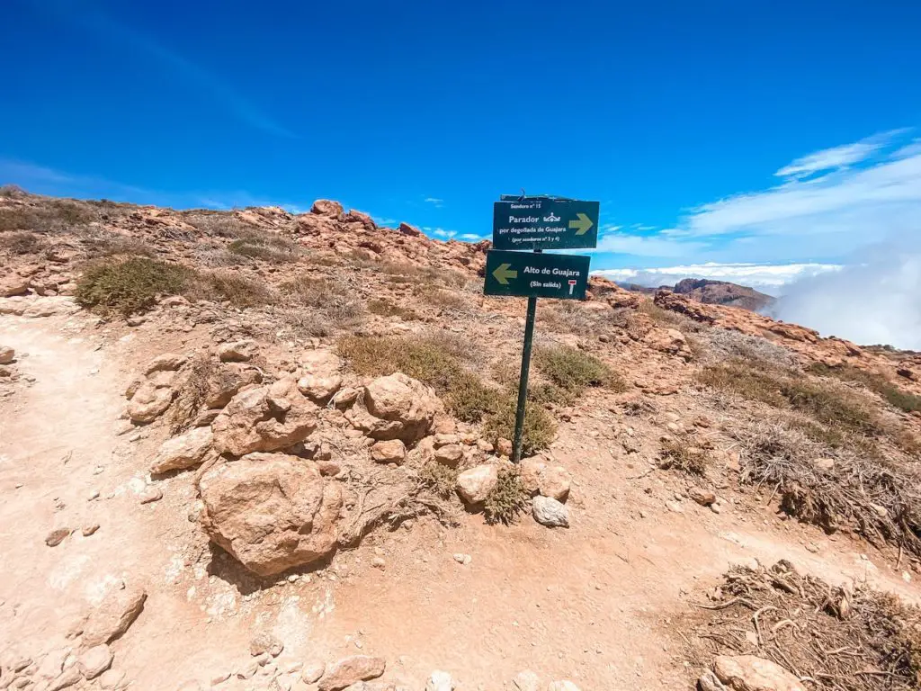
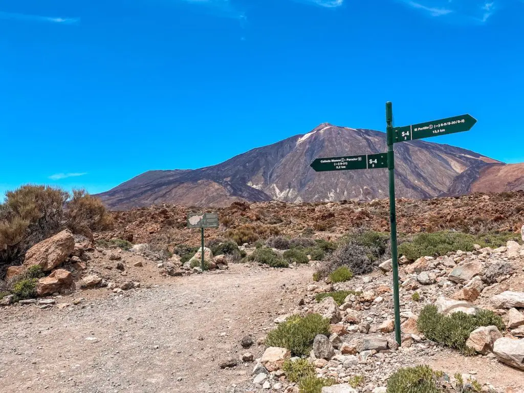
After hiking for a while, I reached a part of the trail that was shaded, which provided a much-needed break from the sun. I took a few minutes to rest and catch my breath before continuing on my journey to the top of the mountain. After passing that randomly places tree, I reached a signpost that marked the trail.
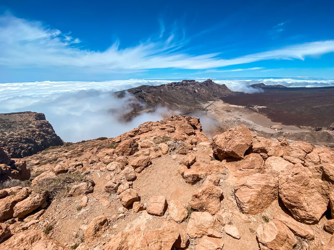
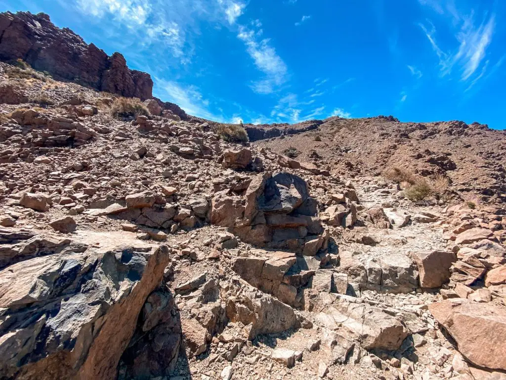
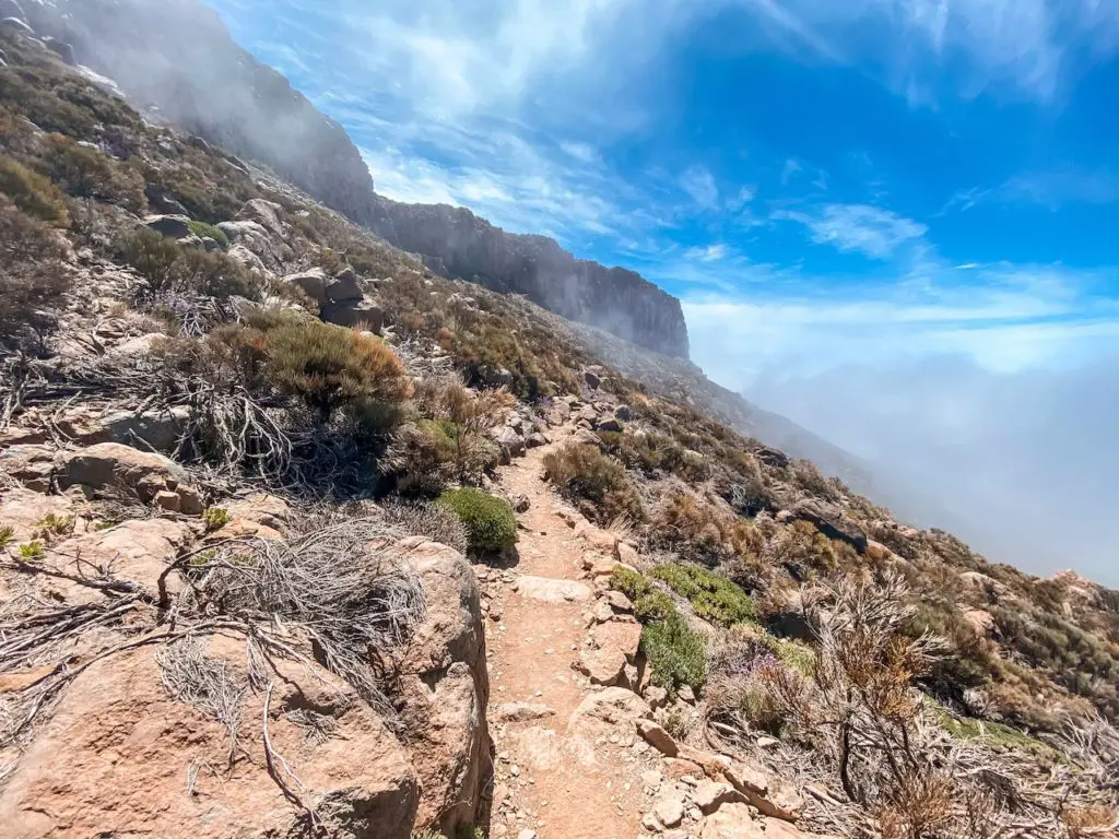
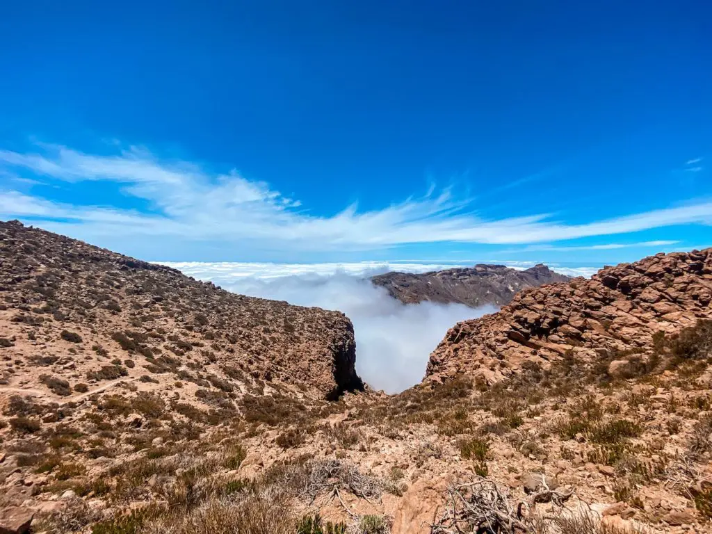
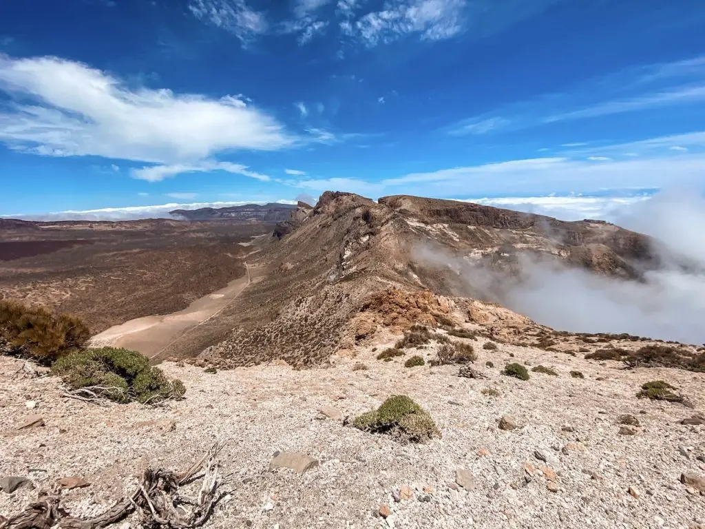
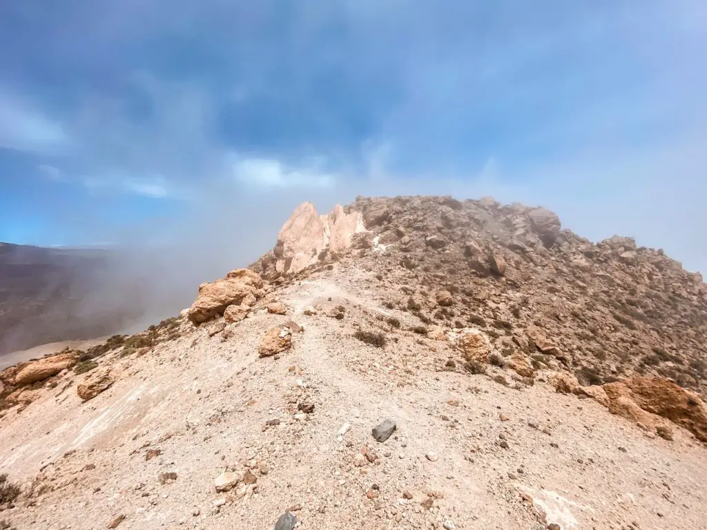
Reaching the ridge of the mountain felt really cool. The clouds were rushing past me, and it was a unique experience to have no visibility on one side and perfect views on the other. This is where the second part of the ascent begins, as you continue to climb towards the Alto de Guajara. Stunning!
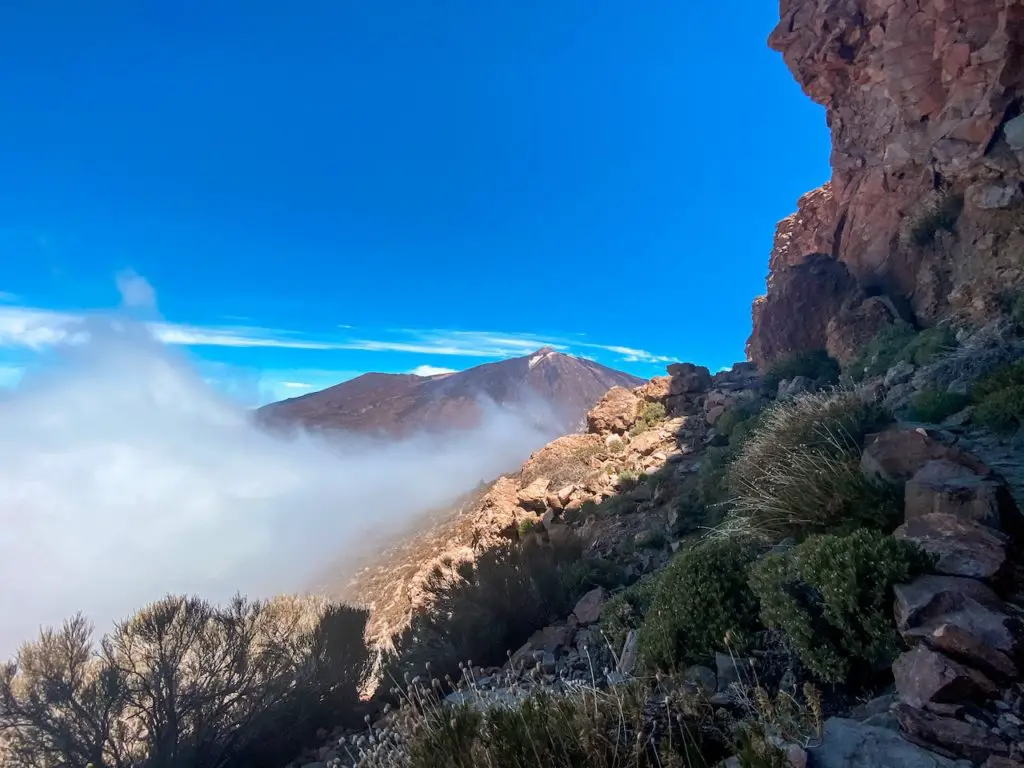
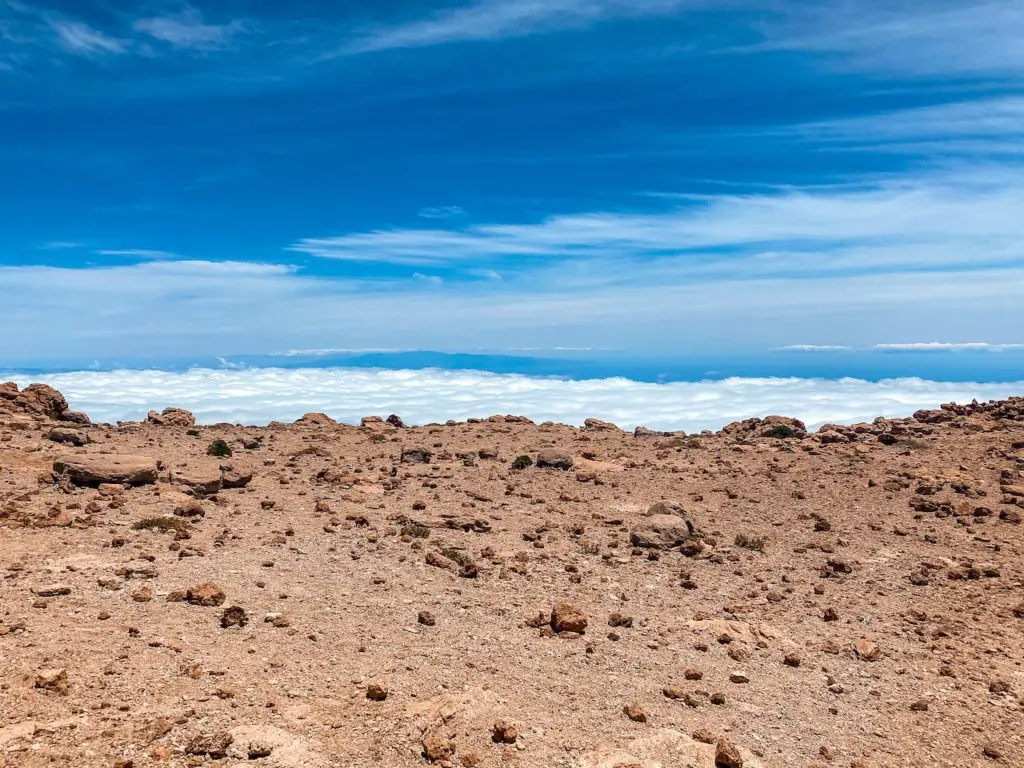
As I continued my climb, I could feel myself getting closer to the top of Alto de Guajara. After reaching the signpost, I could see the clouds below me, which gave me a boost of energy. For some weird reason, I truly love being above the clouds. Every single time it feels like being at the top of the world, I could never get bored of it.
Finally, I reached the top of Alto de Guajara. The peak is huge, and the views from the top are absolutely breathtaking. I spent about 20-30 minutes wandering around and taking in the incredible sights. I even video-called my mom to share the moment with her. The 4G reception was great, and she was able to experience this hike with me, that’s also where a little headache started kicking in due to the altitude.
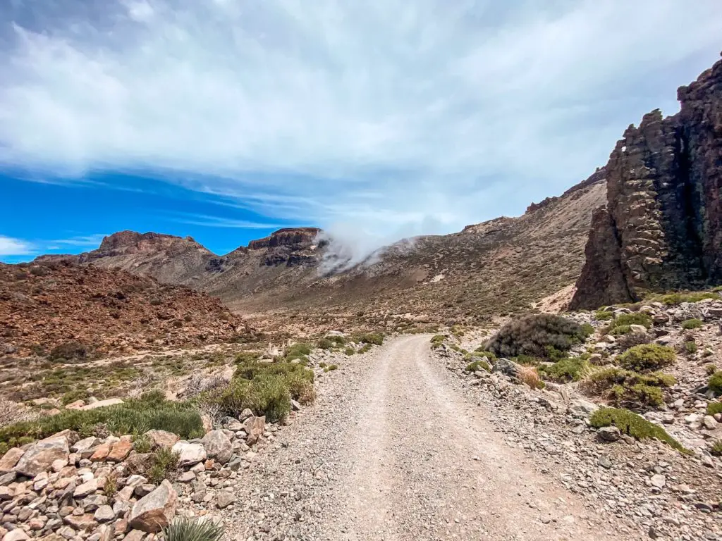
After a while, I decided to head back. The trail continues directly from the summit. It is not always easy to follow, so it’s important to pay attention and occasionally check your GPS or a map. The next part of the trail is a steep descent towards the Teide National Park. Be careful, as the terrain is very dry and slippery (pebbles). Overall, It is a beautiful and scenic descent, with incredible views of the surroundings. As you make your way down the mountain, you will pass through a variety of different ecosystems, including forests, meadows, and rocky outcrops.
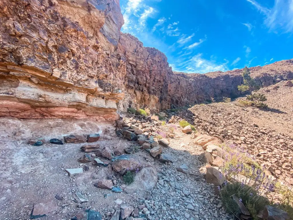
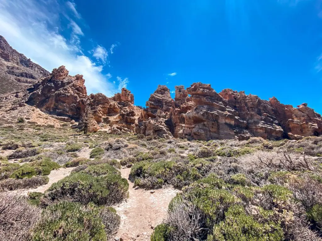
Once I made it down, I reached another signpost that pointed me in the direction of the Parador Hotel. From here, it was an easy walk on a wide gravel road. I spent most of the time admiring the incredible rock formations on the left side of the trail.
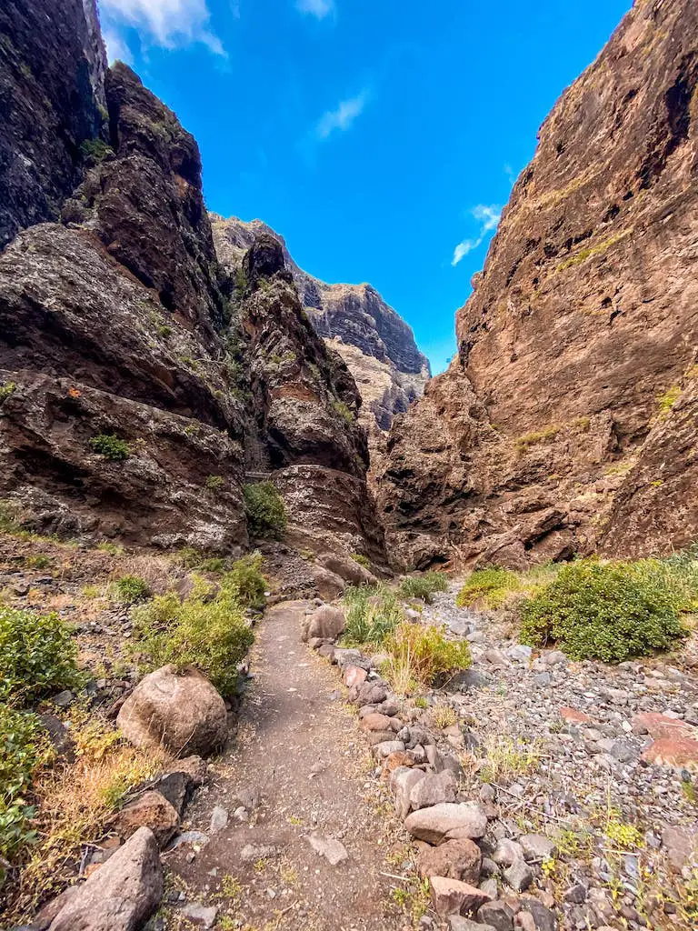
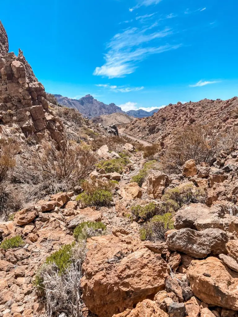
There is also a shortcut that allows you to avoid walking on the road. You can see a picture of this shortcut below. This trail is a bit steeper and more challenging than the road, but it offers a more direct route back to the starting point.
Honestly, I am not surprised that Alto de Guajara hike is considered one of the best hiking trails in Tenerife. The views from the top are really magical, and the hike itself presents a good physical challenge. I would highly recommend this trail to anyone visiting the island.
I hope you enjoyed reading about my experience hiking Alto de Guajara in Tenerife. If you have any questions, please don’t be shy and comment below. I wish you happy and safe hiking, and I hope that you have an amazing time exploring the beautiful trails of Tenerife.
HAVE YOU SEEN MY OTHER GUIDES FOR TENERIFE?
I lived and worked in Tenerife for three months, hiking nearly every day. I’ve explored over 70 trails to bring you an ultimate guide – highlighting the Top 30 Best Hikes in Tenerife. Each guide has a detailed description including the distance, difficulty, gear needed and everything else needed to complete the hike successfully. If you happen to notice any changes on the trail that should be updated – please drop the comment below so I can keep this guide up to date.
If you prefer easier hikes that can be completed under 3 hours, check out Top 12 Short Hikes in Tenerife guide.
Safe and happy hiking my friend!