PAISAJE LUNAR – ULTIMATE HIKING GUIDE
Welcome to the moon! Paisaje Lunar is one of the most interesting natural wonders in Tenerife. This unique hiking trail takes you through a lunar landscape created by volcanic eruptions, with lava that has hardened into striking rock formations. In this guide you can choose two different routes based on your preference. No matter which one you choose, Paisaje Lunar surely will be an unforgettable experience, I promise!
WHICH ROUTE TO TAKE?
My initial plan was to hike Paisaje Lunar only once, taking the longer route from Cruz de Tea. The whole journey was really beautiful, leading through pine tree forests and up to the peak of Montaña Bermeja (1883m). Unfortunately, the weather on that day was not great, and I was unable to see much of the lunar landscape due to fog and clouds.
As a result, I decided to come back the next day and take a different route to Paisaje Lunar. This allowed meto see Paisaje Lunar in all its glory and take some great photos. In this guide, I’m sharing both of these routes so you can choose the one that best suits your hiking abilities and preferences. Whether you want a shorter, easier hike or a longer, more challenging trail, Paisaje Lunar has something for everyone.
GUIDE FOR THE SHORT ROUTE
This trail to Paisaje Lunar is a great option if you are short on time or if the longer hike through the forest doesn’t appeal to you. It is mostly flat, short and overall a very pleasant walk.
PAISAJE LUNAR FACTS
Distance: The total distance for this hike was 9km for the loop trail.
Hike duration: This hike’s duration was around 2h. Adding a few stops, the whole adventure should take no more than 3h.
Elevation gain: The total elevation gain for this hike was 401m.
Difficulty: This hike is super easy. Path is wide and mostly flat. It’s very well marked and leads through a pine tree forest making it a very pleasant walk.
My Strava upload can be found here: Paisaje Lunar (easy)
GPS route to follow on your watch or a smartphone: Paisaje Lunar (easy).GPX
Gear needed: Try to avoid doing this hike during or right after rain as the trail might get slippery. Make sure to bring a waterproof jacket and long trousers as the weather can change rapidly in that area so having that extra layer in your bag can be really useful. If you’re unclear on what else to bring for a hike – read this article.
GETTING TO PAISAJE LUNAR
By car: Google pin for starting point can be found here. It requires driving on a gravel road through the forest – the maximum speed allowed there is 30km/h – please respect that, there’ll be many people walking on that road!
By bus: There’s a bus stop for line 482 a bit further down in Vilaflor. You can find the current schedules here.
MY EXPERIENCE HIKING PAISAJE LUNAR SHORTER ROUTE
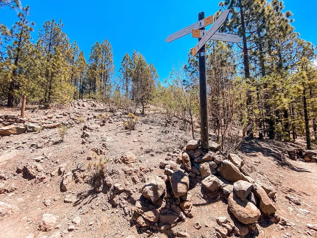
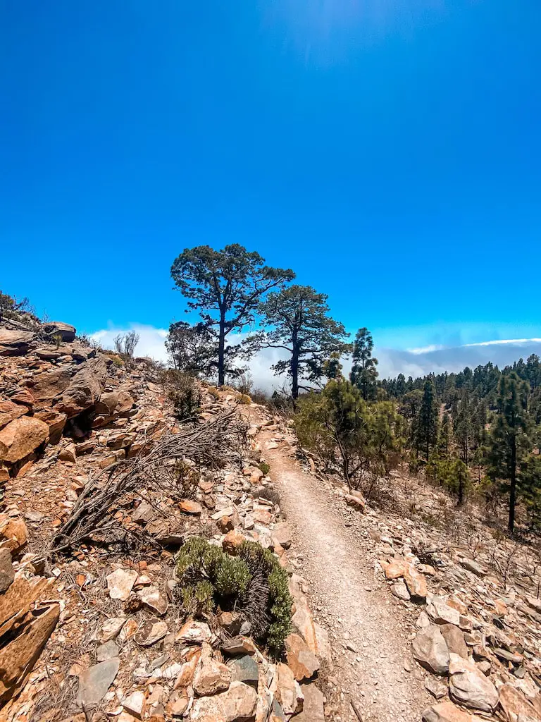
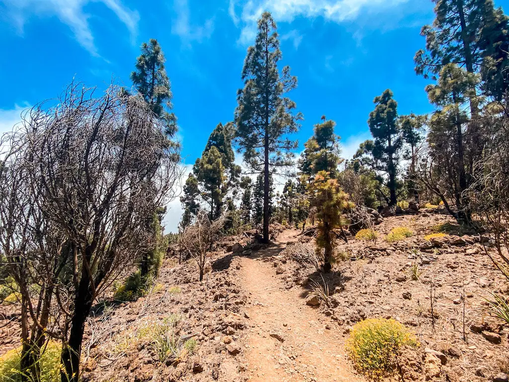
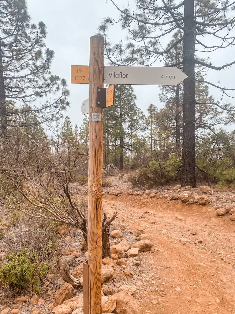
The trail, marked PR-TF72 to Los Escurriales, begins right next to the car park and is very well marked. It is a gentle ascent through the same pine tree forest, offering stunning views and the opportunity to spot a variety of plants and animals.
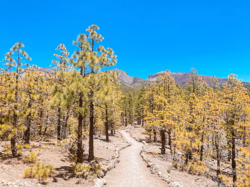
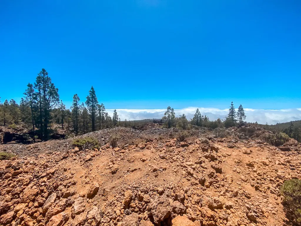
As I made my way through the forest, I was enjoying a beautiful views of the clouds on my right side. The weather was perfect, and I was able to fully enjoy those stunning views. I was getting closer to Paisaje Lunar, and my excitement was growing!
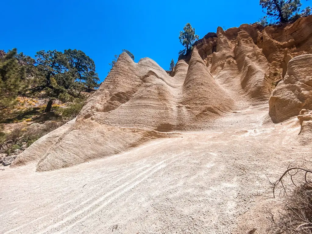
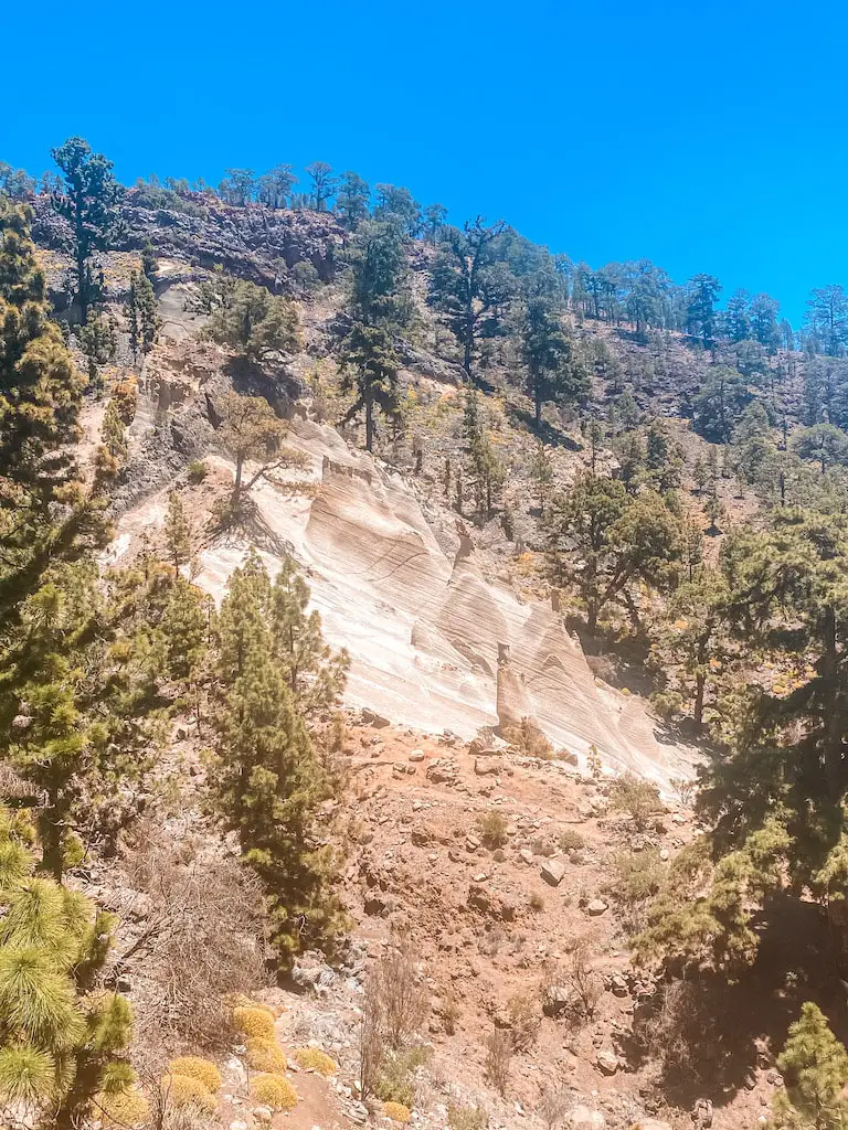
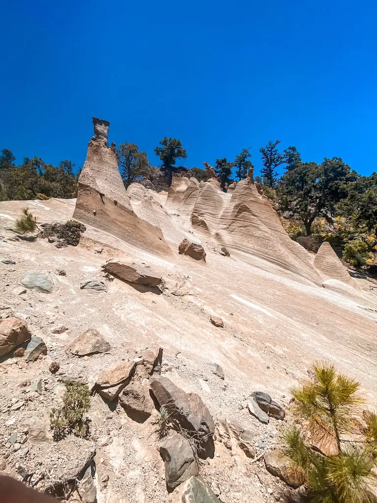
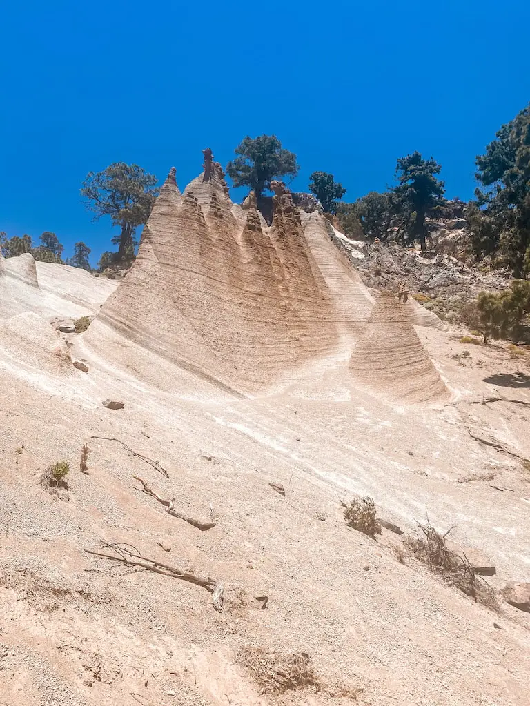
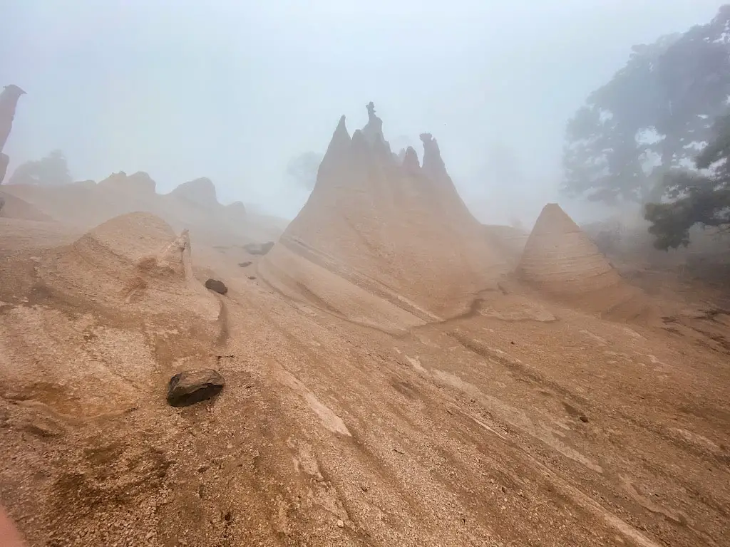
Once I reached the edge of the forest, I was then greeted by the incredible lunar landscape of Paisaje Lunar. The rock formations created by the volcanic eruption are simply breathtaking. I spent some time exploring the area, taking in the sights and enjoying the quiet forest.
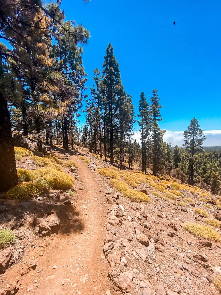
After exploring the whole Paisaje Lunar area and taking in the stunning views I decided to take an alternative route back, which started at the same viewing point as when I arrived at Paisaje Lunar. The trail led through the same pine tree forest, offering a gentle descent and some beautiful views.
As I started my descent back to the starting point, I could already see the clouds starting to catch up with me. It was a reminder of my previous hike and made me feel really lucky to have been able to see Paisaje Lunar before the clouds obscured the view. Overall, it’s important to keep an eye on the weather and be prepared for it to change quickly when hiking in this area.
GUIDE FOR THE LONGER ROUTE
PAISAJE LUNAR FACTS
Distance: The total distance for this hike was 18km for the loop trail.
Hike duration: This hike’s duration was around 6h. Adding a lunch break, the whole adventure should take no more than 7h.
Elevation gain: The total elevation gain for this hike was 1000m.
Difficulty: This hike is moderate. Difficulty will of course depend on your experience and fitness level. Although there’s no real danger on this trail, I’m rating it as moderate due to the distance and the elevation gain of 1000m which can be very challenging for some people.
My Strava upload can be found here: Paisaje Lunar (hard)
GPS route to follow on your watch or a smartphone: Paisaje Lunar (hard).GPX
GETTING TO PAISAJE LUNAR (LONG ROUTE)
By car: Starting point for this hike is in Abona village, right above Cruz de Tea. Google pin for parking your car can be found here. It is right at the beginning of the trail. Space is very limited, my advice is to arrive as early as you can to secure a spot.
By bus: There’s a bus stop for line 475 right next to the restaurant Cumbres de Abona, you can find the current schedules here.
MY EXPERIENCE HIKING PAISAJE LUNAR LONGER ROUTE
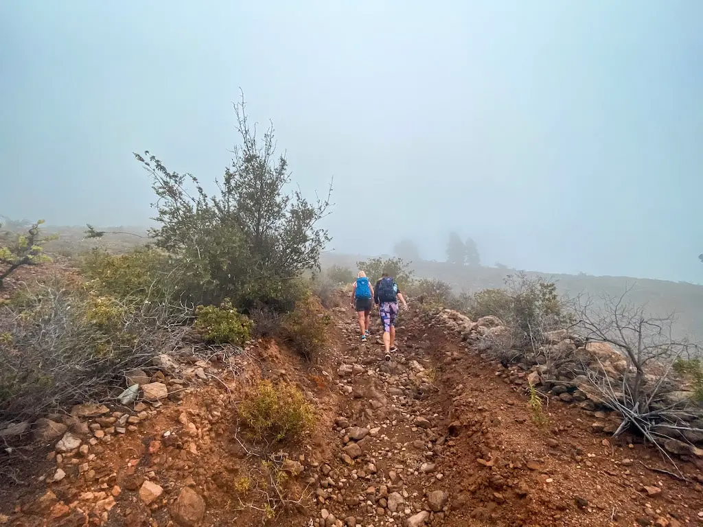
The first part of the trail to Paisaje Lunar is a constant ascent starting in the village of El Tanque. The trail, known as PR-TF83, takes you all the way up to the peak of Montaña Bermeja (1883m). I recommend bringing a GPS device to avoid getting lost, as this trail intersects with several other trails along the way.
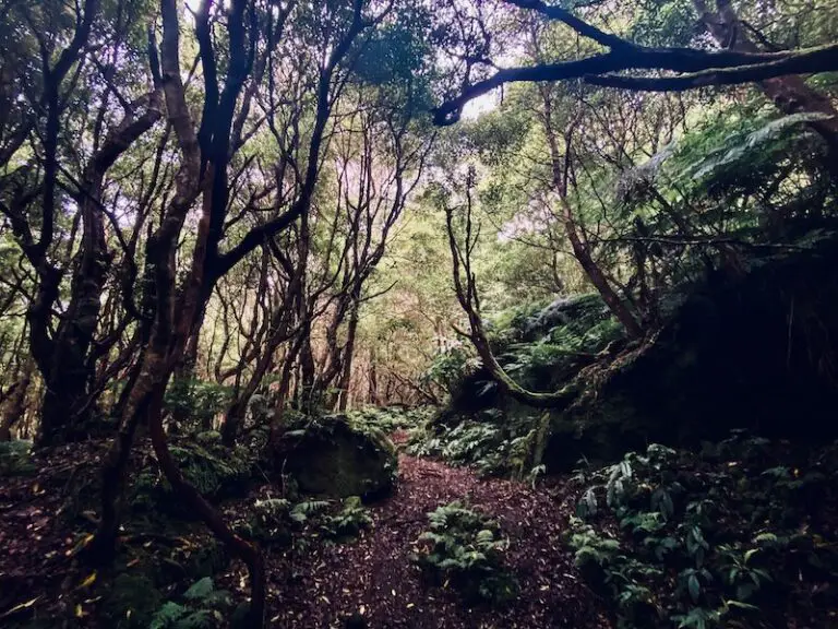
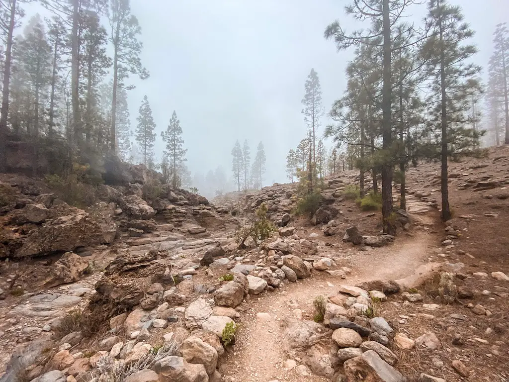
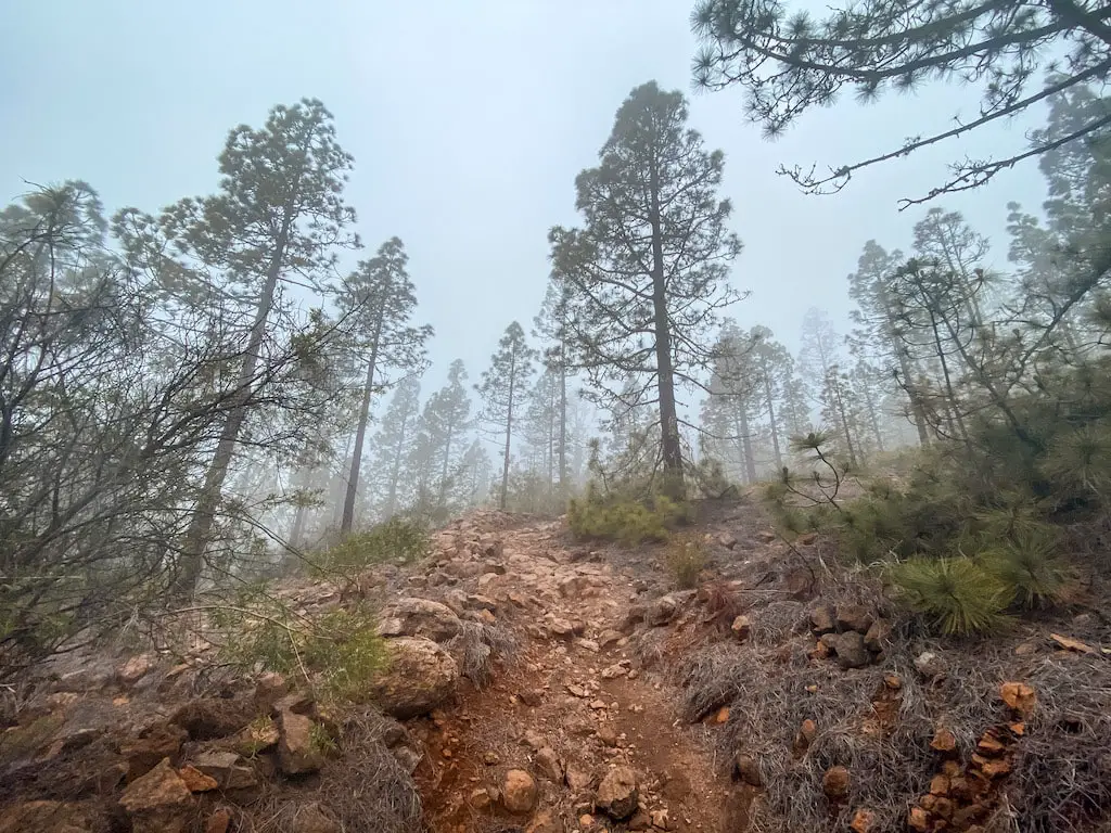
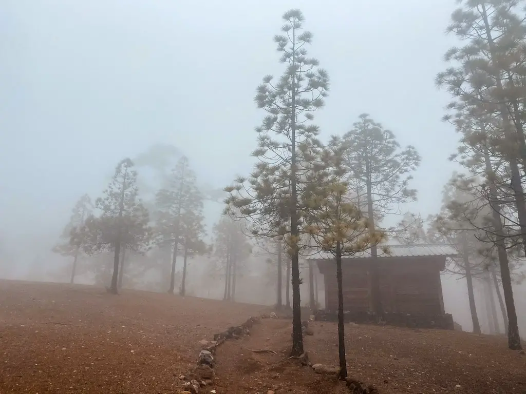
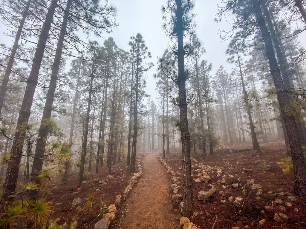
The entire route is surrounded by beautiful pine tree forests, and on the day I hiked it, there was a lot of mist which added to the adventure.
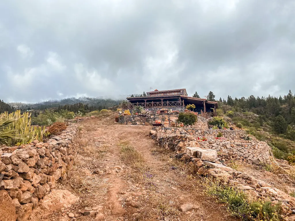
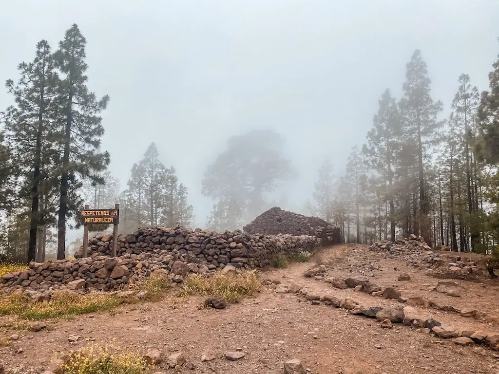
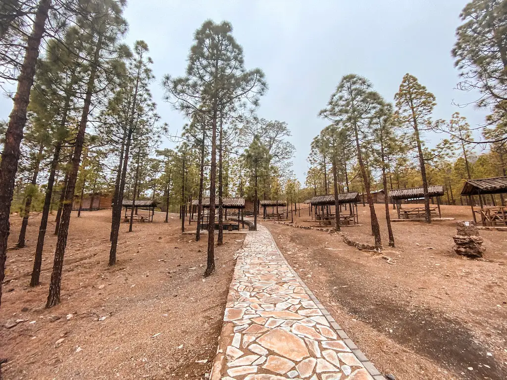
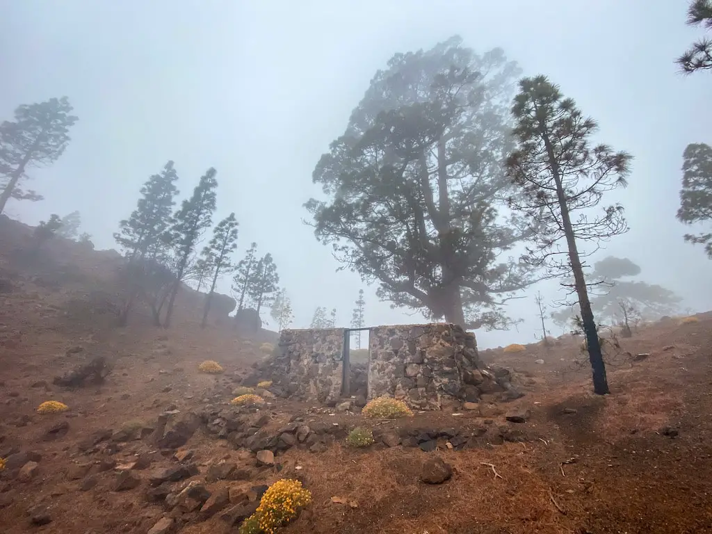
After hiking for a while, we reached a gravel road and soon after that, the Campamento Madre del Agua (1628m). This place was really interesting, at first we thought it was a scout camp, like the ones you can find in Canada. But we later learned that it is actually a holiday destination where you can rent one of those cute wooden houses and completely disconnect from the world. Such a serene spot!
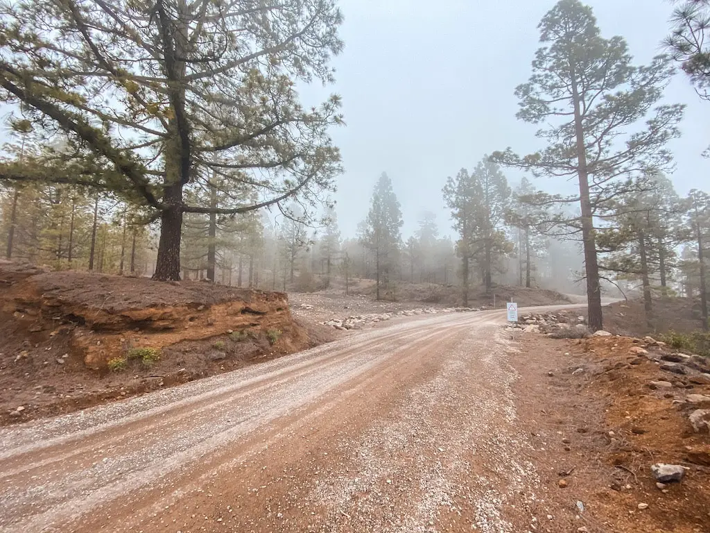
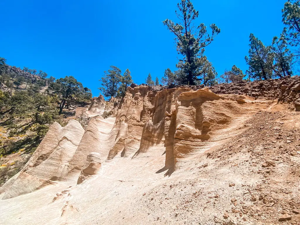
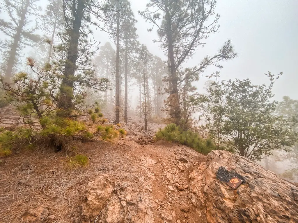
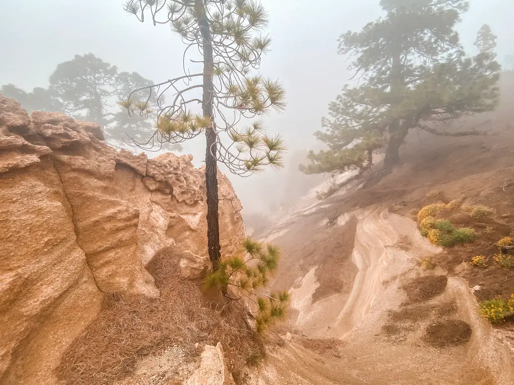
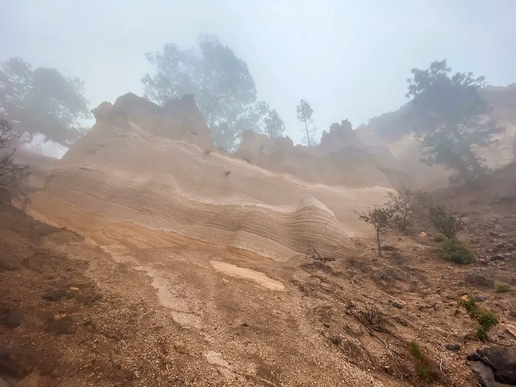
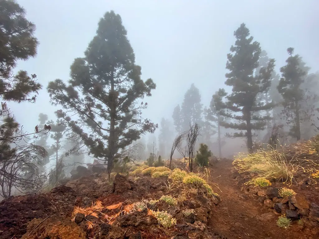
From Campamento Madre del Agua, the trail continues on the gravel road for a short distance before turning off onto a dirt path again. This is where the real beauty of Paisaje Lunar begins to reveal itself. The trail is surrounded by incredible rock formations and lunar landscapes. Even though it was very misty and cloudy, it was still enjoyable.
After hiking for a while, we reached the peak of Montaña Bermeja (1883m), that’s pretty much the top of Paisaje Lunar rock formations. The opposite side to the shorter hike described above.
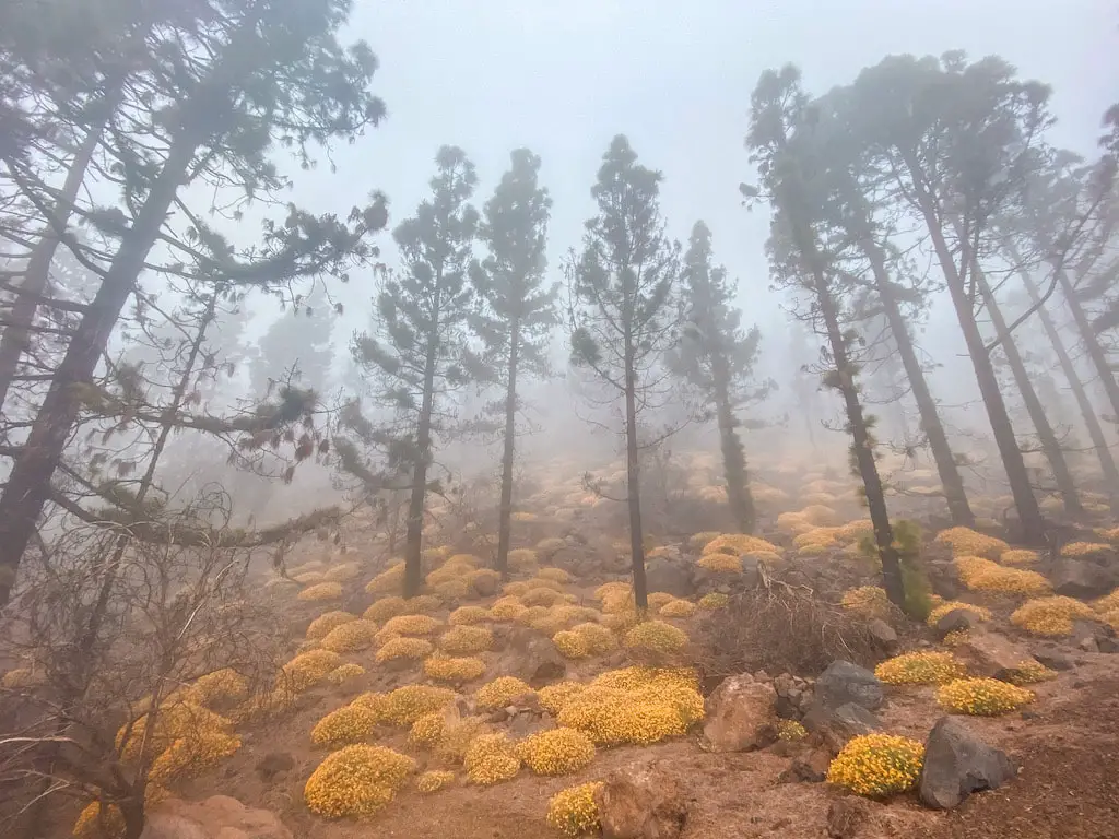
On the way back, we retraced our steps through the pine tree forest, but this time we took a different path just to make a loop out of it. This new path was very nice as well, it was very misty, cloudy and overall it kinda looked like taken straight out of a fairy tale.
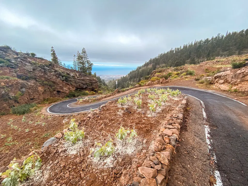
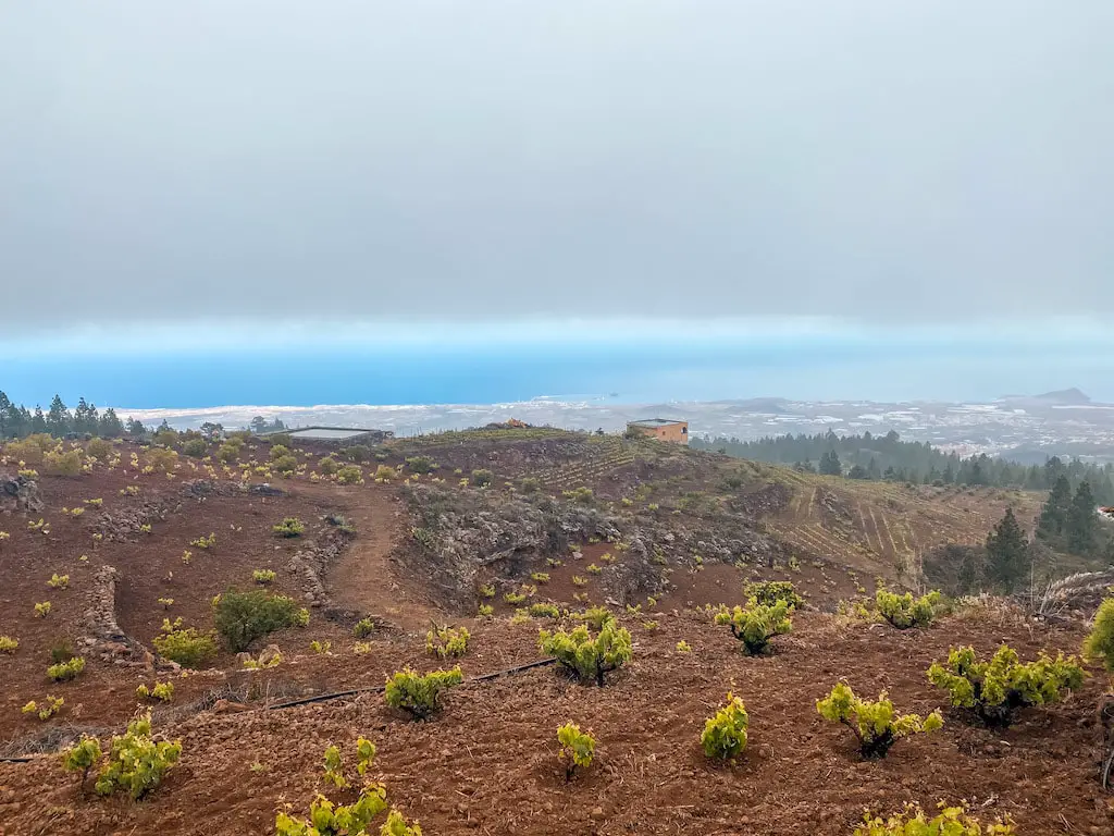
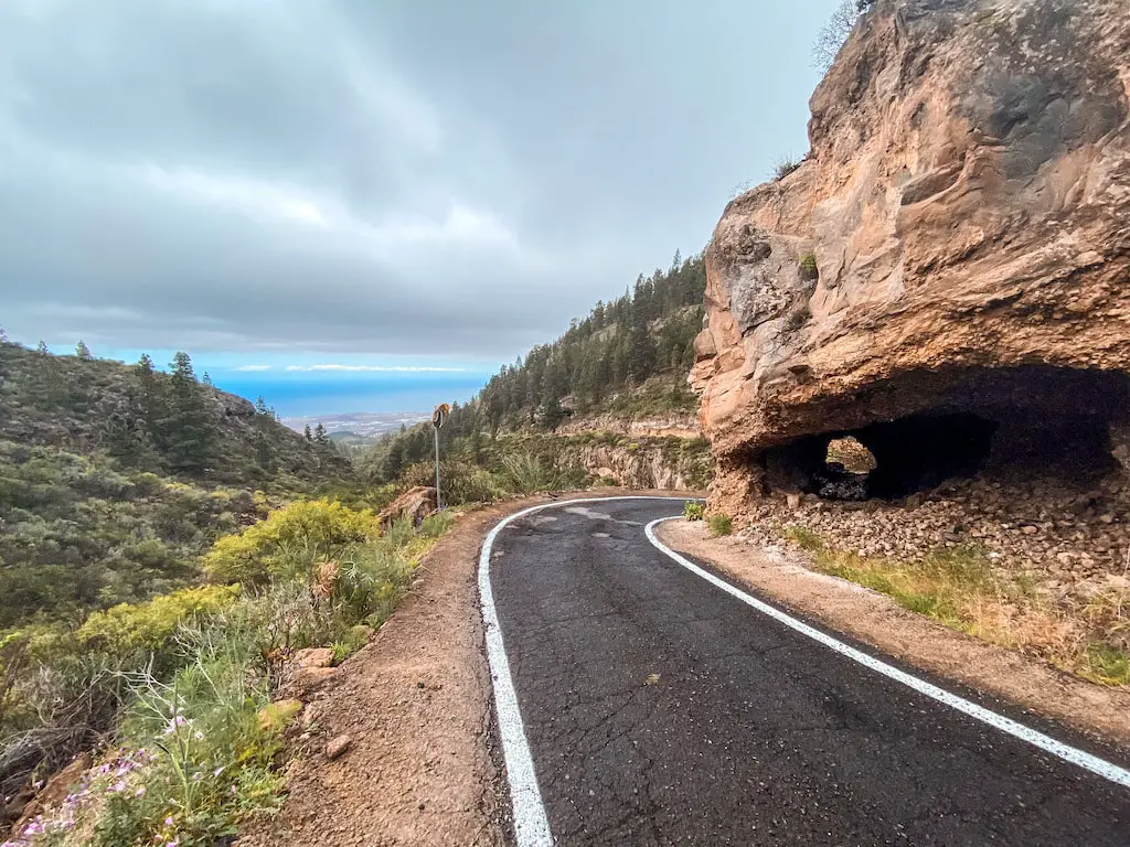
After the forest, we made our way down a twisty road that connected the nearby villages with the south. It was interesting to see how some people are able to live in such remote locations, and we were surprised to see how few cars passed us on the road. The descent took about 45 minutes.
I hope you enjoyed reading about my experience hiking to Paisaje Lunar. If you have any questions or comments, please don’t be shy and leave them in the comments section below. I wish you happy and safe hiking, and I hope that you have an amazing time exploring the beautiful trails of Tenerife!
HAVE YOU SEEN MY OTHER HIKING GUIDES FOR TENERIFE?
I lived and worked in Tenerife for three months, hiking nearly every day. I’ve explored over 70 trails to bring you an ultimate guide – highlighting the Top 30 Best Hikes in Tenerife. Each guide has a detailed description including the distance, difficulty, gear needed and everything else needed to complete the hike successfully. If you happen to notice any changes on the trail that should be updated – please drop the comment below so I can keep this guide up to date.
If you prefer easier hikes that can be completed under 3 hours, check out Top 12 Short Hikes in Tenerife guide.
Safe and happy hiking my friend!