SOMBRERO DE CHASNA HIKE
Sombrero de Chasna (2407m) is one of the coolest short hikes in Tenerife. This short but rewarding route takes you to the top of the peak, which resembles a hat, and offers panoramic views of Mount Teide, the Las Cañadas National Park, and the south coast of Tenerife. At just 8 km in distance, this hike is a great way to explore the higher elevations of Tenerife in just a few hours. Of all the short hikes I’ve done on the island, this one is definitely one of my favourites.
SOMBRERO DE CHASNA FACTS
Distance: The total distance for this hike was 8km for the loop trail.
Hike duration: This hike’s duration was nearly 2,5h. Adding a stop on the top of the peak, this hike should take no more than 3h.
Elevation gain: The total elevation gain for this hike was 435m.
Difficulty: This hike is moderately easy. The reason for rating this one as moderately easy is an elevation gain of almost 435m and the constant exposition to the sun that could be challenging for some people. Other than that it’s an easy hike.
Gear needed: Although Tenerife is warm all year round, you should always remember to check the weather forecast. You’ll need comfy shoes, a windbreaker and sun protection which is a must for this hike! If you’re unsure on what else to bring for a hike, read this guide.
My Strava map + gpx file can be found here: SOMBRERO DE CHASNA
GETTING TO SOMBRERO DE CHASNA
By car: The starting point for Sombrero de Chasna is located at the bend of the main road TF-21 (1,2km from Las Lajas Picnic Area). Navigating there is easy and here’s your google maps pin. There’s only space for 3-4 cars so it’s best to arrive in the early morning or late afternoon.
By bus: The closest bus stop It’s roughly 8km from the starting point. Car is probably the best option for this hike.
MY EXPERIENCE HIKING SOMBRERO DE CHASNA
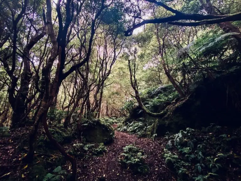
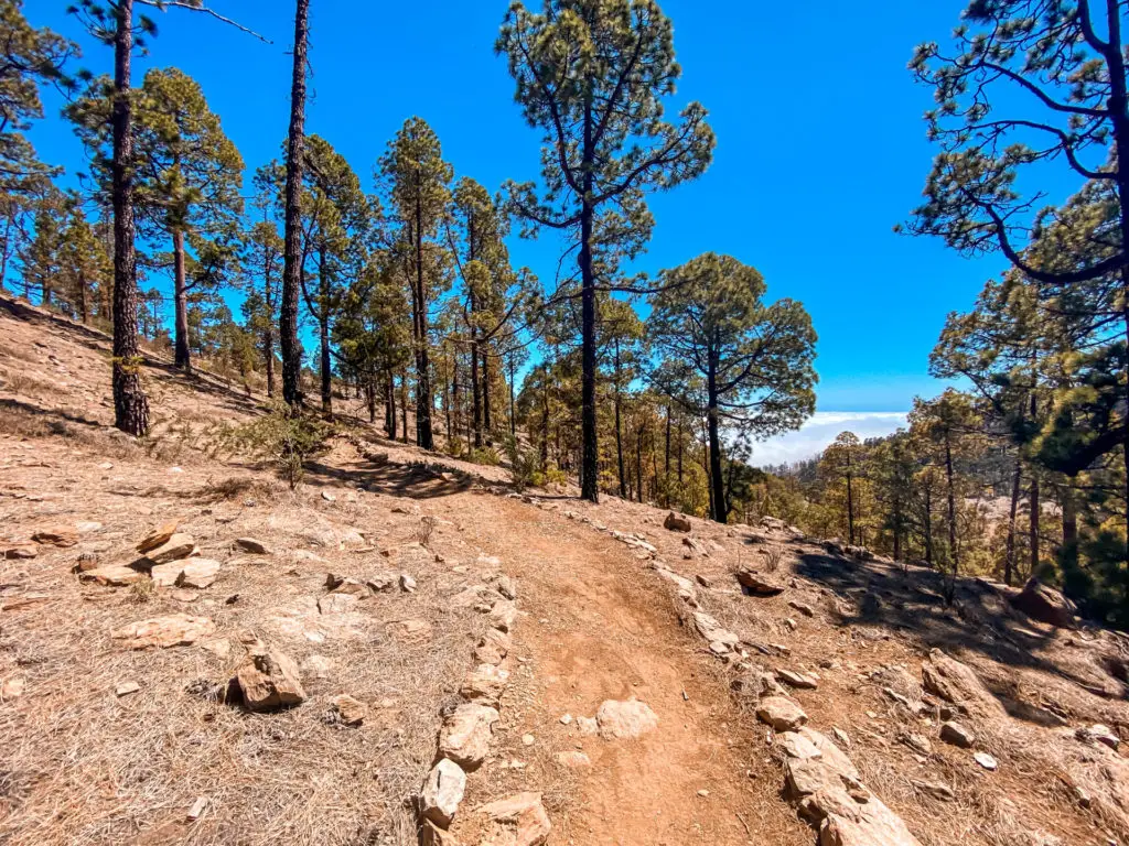
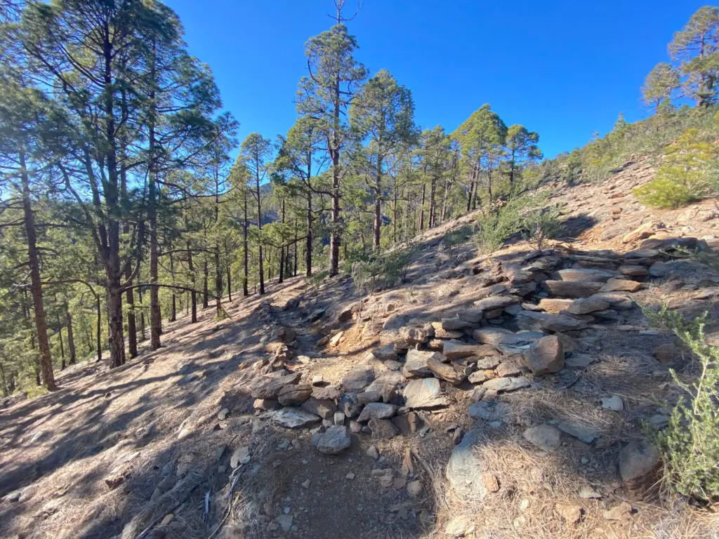
The adventure begins near two abandoned stone houses and takes you on a gentle ascent through a pine tree forest. The terrain is relatively easy. It should take about 30-40 minutes to reach the next point.

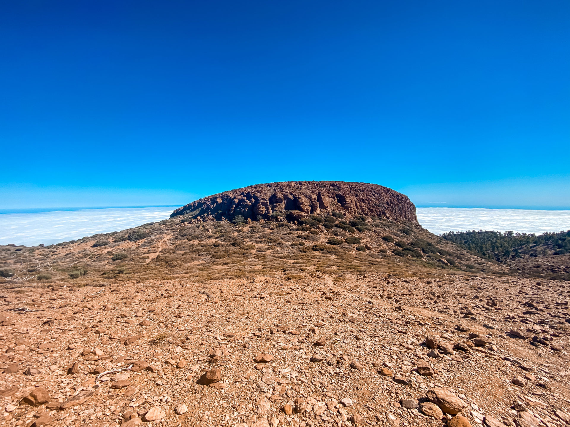
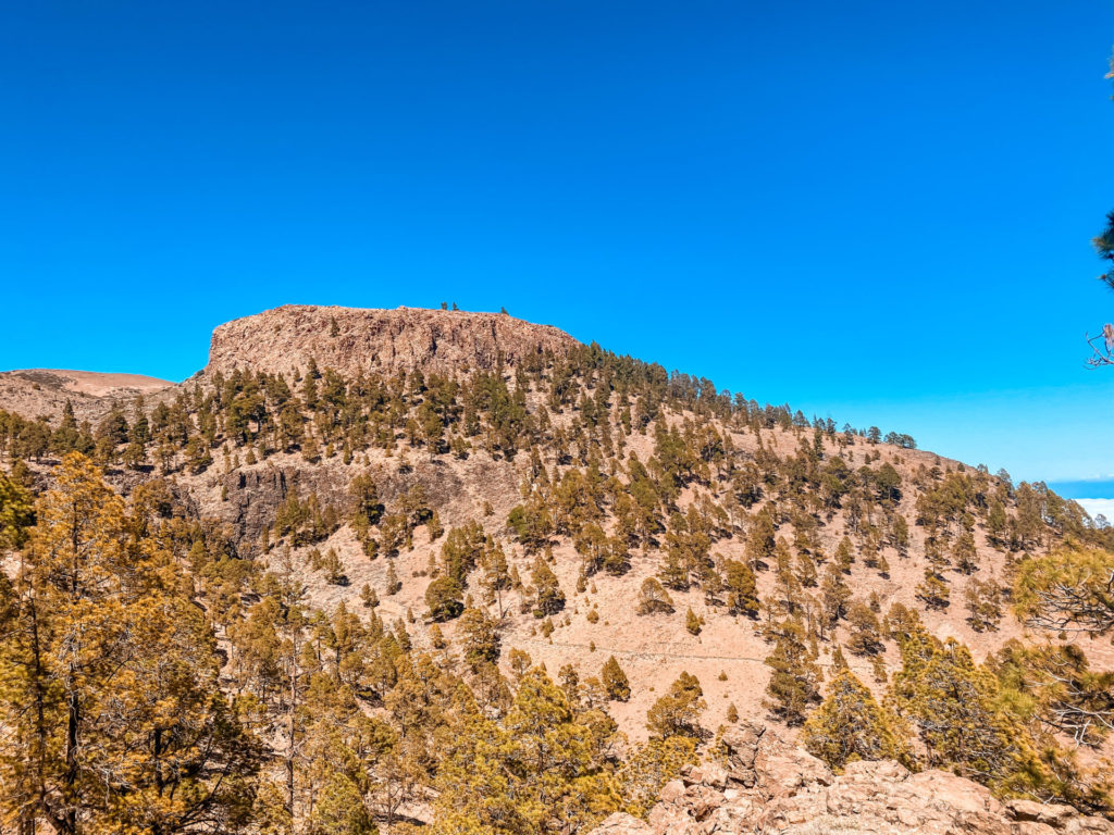
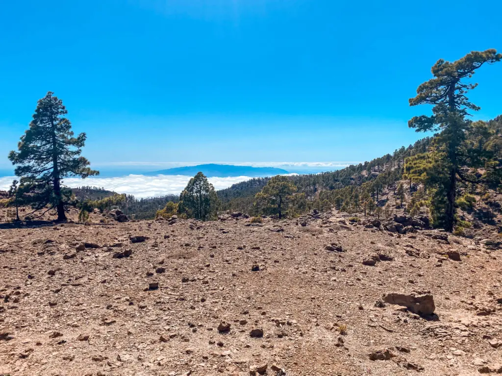
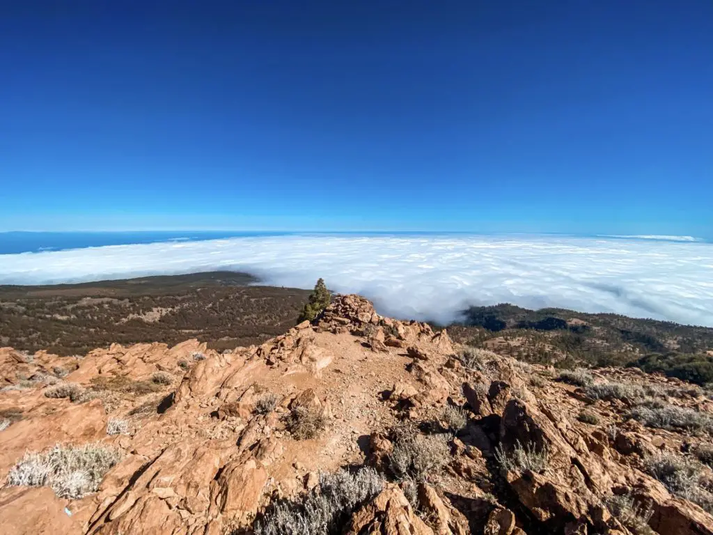
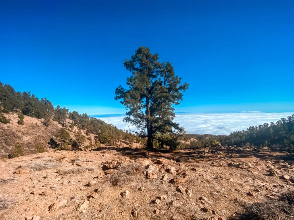
If you’re a regular reader of my blog, you know that one of my favourite parts of hiking is reaching the point where you’re above the clouds. Thankfully, at this elevation, you’re almost guaranteed to experience this phenomenon. As you continue on the trail, you’ll soon catch your first glimpse of the Sombrero de Chasna. As you continue on the trail, the views will only get better and better.

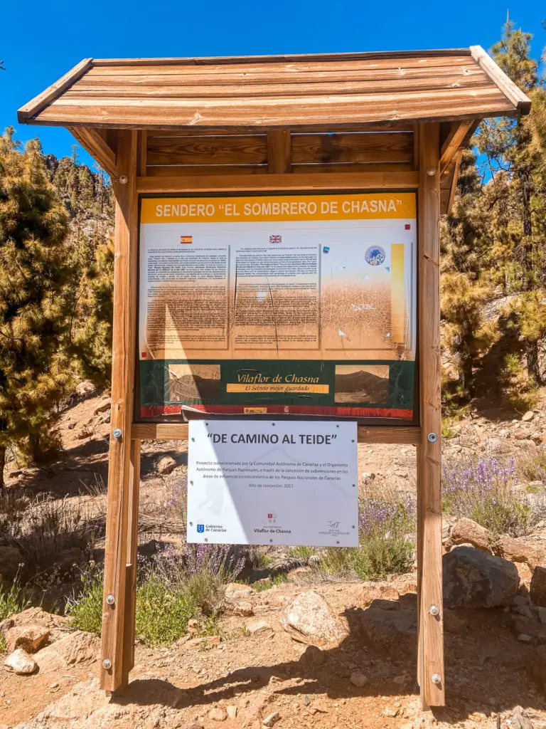
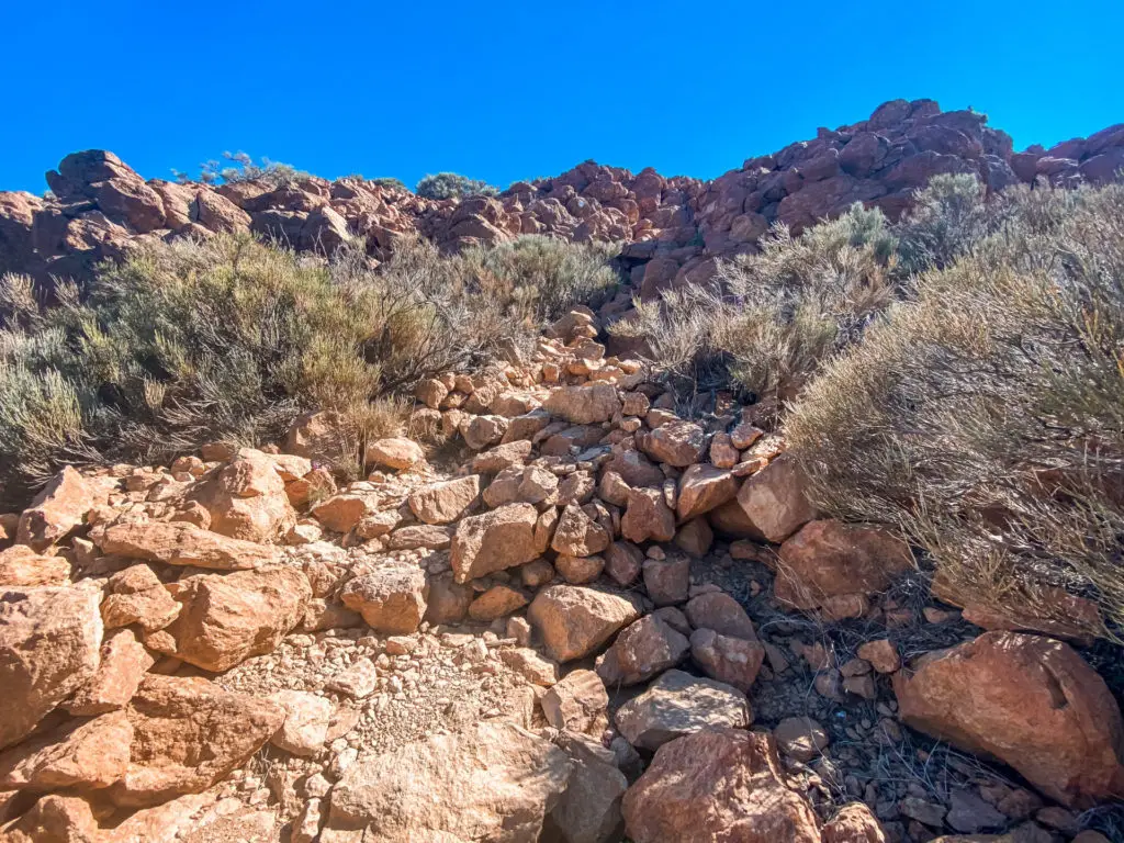
After reaching the point with the sign posts, the trail continues and is not always clearly visible. Keep an eye out for blue dots painted on rocks, they help guide you along the trail. As you continue, you should be able to see some nice views of La Gomera Island.
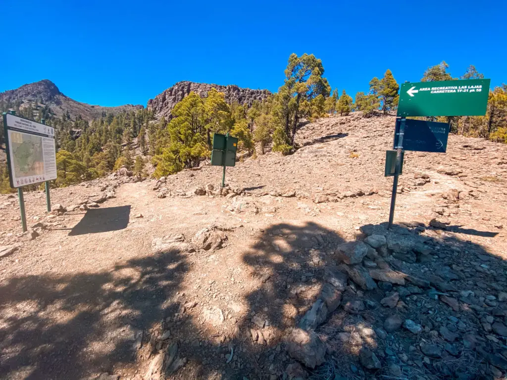


After about 15 minutes, you’ll reach the rim of the Caldera and a fork in the trail with two directions. To the right is the Sombrero de Chasna, and straight ahead is Alto de Guajara which I strongly recommend going after if you like more challenges. This is also a great spot to take a quick break, grab a snack, and appreciate the stunning views of Mount Teide and the Sombrero de Chasna.
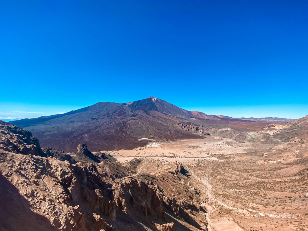
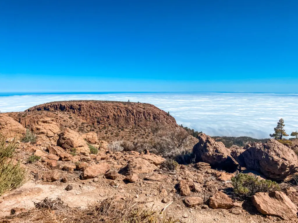
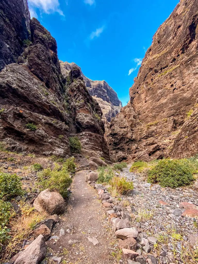
The final ascent will require a bit of scrambling. It’s not overly difficult, but you will need to use your hands in some sections. After making your way to the top, you will be able to appreciate some beautiful views of the sea of clouds slowly rolling into the valley below.

The descent from the Sombrero de Chasna is relatively easy and follows the same route I took on the way up. There is one section of the trail that is covered in small pebbles that can be slippery, so it’s best to take it slow there. Other than that, the descent is a pleasant walk back to the starting point.

CONCLUSION
I hope you found this guide useful and will enjoy this beautiful adventure as much as I did. The Sombrero de Chasna is a great peak that offers awesome views without requiring too much effort. Whether you’re a seasoned hiker or just starting out, this is a great trail to add to your list. If you’d like to explore other short hikes (under 3h), check out: Roques de Garcia, Chinyero Volcano, Monte Aguirre, Roque de Taborno, Pico Verde and Barranco de Ruiz.
HAVE YOU SEEN MY OTHER HIKING GUIDES FOR TENERIFE?
I lived and worked in Tenerife for three months, hiking nearly every day. I’ve explored over 70 trails to bring you an ultimate guide – highlighting the Top 30 Best Hikes in Tenerife. Each guide has a detailed description including the distance, difficulty, gear needed and everything else needed to complete the hike successfully. If you happen to notice any changes on the trail that should be updated – please drop the comment below so I can keep this guide up to date.
If you prefer easier hikes that can be completed under 3 hours, check out Top 12 Short Hikes in Tenerife guide.
Safe and happy hiking my friend!