5 BEST HIKES ON PICO ISLAND: YOUR ULTIMATE HIKING GUIDE
Welcome to my guide for hiking on Pico Island! This Azorean gem isn’t just about conquering Portugal’s highest peak (though that’s definitely one for the bucket list). The island is a playground of dramatic coastlines, lush forests, and incredible lava formations. You’ll find everything here: from crazy summit views to serene swimming spots tucked into volcanic landscapes. Pico’s trails offer a little something for everyone. Here are my top 5 hikes on Pico Island – each one unique, unforgettable, and totally worth the sweat!
5 BEST HIKES ON PICO ISLAND – ESSENTIAL INFO
Pico Island might be most famous for hosting Portugal’s highest peak, and let’s be real – most people head here just to climb it. And hey, fair enough, it’s an epic hike! But if you’re like me and want to dig a little deeper, you’ll be happy to know Pico’s got way more to offer than just that. I spent days exploring the island’s lesser-known trails, and I believe they deserve their own hype.
This guide is all about sharing the 5 best hikes on Pico Island, giving you everything you need to plan your adventures. Think practical details (distance, difficulty, gear) plus my personal takes to make sure you don’t miss a thing. If anything changes on the trails, give me a shout in the comments so we can keep this guide fresh and helpful! 😊
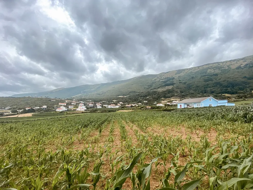
WHERE TO STAY ON PICO ISLAND?
Pico Island is extremely popular during the summer season, especially with visitors coming to climb Portugal’s highest peak. Both accommodations and rental cars get booked up months in advance, so I highly recommend planning ahead to avoid disappointment. So where to stay?
Madalena is a great choice if you want a central location and easy access to restaurants and ferry connections. Lajes do Pico offers a more traditional Azorean charm, with its whale-watching heritage and crazy coastal views. Personally, I opted for Prainha de Baixo, and it turned out to be ideal. It’s a quiet, scenic spot, perfect for unwinding after long hiking days. I booked a room in Pico da Saudade and I found it a great value for money.
Need more options? Check out Booking.com to find something that suits your budget and preferences.
RENTING A CAR IS A MUST HERE
Remember when I said, book in advance? If you don´t, you’ll end up like me.. having to ride a scooter instead of having a car 😅 I basically used both a local company and discover cars on this island.
Local rental companies: they are slightly more expensive, but they often include full insurance, meaning less hassle if something goes wrong. They are more flexible though. Since there were no cars available in the first days of my stay, I booked a scooter from rentacaroasis.com and was pretty happy.
Discovercars.com is how I usually book cars in general. It’s usually cheaper than if I were to book directly with local rental companies and it saves the hassle, you can find the best deal here:
Best season: The best season to visit the Azores is generally during the spring and summer months, from April to September. During this time, the weather is mild, with warmer temperatures and less rainfall, making it perfect for outdoor adventures like hiking. Additionally, the landscapes are lush and vibrant during the spring months, with blooming flowers and green beauty exploding across all of the islands.
Gear – Proper footwear is a must. My all-time favourite shoes for those type of adventures are Hoka Mafate Speed 4 but you can also read the guide for trail running shoes I tested in 2024. Don’t forget a sun protection and a suitable clothing for wind and rain. If you need help choosing the right clothing for a hike – read this guide.
Grading – Difficulty grading is subjective and can largely depend on your fitness level. I am a seasoned trail runner and usually run rather than hike but I am always trying to be as objective as I can when grading trails. Remember to always consider your own physical abilities and fitness level and check if you’re comfortable with trail’s distance and elevation gain.
Apps – The apps I’ve been using to navigate trails in Pico:
- mapy.cz – I’ve been using it for years now and it rarely fails me. Big plus for offline download option.
- maps.me – light app with offline download option
- strava maps – awesome new feature of strava, allowing you to view people´s heat map
Transport – Public transportation in Pico is very limited. You need to either hire a taxi/transfer – very pricy option or simply renting a car. There’s a lot of different rental offices around the island to choose from and most of them are available through DiscoverCars.com, just remember to book months in advance. Read my guide to rent a car in Azores for more details.
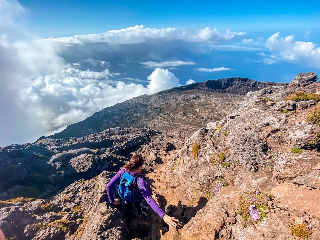
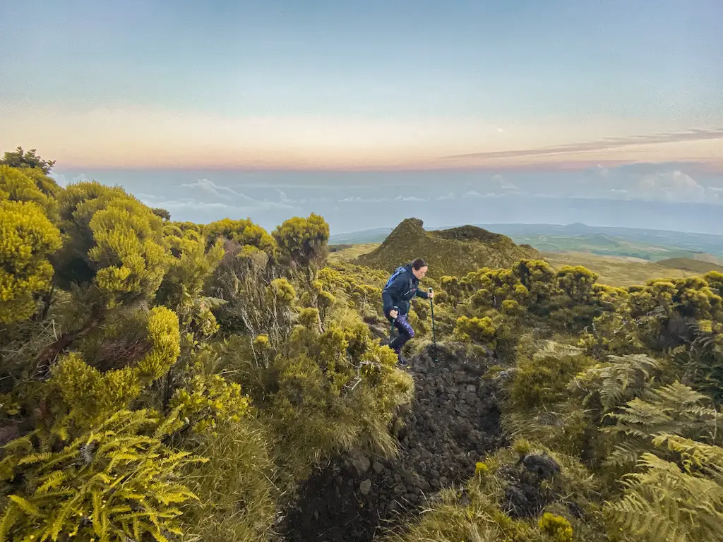
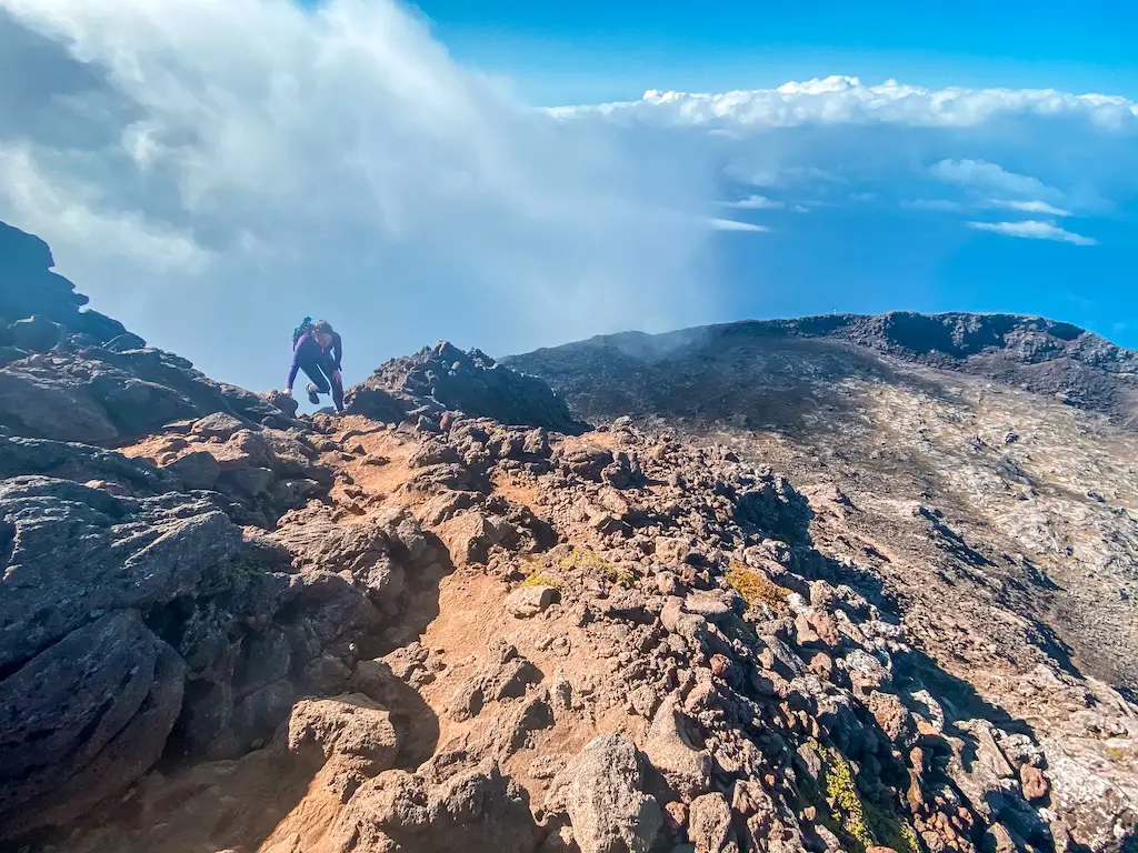
PICO MOUNTAIN: THE HIGHEST POINT OF PORTUGAL
Distance: ~10 km (round trip)
Hike Duration: 6-8 hours
Elevation Gain: 1,200 m
Difficulty: Moderate to Hard. Steep terrain with loose volcanic rocks and unpredictable weather.
Highlights: Conquering the highest point of Portugal, with ever changing weather and steep ascents!
Permit Requirements: Permits are mandatory and must be booked in advance through the official website.
READ THE FULL DETAILED GUIDE: HIKING PICO MOUNTAIN
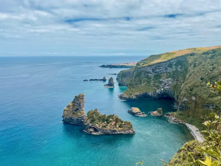
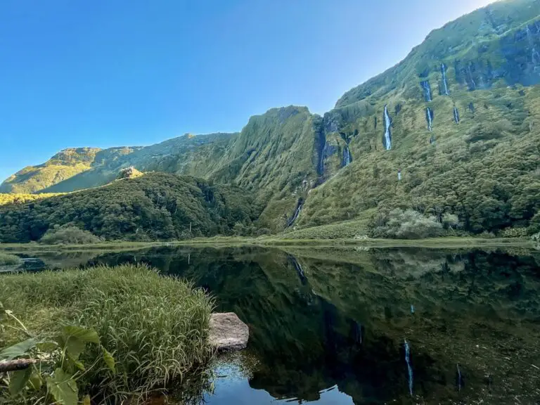
SANTO AMARO TO MIRADOURO TERRA ALTA
Distance: 13 km (out and back)
Hike Duration: 3-4 hours
Elevation Gain: 520 m
Difficulty: Moderately easy. Jungle paths with some rocky climbs.
Highlights: Stunning São Jorge views, serene swimming spots, and peaceful forests.
FULL DETAILED GUIDE: SANTO AMARO – MIRADOURO TERRA ALTA
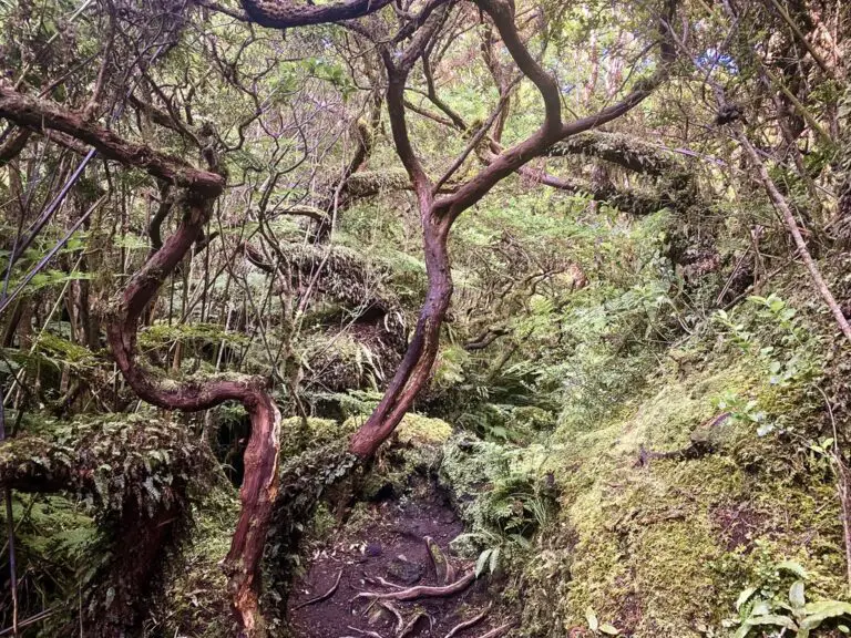
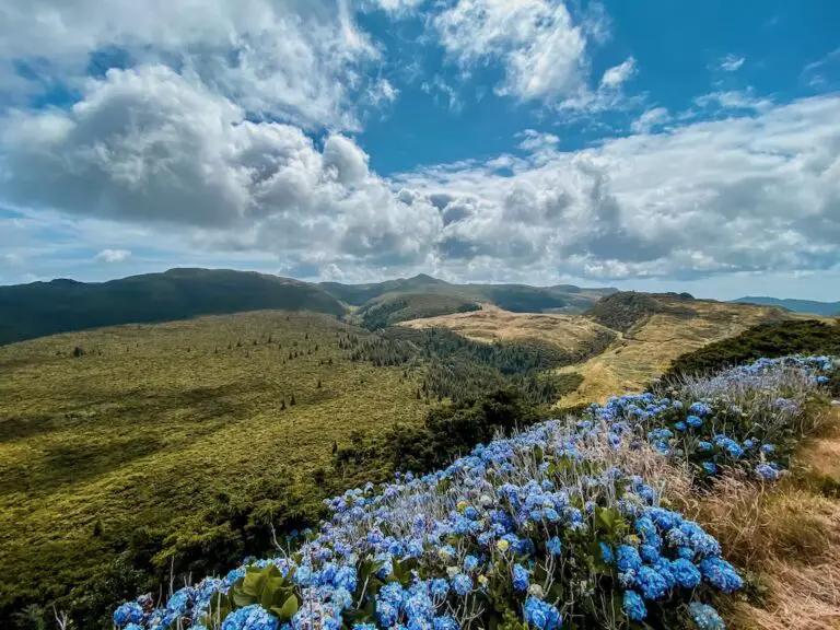
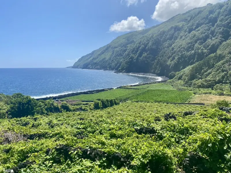
SANTA LUZIA CIRCLE TRAIL
Distance: 10 km (loop)
Hike Duration: 3-4 hours
Elevation Gain: 320 m
Difficulty: Easy. Scenic coastal and lava paths with some steep climbs.
Highlights: Laurisilva forests, lava stone church, and lush vineyards.
FULL DETAILED GUIDE TO SANTA LUZIA CIRCLE TRAIL
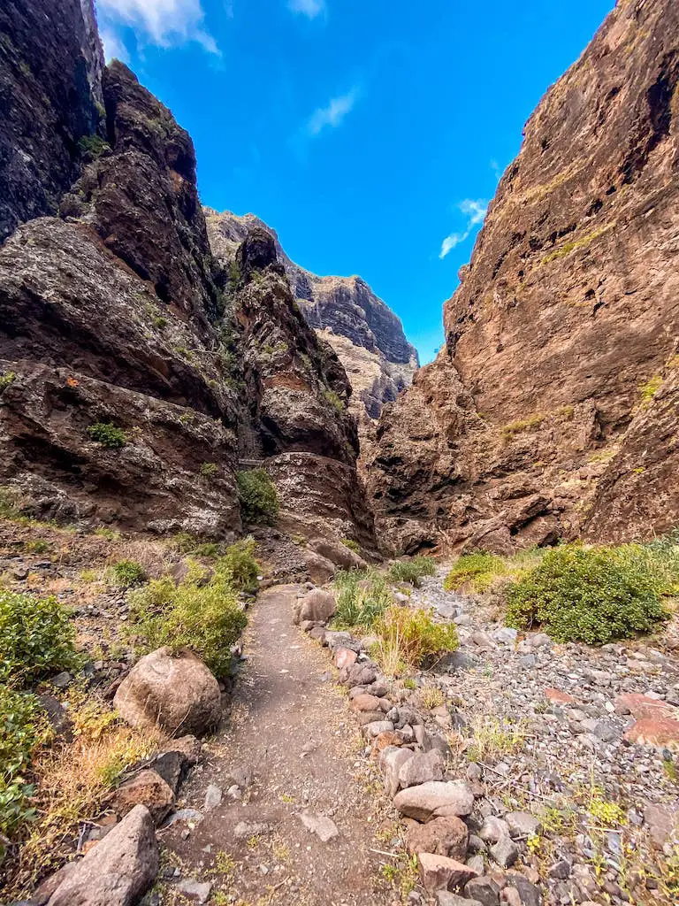
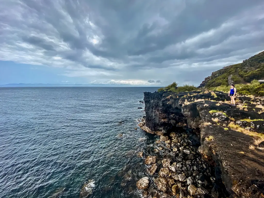
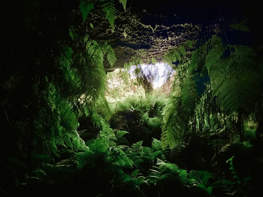
FURNA DE FREI MATIAS CAVE TO MADALENA
Distance: 11 km (one way)
Hike Duration: 2-3 hours
Elevation Gain: flat
Difficulty: Easy. Perfect for a chill hike with great coastal views.
Highlights: Coastal fields, quiet gardens, and Faial Island views.
FULL GUIDE TO FURNA DE FREI MATIAS CAVE TO MADALENA
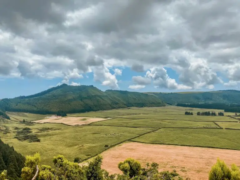
PRAINHA DE BAIXO STROLL
Distance: 6.8 km (loop)
Hike Duration: 1.5-2 hours
Elevation Gain: 150 m
Difficulty: Easy. Relaxed stroll with scenic town views and a lovely forest path.
Highlights: Swimming areas, curious cows, and a pastel de nata stop with epic views.
FULL GUIDE TO PRAINHA DE BAIXO STROLL
FINAL THOUGHTS
I loved every second of hiking in Pico Island and I sincerely hope my guide will help you enjoy this pretty island just like I did. But my work here isn’t finished! I’m currently working on the ultimate hiking guide for the entire Azores – a comprehensive look at the best trails across all nine islands. Each week, I’ll be publishing new guides, so be sure to bookmark this blog and stay tuned for updates.
PS If you notice any changes to the trails or have your own tips – please let me know in comments below. Let’s try keeping this guide as helpful and up-to-date as we can. Also, if you enjoyed reading this, feel free to connect with me on social media or support my work with a coffee 😊 Your support means a lot and helps me keep these guides coming!
Until next time, happy hiking and safe travels!